
Note: This article may contain affiliate links. If you click through and make a purchase, we earn a small commission at no extra cost to you.
Currawinya National Park is full of surprises. No matter which direction you approach it from, you’ll be treated to a long drive through mulga forests and arid red sandplains.
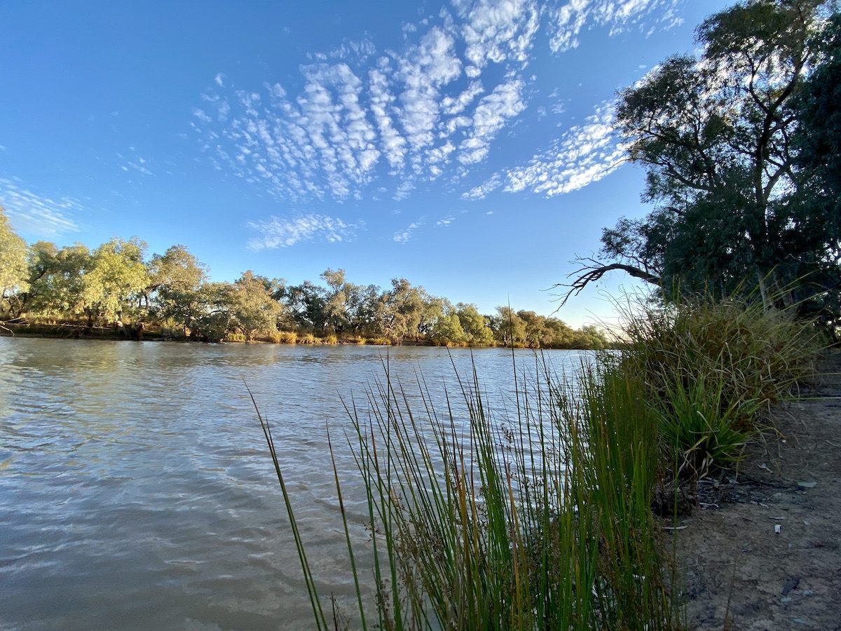
Yet Currawinya is home to the Paroo River, the last free-flowing river in the entire Murray-Darling basin. Sad but true.

And there’s the incredible lakes, RAMSAR-listed for their international importance.
As if that wasn’t enough already, you’ll discover
- rare mound springs,
- have a choice of five excellent camping spots, and
- drive through extraordinary red sandplain country covered with dense stands of mulga.
So, where is Currawinya National Park and how do you get there?
Where Is Currawinya National Park?
Currawinya National Park sits on the Queensland/NSW border in central-western Queensland.
There are five ways into the Park:
- From the bottom, through the Dog Fence from New South Wales into Hungerford. You can take the Dowling Track from Bourke or come up from Wanaaring/Louth direction.
- From Thargomindah, travel 150km to the south-east via the Dowling Track (which is a well-maintained road).
- A short 22km drive from the sealed Cunnamulla Road, into the top north-western edge of the Park.
- From Cunnamulla (126km) or Eulo (58km) on the Hungerford Road, which starts about 5km west of Eulo on the Adventure Way.
- From Cunnamulla (143km) or Eulo (75km) on the Pithery Road, which leaves Eulo on the western edge of town.
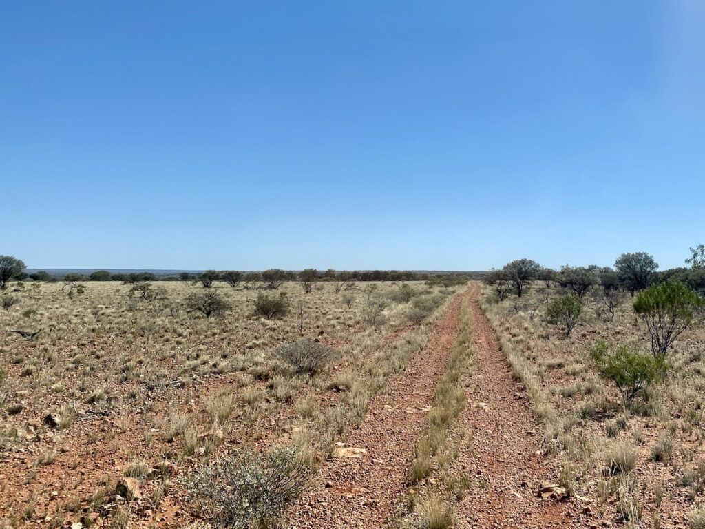
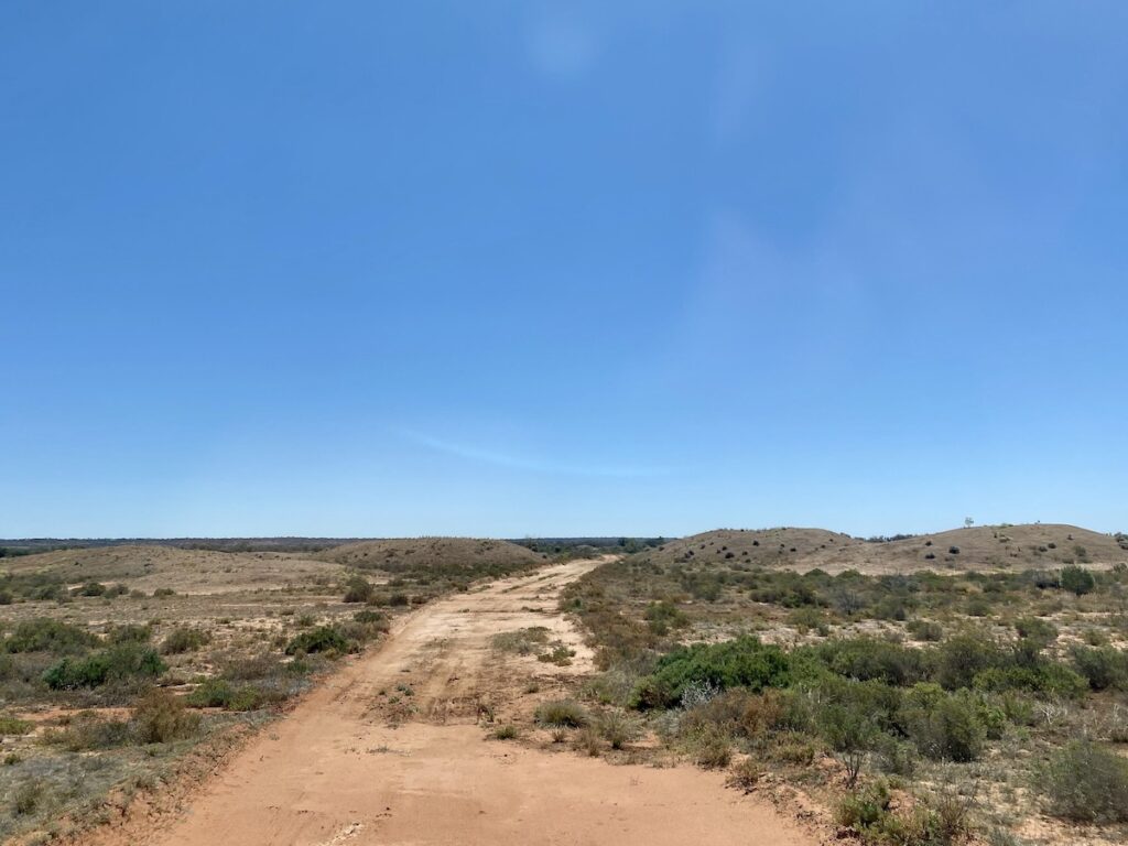
Whichever route you take, a high-clearance 4WD is the best way to travel. Road conditions vary from smooth to extremely rough. It depends entirely on when the grader last went through.
If there’s any sign of rain, stay away from Currawinya National Park. The roads cross vast black soil floodplains in places, which turn to porridge with the slightest sniff of rain.
And you’ll definitely need a high-clearance 4WD if you plan to do any of the loop drives within the park.
Queensland Parks and Wildlife Service (QPWS) have installed excellent interpretive signage at all the Park entrances and along many of the places of interest. Spend some time reading these, you’ll always learn something new.
There’s no doubt, QPWS do their utmost to educate people about the country they’re standing on. Full credit to them.
Camping and Facilities
Currawinya National Park has five campsites dotted through its vast (344,000 ha) area. Four of these are on the Paroo River, while the fifth sits beside an ephemeral wetland in the park’s western section.
QPWS allow campfires, depending on what time of year you visit. Bring your own firewood, as you’re not allowed to collect it from within the Park.
There’s no phone reception in the Park… except for a very occasional weak, intermittent Telstra signal in a few places.
Here’s a summary of each campsite.
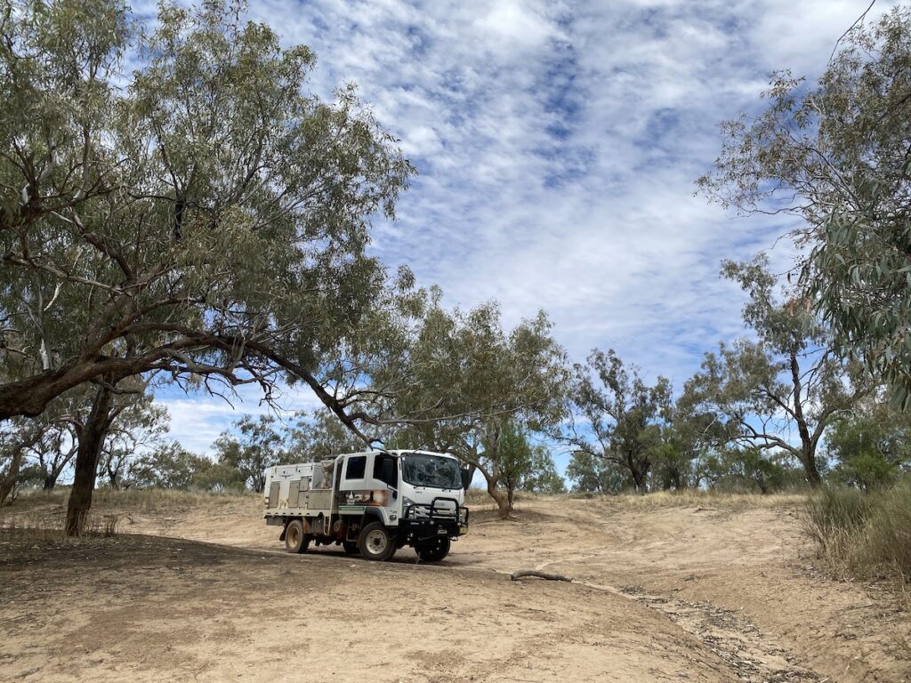
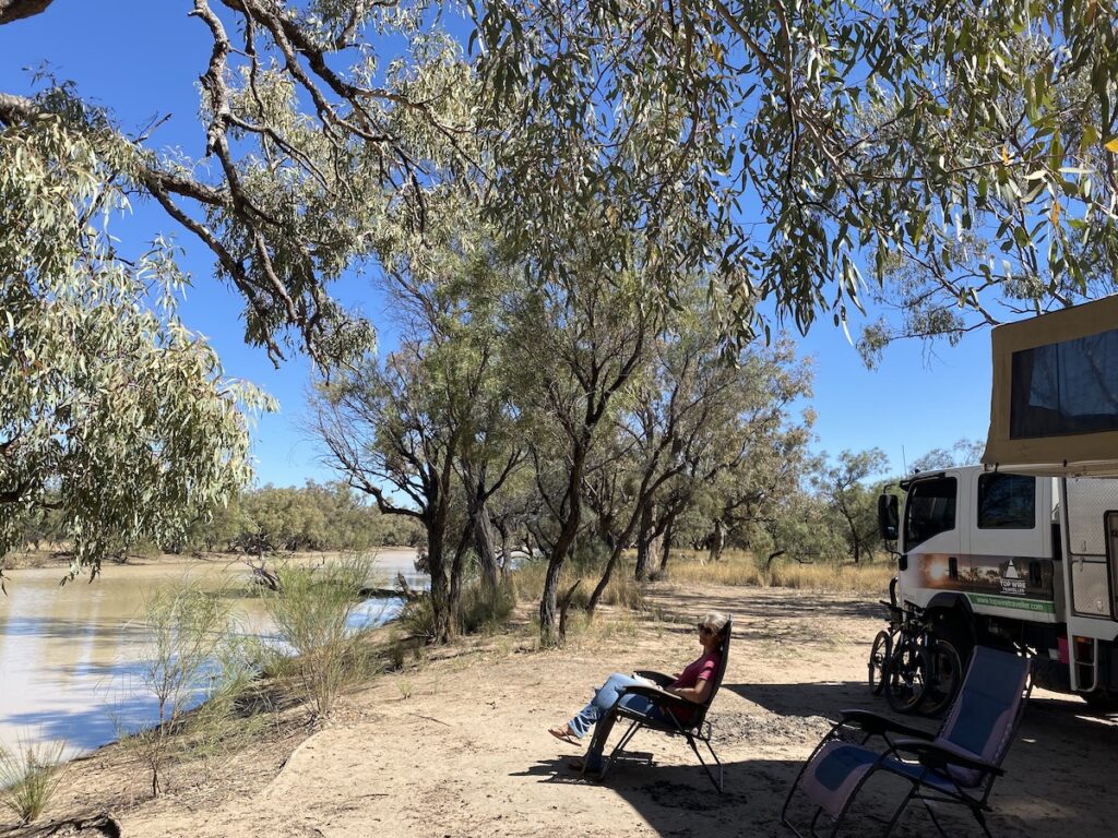
1. Pump Hole Campground
Pump Hole campground on in the Paroo, near the top (north) on the eastern side of the river. It’s about 40km north-east from the Ranger Station (which is at the south-east end of the Park) and a 4WD is recommended.
There are no designated sites and it’s a bush camp. You’ll need to be entirely self-sufficient (including toilet), as there are no facilities.
This shady campground is an ideal place to launch a kayak or to throw a line in the river. There are two separate camping areas along the river. They’re about 500m apart and connected by a 2-wheeled track.
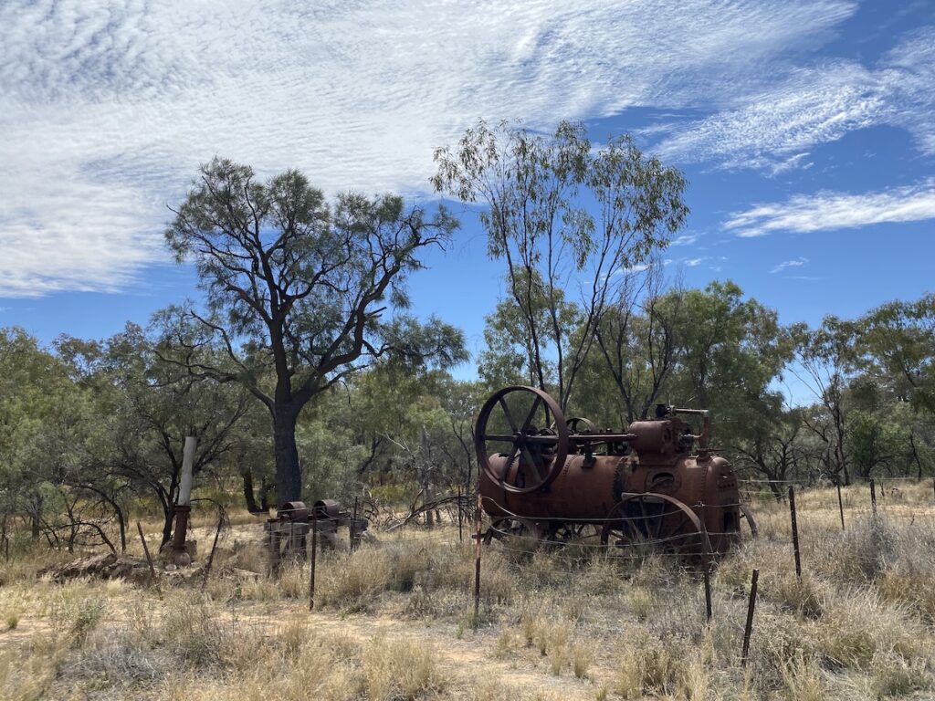
On the track in from the main road, you’ll see an old shed with rusty farm equipment. Rusted harrows, a plough and a seeder can mean only one thing. Someone optimistically decided this was a good place to either grow pasture for stock or maybe even try growing a small crop.
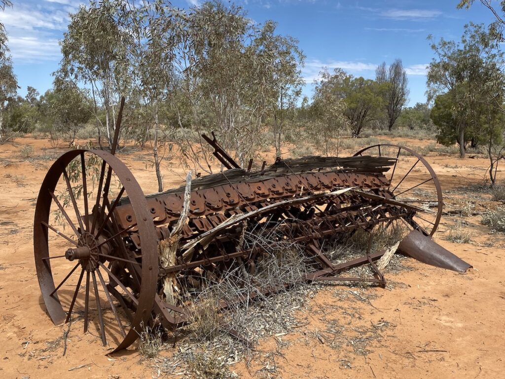
When you look at the surrounding country, I’m sure you’ll agree this was a very optimistic venture indeed!
2. Caiwarro Waterhole
Caiwarro is about 12km south of Pump Hole campground, again on the eastern side of the Paroo River and around 45km north-east of the Ranger Station. A 4WD is recommended.
Caiwarro has no designated camping areas, and you need to be self-sufficient (including toilet).
It’s quite exposed, but you could find a good spot here if you had a small set-up. The biggest attraction here is the river… and the solitude.
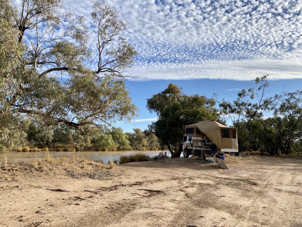
3. Corni Paroo Waterhole
Corni Paroo is at the north-east end of the Park, on the western side of the Paroo. This campground stretches for more than a kilometre along the banks of the Paroo River, so you should be able to find somewhere private.
Campsites vary from well shaded to exposed, so you can choose a site to suit your preferred style of camping.
There’s a drop toilet at nearby Old Caiwarro Homestead site. However, you’ll need to drive (or ride) there from the campground. Otherwise, you need to be self-sufficient.
We’ve camped here before and it’s one of our favourite campgrounds. You can easily spend the day doing nothing more than gazing across the river, watching the birdlife and occasional roo coming down to drink on the far bank.
This time, we chose an exposed site with protection from freezing southerly winds.
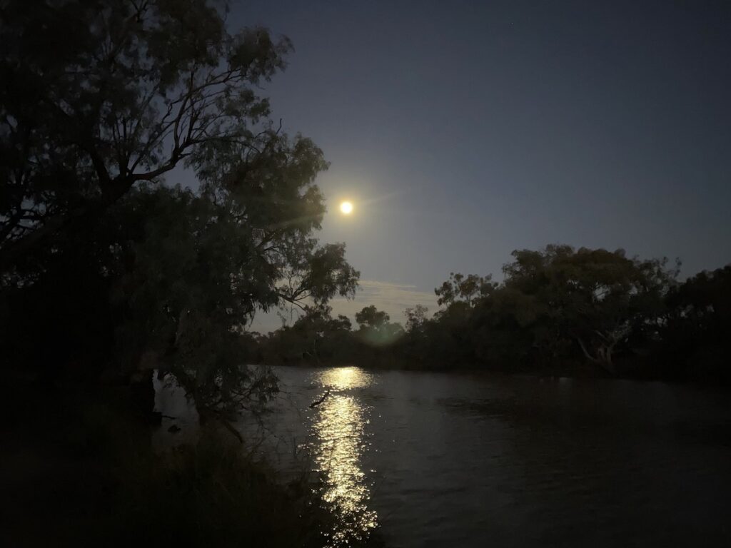
We had planned to kayak along the Paroo, but the strong southerly winds put that idea to bed very quickly. Although we did manage to have a very quick swim… it was bracing to say the least!
4. Ourimperee Waterhole
Ourimperee Waterhole campground is directly across the road from the Ranger Station, a few kilometres south-east on the Paroo.
It’s similar to Corni Paroo. The campground stretches along the river and there are several sites.
There are flushing (yes flushing!) toilets nearby, otherwise you need to be self-contained.
Corni Paroo used to have an open-air shower, with corrugated iron walls and no roof. But QPWS pulled this down and haven’t replaced it.
Ourimperee and Corni Paroo are the most popular campgrounds in Currawinya National Park, because they’re the most accessible from the main road. However, campsites are well spaced. So neither campground feels crowded, even when busy.
5. Myninya Campground
Minyanya Campground is the only campground that’s not on the Paroo River. It’s in the “new” section of the Park (we’ll get to this soon), about 50km north-west of the Ranger Station.
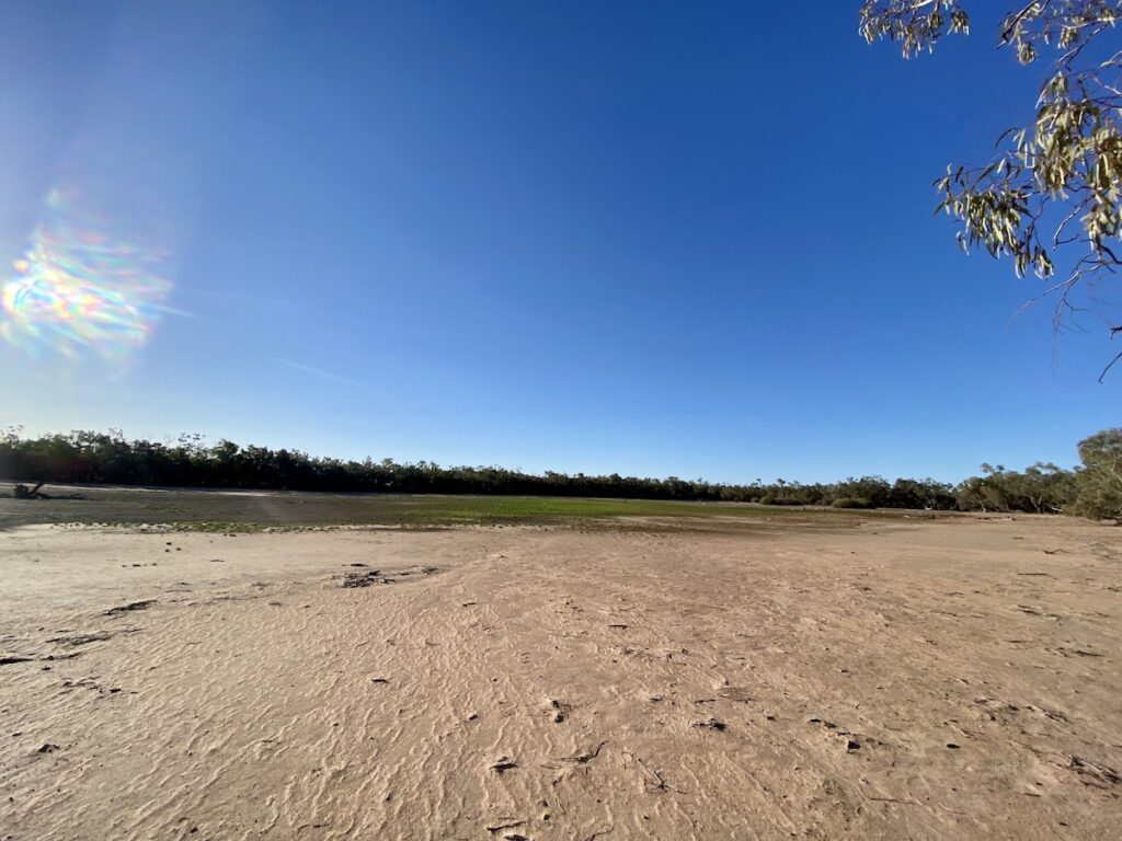
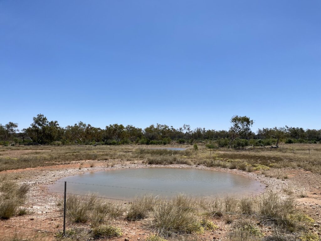
Myninya is beside an ephemeral wetland, which had just dried out when we visited. It has unmarked, designated campsites.
Surprisingly, Myninya has a flushing toilet and a cold shower. Otherwise, you’ll need to be self-sufficient.
Being the furthest from the main road through Currawinya, it’s generally quieter than the other campgrounds. And it’s a totally different camping experience.
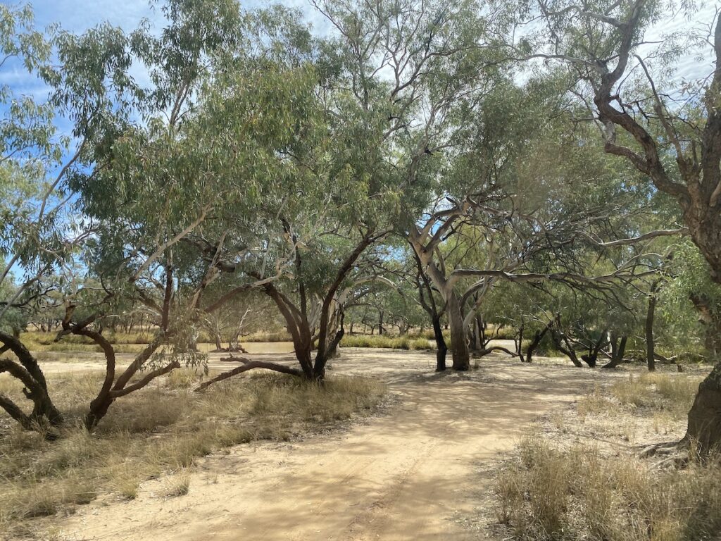
Whereas the other four campgrounds sit on the black soil floodplains of the Paroo River, Myninya is in the classic sandplain country so typical of this region.
When To Visit
April to September is the best time. Outside of these times, expect mid to high 40s and hot north-westerly winds. However, you could still camp at one of the campsites on the Paroo. They’re on permanent waterholes, so you can at least have a swim to cool down.
And as we mentioned earlier, you really don’t want to be in Currawinya National park when the rain starts. If you are, you’ll be stuck there until the black soil roads dry out… which can take several weeks or more.
We know a lady who was trapped at nearby Hungerford for a month, waiting for the roads to dry out.
What To See
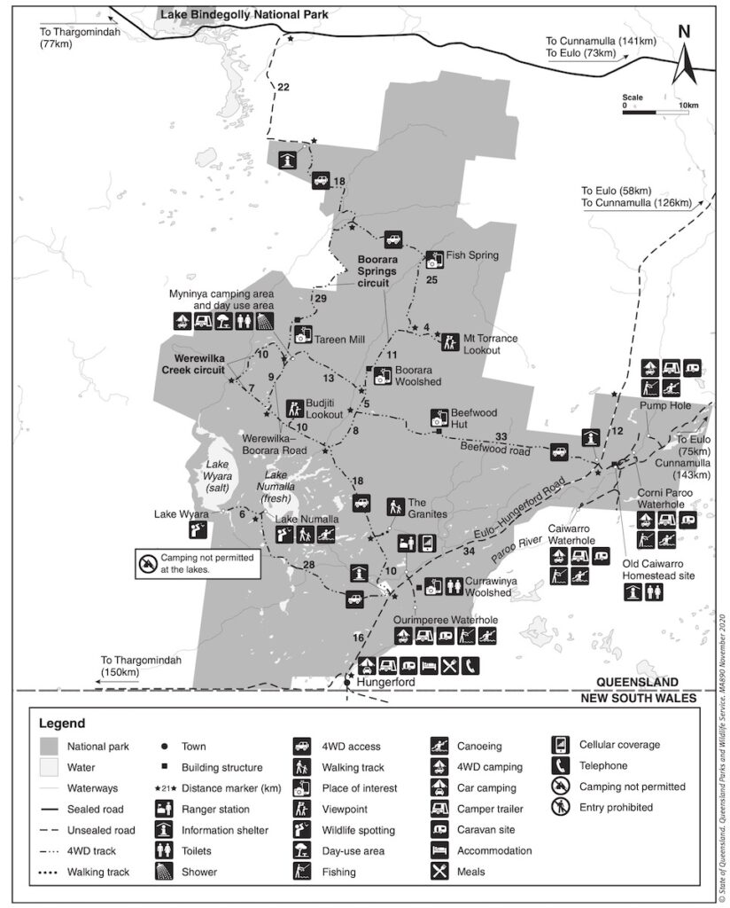
When you look at the QPWS map of Currawinya (see above), the distances around the Park look reasonably small. However, some of the roads are nothing more than rough tracks. So allow plenty of time.
And give yourself time to see the attractions along the way… there’s plenty to see!
Just on this. Make sure you have enough fuel, as the distances add up quickly. You can easily do 300km or more within the Park.
Currawinya National Park pretty much doubled in size to 344,000 ha after Queensland Parks and Wildlife Services purchased Boorara, Werewilka and Bingara stations. They’re to the north-west of the original National Park and are vital catchments to the original Currawinya RAMSAR-listed wetlands in the south-west of the Park.
This new section also contains significant groups of mound springs, which are extremely rare in Queensland. More on this soon.
So, let’s find out what you can see during your stay at Currawinya National Park. There’s so much to see that it’s difficult to know where to start!
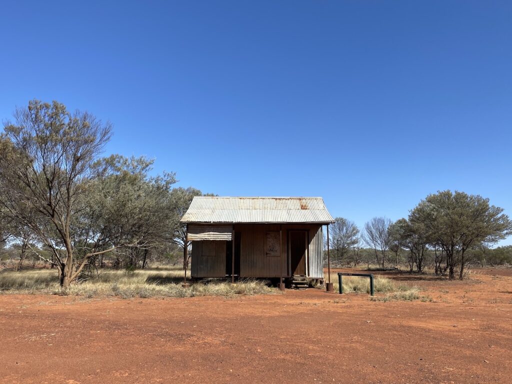
1. Hungerford
Although it’s just out of the National Park, Hungerford’s worth having a look at. It’s right on the NSW/QLD border and there’s a gate through the Dingo Fence into NSW.
The Royal Mail Hotel has a long history. And it’s a reminder of just how remote and isolated these places were before the days of the modern motor vehicle.
Take a look here for some more information on Hungerford.
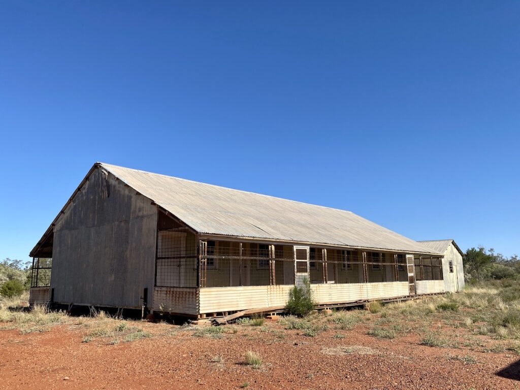
2. Currawinya Woolshed
About 20km north of Hungerford and opposite the Ranger Station is the Currawinya Woolshed complex. Take the road off the Eulo-Hungerford Road to Ourimperee Waterhole and you’ll reach the woolshed and shearers’ quarters.
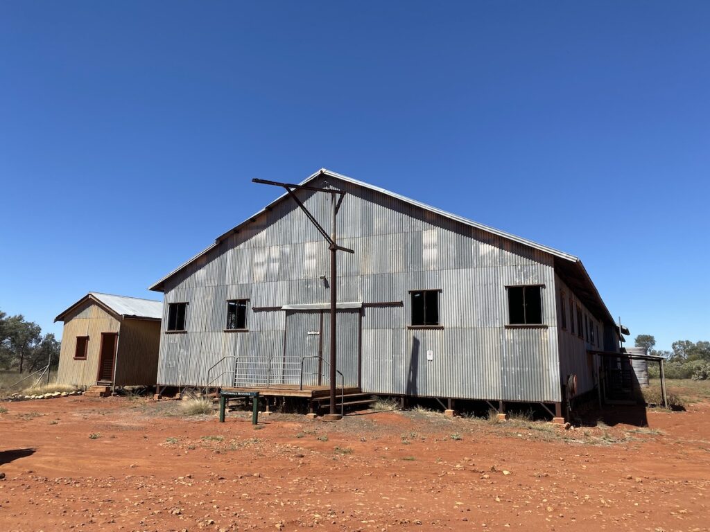
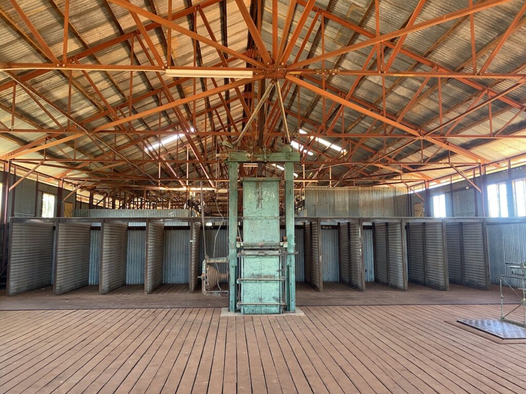
The 10-stand woolshed’s comparatively small for an Outback Queensland shearing shed. But it’s impressive nevertheless. It still has that distinctive smell of lanolin, instantly familiar to anyone who’s ever worked with sheep.
And the old meatsafe and basic shearers’ quarters might give you some understanding of what a tough breed the shearing teams were. A diet of mutton, mutton and more mutton… then a rough standard-issue, steel-framed bed with saggy springs and a lumpy mattress.
3. Old Caiwarro Homestead Ruins
About 35km north-west along the Eulo-Hungerford Road, turn right towards Corni Paroo campground. Just past the turnoff to the campground, you’ll find Old Caiwarro Homestead Ruins near the Paroo River causeway.
It was established in the mid-1800s, and the homestead complex was more like a mini-village than a simple homestead. I guess this is not surprising, considering Caiwarro Station covered over a million acres (405,000 hectares).
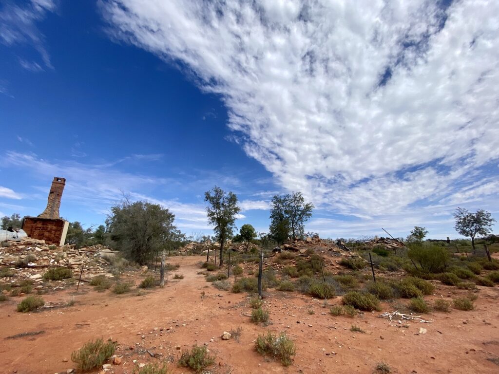
Now it’s just a pile of ruins, with only the old meatsafe still standing. There’s also two steel-framed buildings which look distinctly out of place among the stone ruins of the older buildings.
There’s no doubt the Paroo River floodplain is a beautiful stretch of country, with the river at its centrepiece. However, to us the best part of the Park was to the west of the Eulo-Hungerford Road.
It’s here where you’ll find some special places…
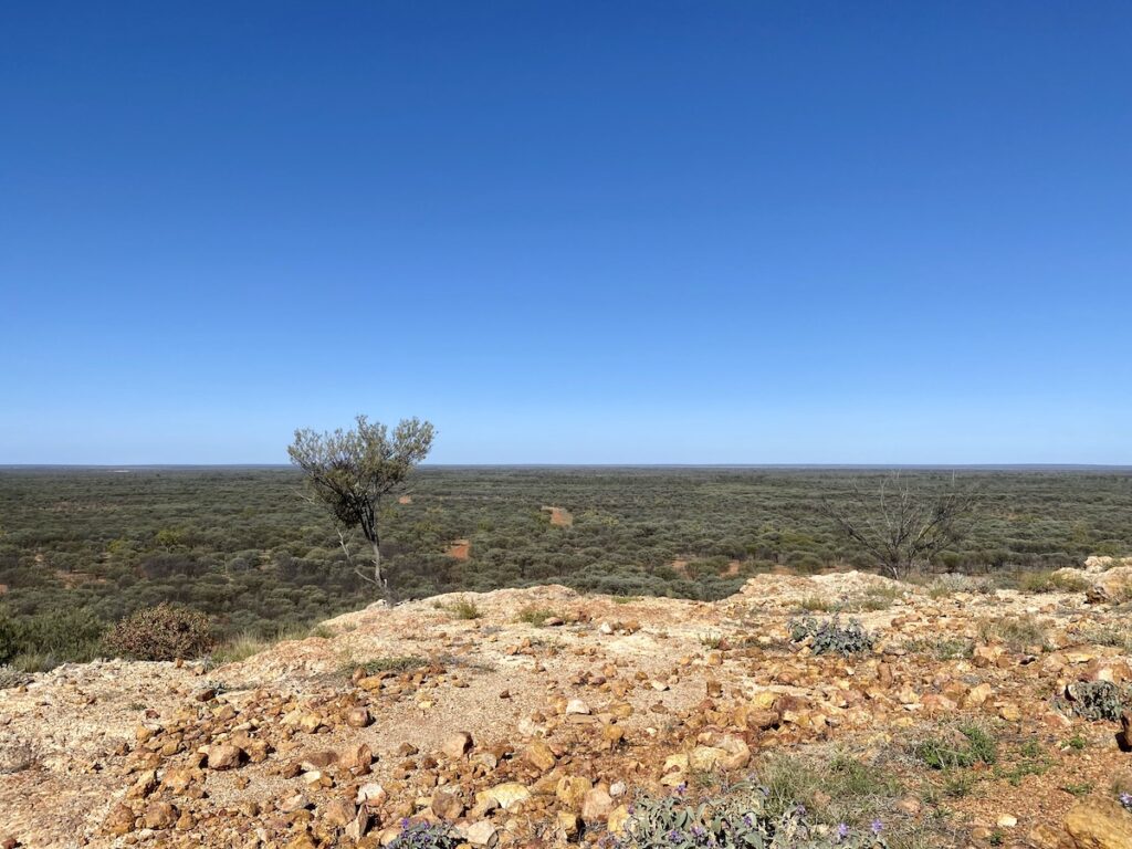
4. Beefwood Road
A short drive back to Eulo-Hungerford Road from Old Caiwarro Ruins and you’ll see a track signposted as Beefwood Road.
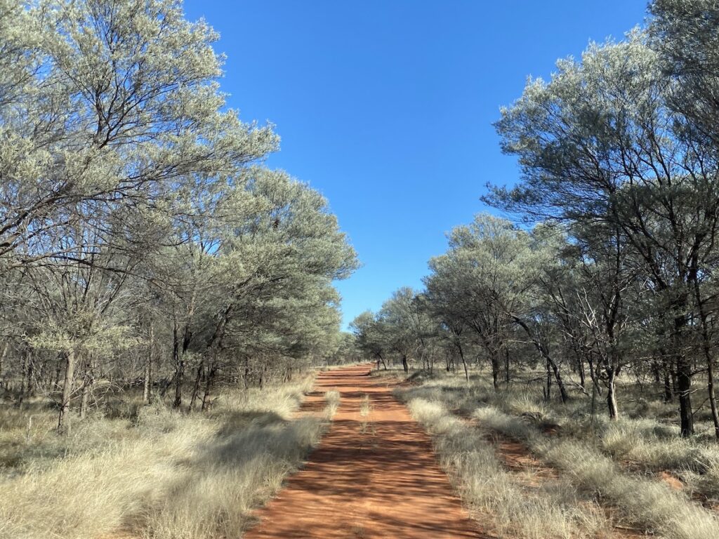
This track heads directly west for 33km, through magnificent arid-zone mulga sandplain country.
In this short drive, you saw thick mulga scrublands in vivid red sandplains, grasslands, and all sorts of native gums and acacias madly flowering after recent rains.
What’s especially interesting is the contrast between the original National Park land and the recently added stations. The older National Park has more ground cover and is slowly reverting back to how it should be, whereas the newer sections are still showing signs of the negative effects of soil compaction and grazing.
It’s refreshing to see the land slowly recovering.
About two thirds of the way along Beefwood Road, you’ll come to Beefwood Hut. This remote hut was used as a place for stockmen to camp when they were working out here.
It’s rather basic… two tiny rooms and four corrugated iron walls with plenty of gaps and holes to let the cold in at night.
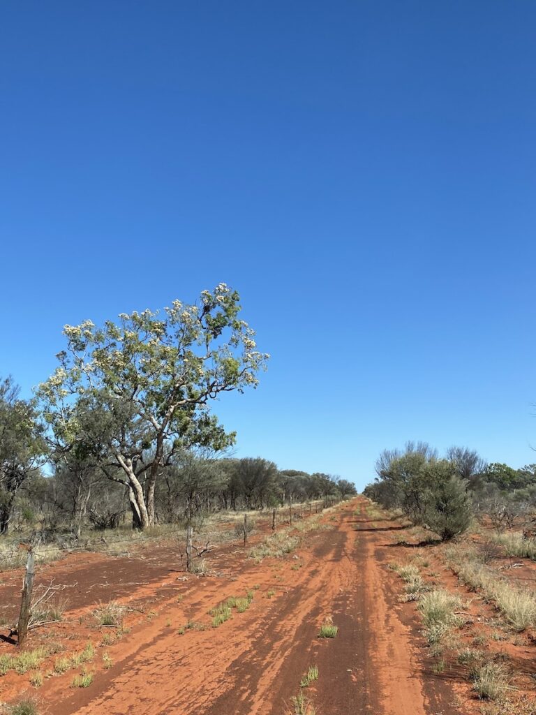
West of Beefwood Hut, you “climb” the optimistically named Hoods Range… more a slight rise than a range. Although, Hoods Range is noticeably rockier than the surrounding country, a sure sign you’re in arid-zone country.
Just the slightest change in elevation can make all the difference in this country. The vegetation instantly changes to sparse ground cover and rocky ground.
5. Boorara Springs Circuit
Turn right at the western end of Beefwood Road. After a short drive north, you’ll be on the Boorara Springs Circuit. This circuit is only about 60km, but is slow and rough in places.
But it’s well worth taking the time.
The Boorara Springs Circuit takes in a wide range of country, from ridge country to more fertile sandplains and even some black soil country our near the western boundary of the Park.
Boorara Woolshed
A little way along the circuit, you’ll drive past Boorara woolshed. Stop and take a look inside. QPWS have interpretive signage inside, which brings to life the day-to-day hustle and bustle of the shed at shearing time.
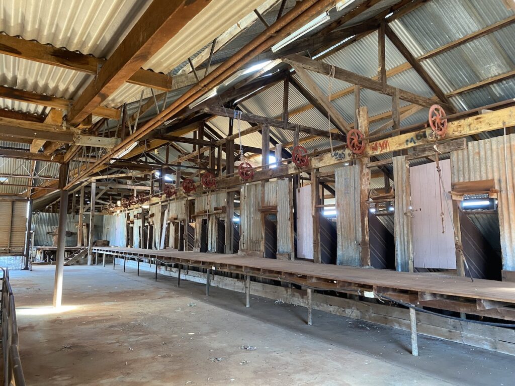
Across the road are the shearers’ quarters and various related buildings.
Mt Torrance
After the woolshed, you’ll gradually ascend into mesa country. The track becomes rocky and the vegetation thins out. Turn off to Mt Torrance and wind you way around the ancient mesas until you reach a turn-around.
The track in is rough and badly washed out in places. So take your time.
While the QPWS map labels this as “Mt Torrance Lookout”, it’s not really. There’s a sign saying “Mt Torrance” but according to our maps, it’s not actually Mt Torrance. Very confusing!
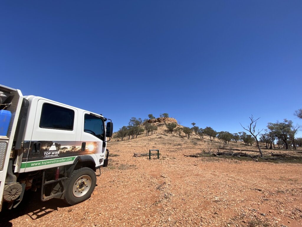
Regardless, this drive gives you a chance to see this strange mesa country up close. It’s well worth the short diversion off the main circuit.
Mound Springs
Back on the Boorara Springs Circuit and heading north again, you’ll start seeing weird earthen mounds. These are remnants of once-active mound springs.
You’re looking at rare mound springs which are part of the Eulo super-group. Pressurised water from the Great Artesian Basin pushes through to the surface, bringing stones and earth to the surface. Over time, this forms an earth mound which continues to grow while the spring is active.
Sadly, we’re depleting the Great Artesian Basin faster than it fills. So now, over 75% of the mound springs are inactive… in other words, bone dry.
Not only this, hard hooves of cattle, sheep, feral pigs, and feral goats damage the springs. And introduced grasses choke out the native species, causing more damage.
To top it off, landholders dug out springs to form dams or to use as wells. So what was once a large area of vital permanent wetlands, is now bone dry.
The few remaining mound springs struggle on valiantly, but it’s only a matter of time before they too dry out.
It’s high time we re-considered gifting huge mining companies free rights to unlimited water from the Great Artesian Basin and for us all to stop thinking of it as an endless resource.
Tareen Mill
You’ll swing west, over another rough and rocky range before gradually descending back into the sandplains. Turn left at the Werewilka-Boorara Road to continue along the Boorara Springs Circuit.
This follows the western boundary of Currawinya National Park for quite a while. It passes various disused bores and dry springs.
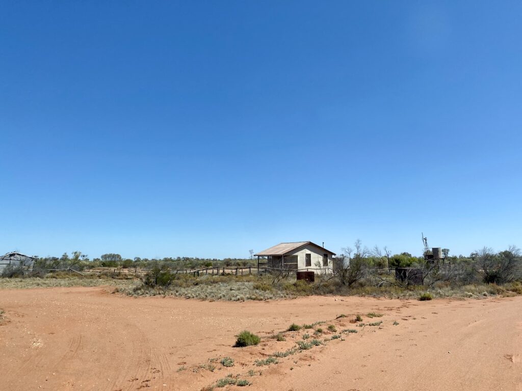
After about 20km, you’ll reach the oddly-named Tareen Mill. It’s a tiny cottage with a couple of sheds. This place is extremely isolated and remote… worth a visit, if only to stand there and take in the isolation of this place.
The Boorara Springs Circuit ends about 10km south of Tareen Mill. From here, you can
- keep going south-east for about 50km to re-join Eulo-Hungerford Road,
- turn left into Myninya Campground,
- turn left through Myninya Campground to re-join the Boorara Springs Circuit near the beginning (warning – this track is rough), or
- turn right onto the Werewilka Creek Circuit.
6. Werewilka Creek Circuit
The Werewilka Creek Circuit showcases yet another type of landscape within Currawinya National Park.
It vaguely follows Werewilka Creek, and passes canegrass swamps. These slight depressions fill after rain, supporting the highly adapted canegrass. In dry times, the canegrass appears to be dead. However, it effectively hibernates until the rains come then springs back to life.
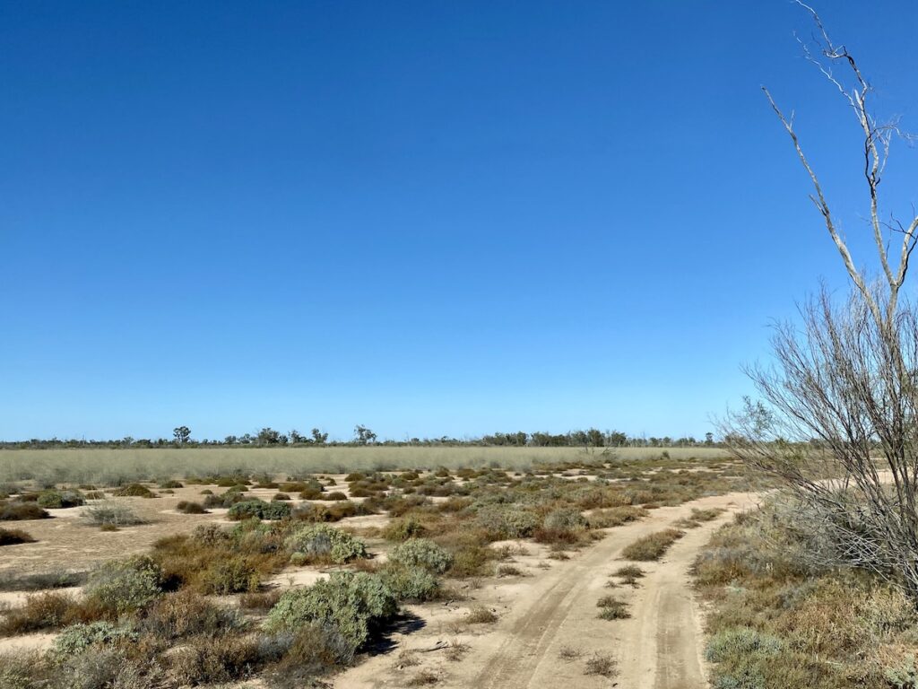
The country along this circuit reminded us of the country around Lake Pinaroo and Fort Grey in Sturt National Park, NSW.
From the Werewilka Creek Circuit, we took the Werewilka-Boorara Road south-east towards the Eulo-Hungerford Road. Along the way are Budjiti Lookout and The Granites, both worth a visit.
7. Budjiti Lookout
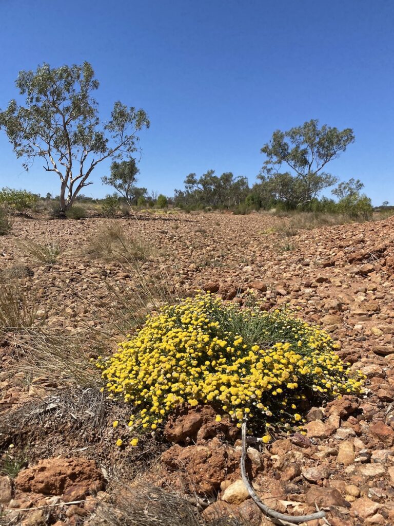
Budjiti Lookout is a 1.3km drive off the main road, then a short walk to the peak. Once on top, you’ll get 360° views of the surrounding Currawinya National Park.
From up here, it’s easy to see why these are called the Mulga Lands! Mulga forests spread in every direction, broken only by the occasional salt lake.
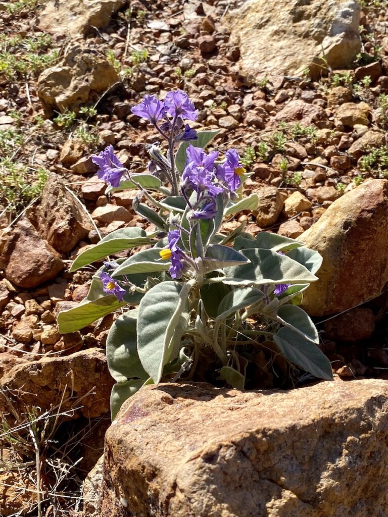
When we visited, the wildflowers were blooming wherever they could get a foothold. These hardy plants take full advantage of any wet weather, desperate to reproduce and continue their genetic lineage.
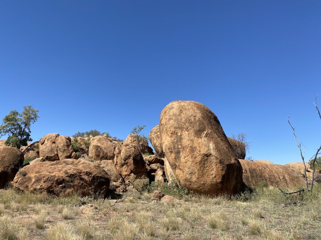
8. The Granites
After re-joining the Werewilka-Boorara Road from Budjiti Lookout, follow it for about 28km south-east. You’ll see a signpost to The Granites, a short drive into a car park.
On the way into the car park, you’ll wind though another group of mound springs. Unfortunately, these are also dry. When they were active, this area would have been another wetland oasis.
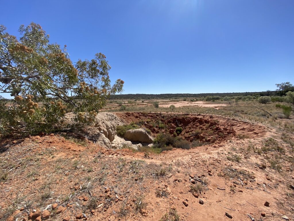
The Granites are an ancient seam of granite rock, so deep that they penetrate the Great Artesian Basin. Water was forced up through myriad cracks in the granite to form the mound springs you see around you.
The Granites are an impressive sight… and look quite strange in this otherwise sandy landscape. They comprise two distinct rock outcrops and are culturally significant to the First Nations Budjiti people. One group is a men’s site and the other a women’s site.
For this reason, the track keeps away from the formations. Please respect the Budjiti people by keeping to the track and not climbing on the rocks.
9. The Lakes Drive
We’ve left the best until last!
Heading south-east again, you’ll come to the main Eulo-Hungerford Road about 10km after The Granites turnoff.
Just before the intersection, you’ll see signs to Lake Wyara and Lake Numalla. This road is signposted as “4WD Only” and is about 30km to the lakes. However, it’s no better or worse than the other roads in Currawinya National Park. You’ll be fine in a AWD vehicle.
These lakes are unique.
Only a few kilometres of sand dunes separate these large lakes. Yet Lake Wyara is saltwater, while Lake Numalla is freshwater, due to a quirk in the landscape. They’re fed from different sources, hence the reason why one is salty while the other is fresh water.
This means they support completely different habitats, especially the bird life. Avid birders and ecologists love these lakes due to the variety of birdlife and other habitats they support.
These lakes are RAMSAR listed, due to their critical role in supporting a diverse range of habitats.
During big flood events, the Paroo River spills over into the freshwater Lake Numalla. It’s difficult to imagine, given the Paroo is some 30km to the east.
Lake Wyara is massive, covering over 3,400 hectares. It appears in the distance like an inland ocean, sparkling an impossibly crystal-clear sheen of blue. It’s a rare sight to see this lake full. It frequently dries out, leaving a vast shimmering salt pan.
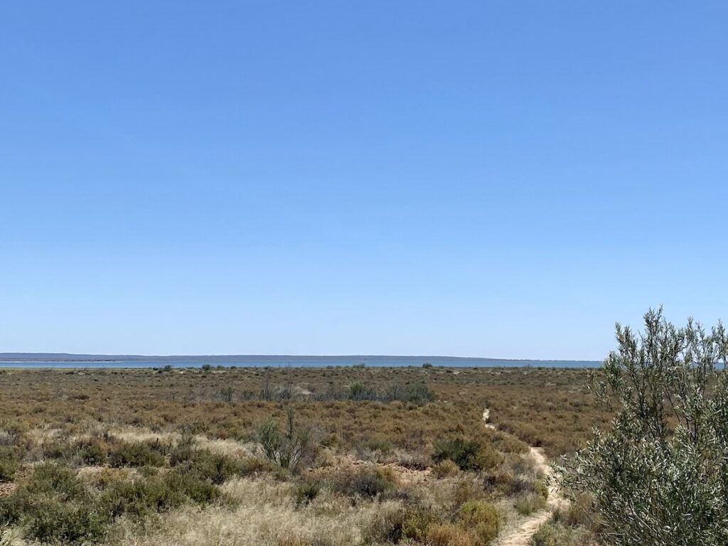
Just 3km down the track, Lake Numalla is the polar opposite of Lake Wyara. This lake is typical of inland, arid zone lakes. The water is cloudy and filled with fine sediment suspended in the water.
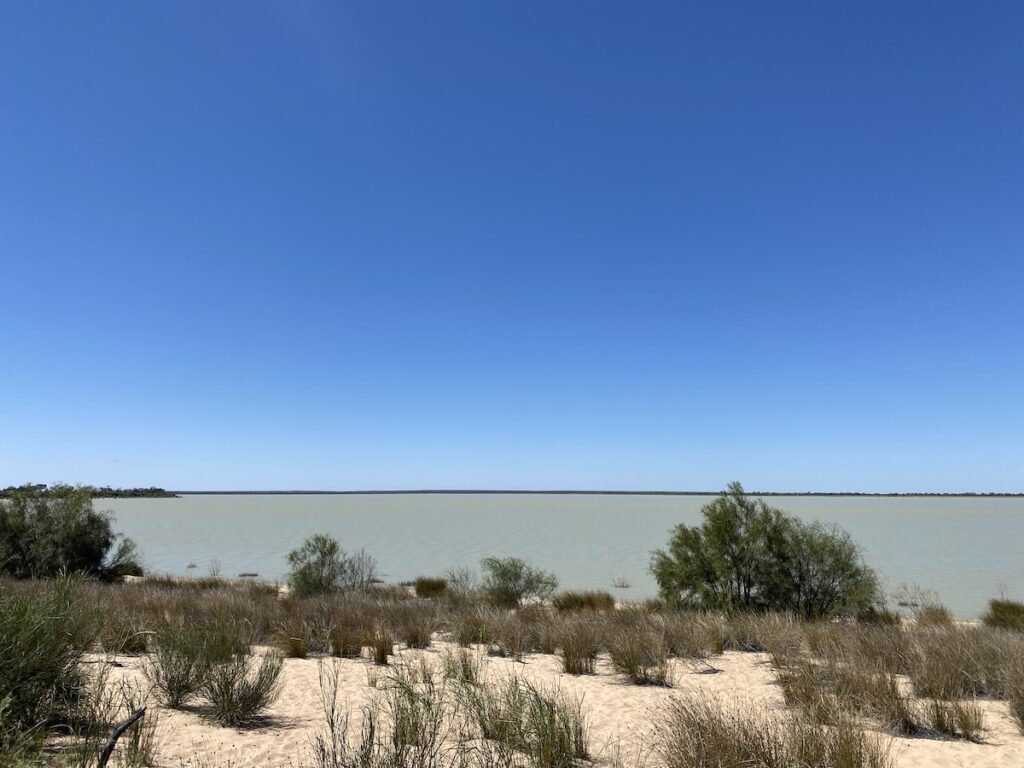
In contrast to the clear waters of Lake Wyara, very little light penetrates the waters of Lake Numalla. So, few aquatic plants grow in this lake. This means the two lake habitats are vastly different… and one of the reasons why they are ideal study and observation sites for ecologists and other scientists.
Lake Numalla rarely dries out, making it a critical source of water in the dry times. Migratory birds from Asia use these lakes as vital stopovers on their incredible migrations across continents.
On the drive to and from these lakes, you’ll pass a few other smaller salt lakes. Stop and have a look. You’ll likely see some bird life, emus and kangaroos grazing along the edge.
A Unique Landscape
From mulga-covered sandplains, to canegrass swamps, mound springs, sand dunes, First Nations history, colonial relics, fantastic camping spots, vast lakes, and the last free-flowing river in the Murray-Darling Basin… Currawinya National Park has it all.
You really need to spend a few days here to immerse yourself in this incredible Park.
It’s always been one of our favourite places. And after driving every track in the Park, we’d have to say Currawinya National Park is definitely one of our Top 3 National Parks in this incredible country of ours.
It’s a unique landscape, a stunning showcase of the best that Outback Australia can offer.
If you’re searching for camping gear and accessories, Wild Earth has a wide range available. Go here to find out more.
Currawinya National Park is on Budjiti Country.
Looking for more great articles on QLD National Parks? Then go here.

Get your Traveller’s Guides
… and a whole lot more at our FREE RESOURCES Page!
Any questions or comments? Go to the Comments below or join us on Pinterest, Facebook or YouTube.
Any errors or omissions are mine alone.
We were there in May this year (2023), and did most of what you did over 2 days.
it is very big with a LOT of driving, many interesting things to see, we came from Eulo, and we also came in the bottom from NSW at Hungerford, very nice stop over and a donation caravan park, showers , flush toilets and even a washing Machine!
Thanks for putting this together
Hi Laurence,
You’re right, that’s a lot of driving in two days! Thanks for sharing the info on Hungerford.
Cheers, Andrew