
Note: This article may contain affiliate links. If you click through and make a purchase, we earn a small commission at no extra cost to you.
The Cut Line is slowly being tamed. It runs through outback New South Wales, 425km from Bourke to Tibooburra through magnificent desert country.
It’s a popular route for travellers heading out to the NSW Corner Country, Cameron Corner and beyond.
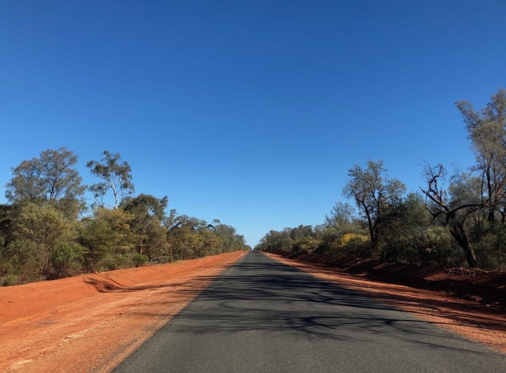
A ribbon of tar is gradually pushing towards Wanaaring from Bourke. What was often a rough 190km trip over massive corrugations in the red sand, is now becoming easier.
Don’t be deceived though. You still have to take on another 235km of dirt before you roll into Tibooburra.
One day in the not too distant future, The Cut Line will be fully sealed… all the way from Bourke to Tibooburra. For now though, it’s still an adventure.
Journey Information
Road Conditions
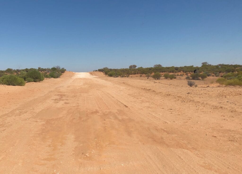
Road conditions vary from smooth clay-packed surfaces to rough sandy stretches, full of huge corrugations and big holes.
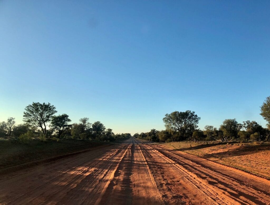
We’ve travelled The Cut Line many times and every time it’s different. Sometimes the road is smooth and easy. Other times, it’s a rough trip all the way from Bourke to Tibooburra… tarred sections excluded of course!
Be prepared for a rough trip. You might be lucky and go through just after the grader. Or you might not…
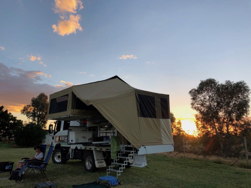
Camping
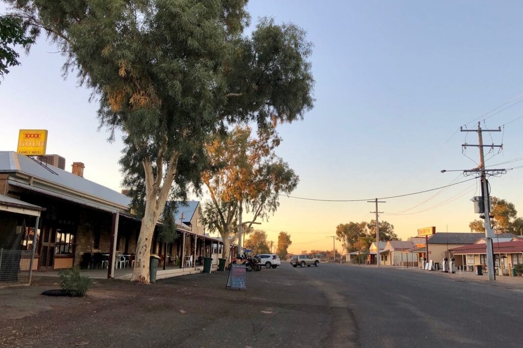
Bourke
In Bourke you can camp at Kidman’s Camp or Mitchell Caravan Park. Another option is the free camp at Mays Bend, just north of town on the Darling River. There are no facilities at Mays Bend, so you’ll have to be completely self-contained.
Wanaaring
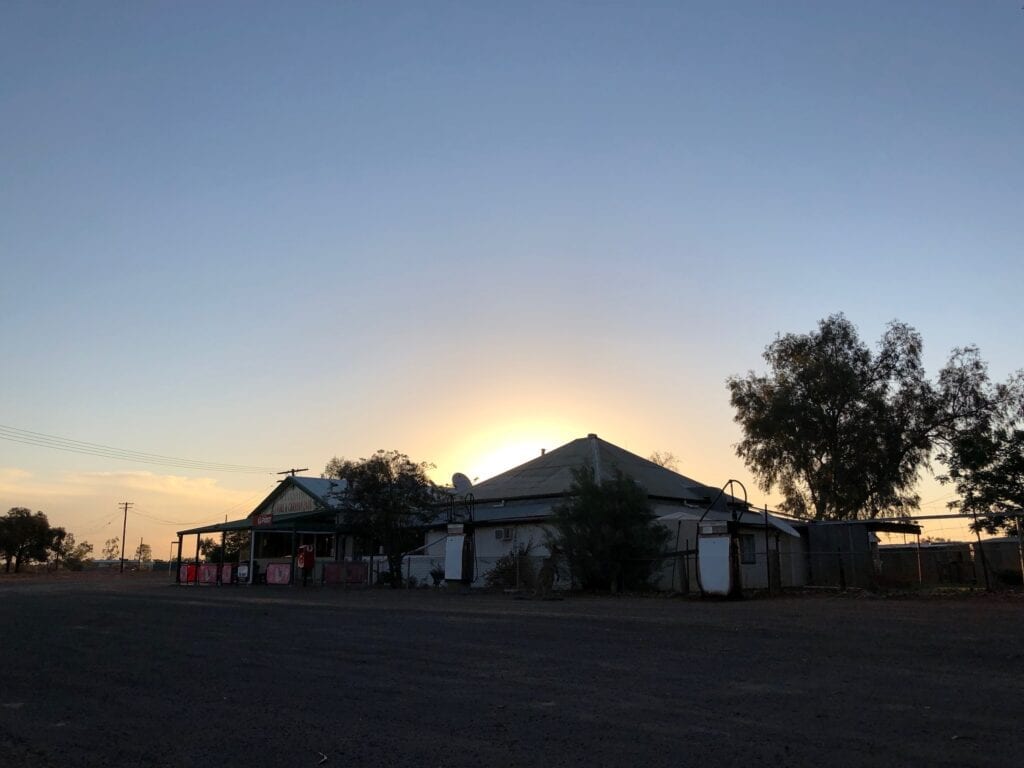
Wanaaring has a great camping area beside the Wanaaring Store. Call into the Store to pay your camping fees and have a yarn to the new owners Col and Kathy. They took over from Ben and Margaret, who were there for several years.
The best part? There’s grass, you can camp on grass!
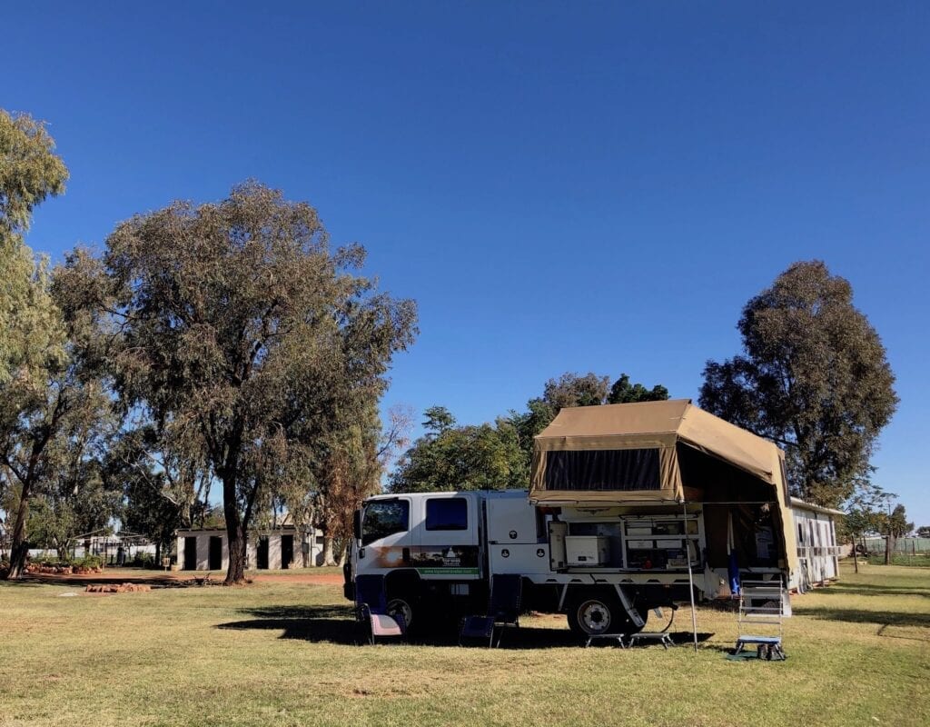
If you’re not self-contained, they also have cabins available.
The campground is basic, yet has everything you need. It’s quiet, clean, tidy and friendly, only a short walk from the pub and the Paroo River.
Speaking of the Paroo, you can camp beside the river if you prefer.
Tibooburra
Tibooburra has a couple of places where you can camp. The Granites Motel Caravan Park is in town, backing onto the famous granite boulders surrounding Tibooburra. Call into TJ’s Roadhouse (southern end of town) to book.
The other option is a fantastic spot just south-east of town, past the end of Burgess Street. It’s the Tibooburra Historic Aboriginal Reserve Campground, nestled into the granite boulders on Racecourse Creek. It has toilets, showers and a BBQ area.
This historical area was once an Aboriginal reserve and you can still see remnants of the last resident’s tin shack. There’s also a walking track and interpretive signage. Go to the Corner Country Store (northern end of town) to pay your camping fees.
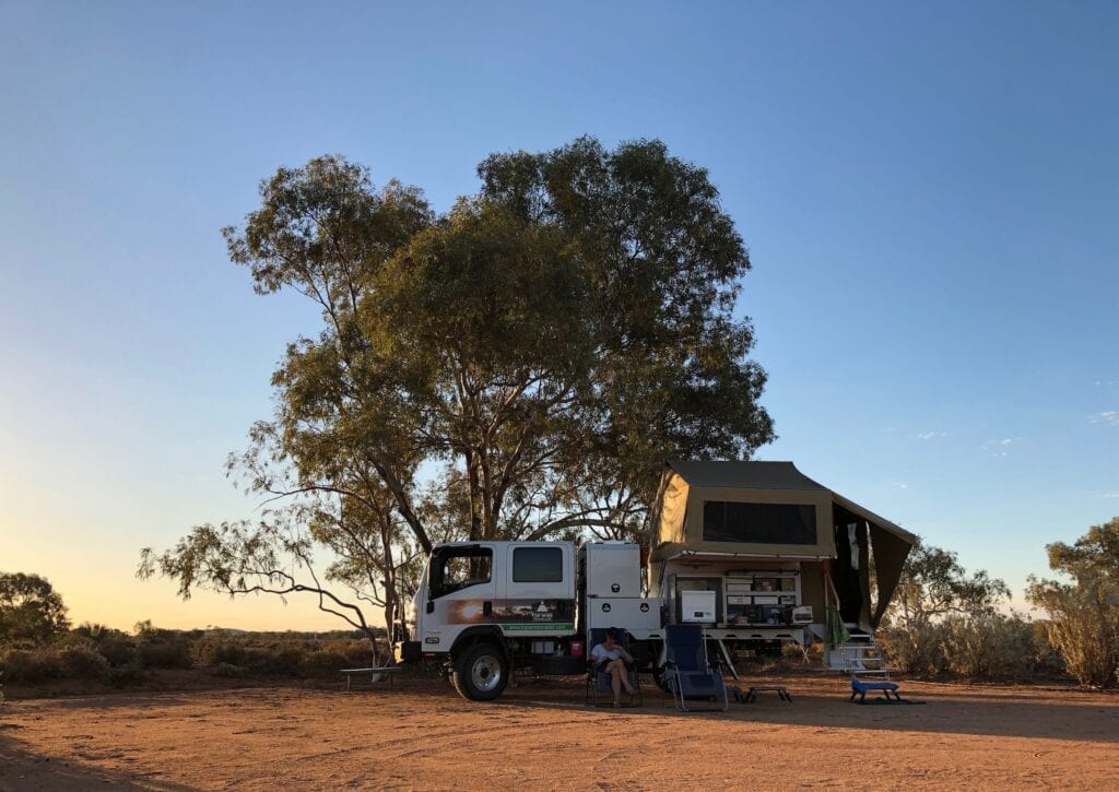
You can also camp along The Cut Line. Like always, be respectful, as you’ll be camping on private property. So stay close to the road, keep away from stock watering points and take any rubbish with you.
Permits
You don’t need a permit to drive this road.
Fuel And Supplies
Bourke, Wanaaring and Tibooburra all have fuel and food supplies. Bourke has a wide variety of food supplies, while Wanaaring and Tibooburra have basic supplies.
Heading Into the “Real” Outback
The Outback is a vague notion and means different things to different people. Some people consider west of Bourke is the start of the “real” outback, whatever that means!
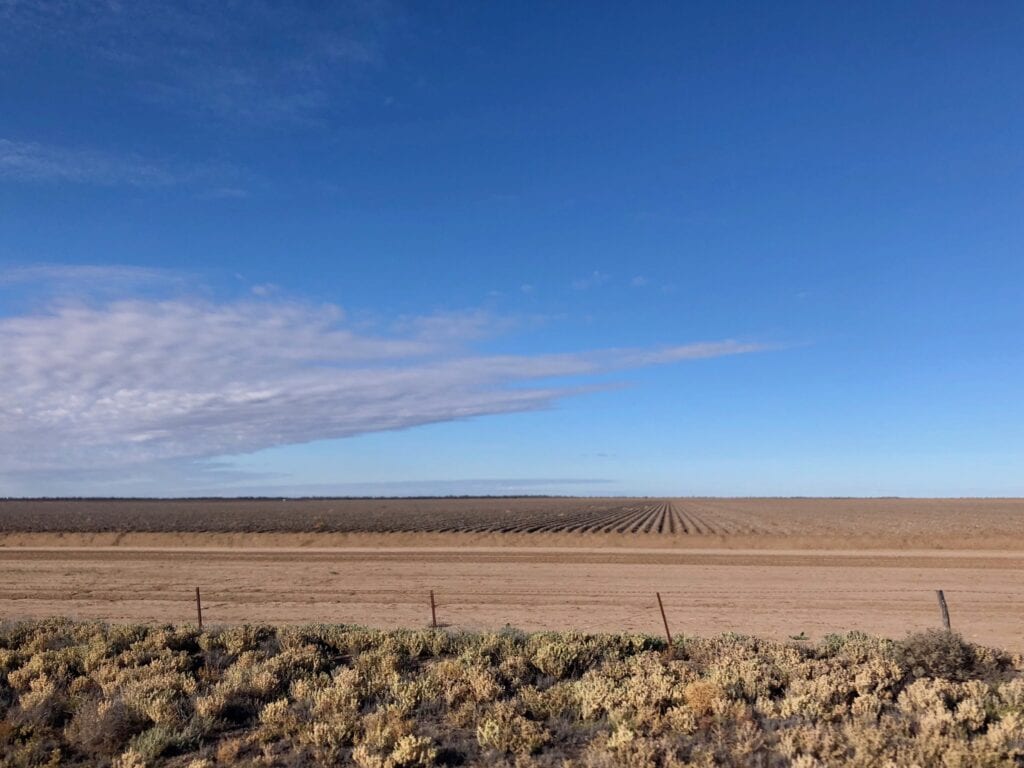
Regardless, once you point your nose towards Wanaaring on The Cut Line road you’re definitely in the outback. The massive water-sucking turkey-nest dams and endless cotton fields west of Bourke quickly give way to scrubby red sand country.
About 32km west of Bourke, you’ll see a turnoff to the left. This takes you down to Toorale and Toorale National Park. It’s also the start of the Darling River Run on the western side of the river.
After a while you’ll cross the Warrego River then the vast expanse of Poison Point Plain. This enormous floodplain occasionally fills when the Warrego floods.
Then you’re back into the red sand country with sand dunes, mulga and the odd claypan.
About 180km west of Bourke (or 10km east of Wanaaring), you’ll see a turnoff to the right. This is Mooleyarrah Road, the road to Hungerford and Currawinya National Park.
Another great drive is Wangamana Road to Louth. The turnoff is about 135km from Bourke or 55km east of Wanaaring.
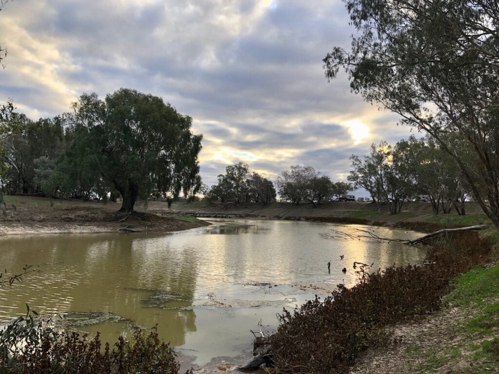
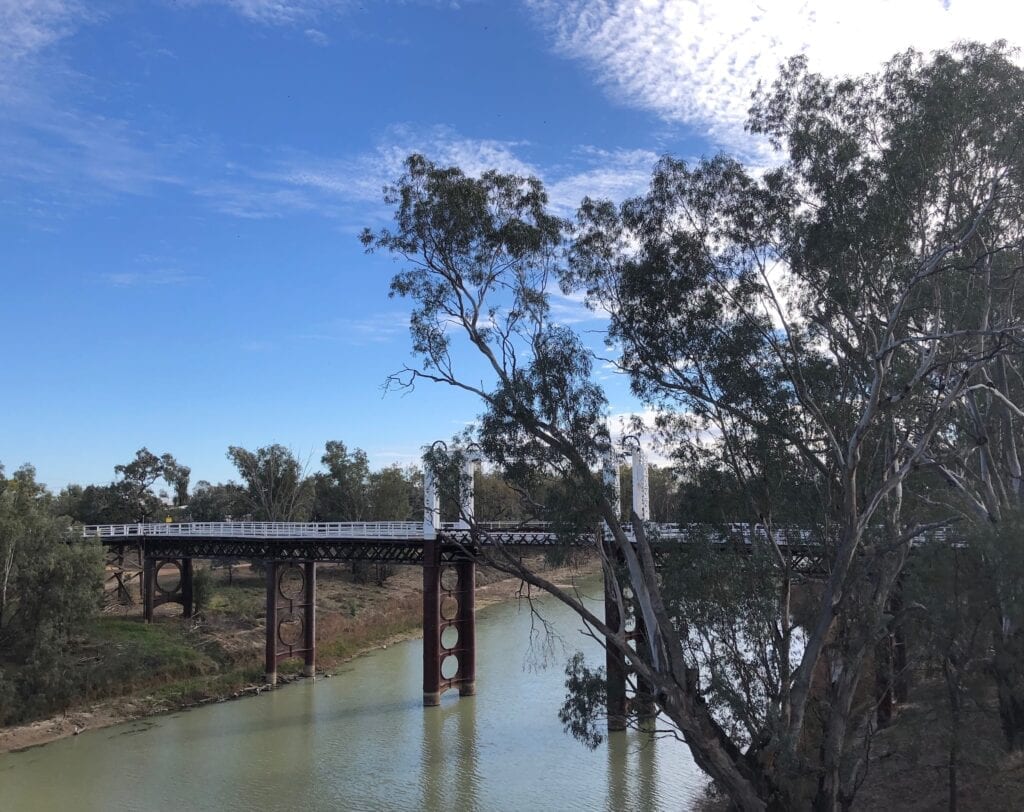
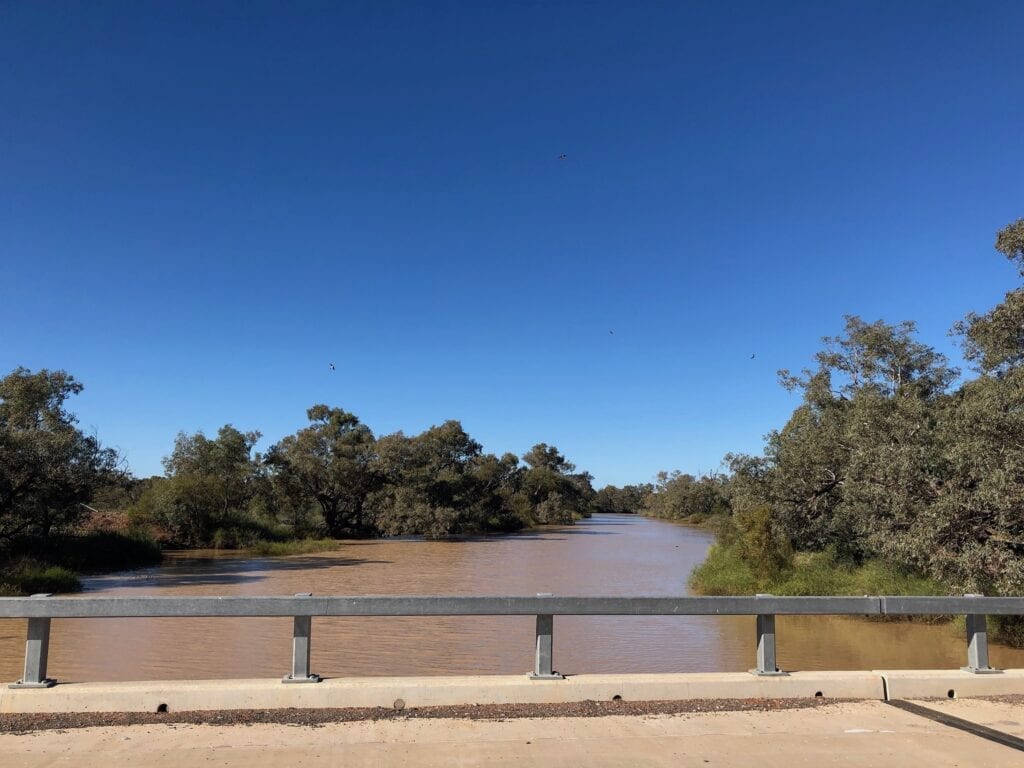
Crossing the Paroo
Just east of Wanaaring you cross the Paroo River. The Paroo starts somewhere north-west of Charleville and Adavale in South-Western Queensland, in the Warrego Range.
I say “somewhere” because like many watercourses in this country, it’s normally just a vague labyrinth of dry channels. Only when the rains come do you begin to understand exactly where the water flows.
The Paroo passes through Eulo, Currawinya National Park and Hungerford in Queensland, before crossing the border into New South Wales.
Next stop for the Paroo is Wanaaring. The town of Wanaaring sits on high ground, so it’s an island when the Paroo floods. So The Cut Line crosses the Paroo twice… to the east and to the west of Wanaaring. Although the western crossing is really just an anabranch of the main river.
Eventually the river meanders vaguely south, before joining the Darling between Tilpa and Wanaaring.
Don’t be fooled though. Only big floods reach the Darling. Normally, any flow going past Wanaaring disappears into a complex mess of channels, lakes and wetlands south of Wanaaring.
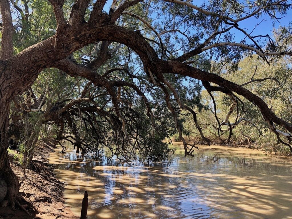
Sadly, the Paroo is the last remaining free-flowing river in the Murray-Darling Basin. At least there’s one left, I suppose…
The Only NSW Town on the Paroo
We’ve seriously lost count of the number of times we’ve been through or stayed at Wanaaring. This is a friendly place. We always enjoyed catching up with Ben and Margaret at the Wanaaring Store and Caravan Park for a yarn, and look forward to meeting Col and Kathy.
This article from the ABC gives an insight into Ben and Margaret’s daily lives as owners of the Store. Not to be outdone, Col and Kathy also have a write-up, this time in The Land! Well worth a read.
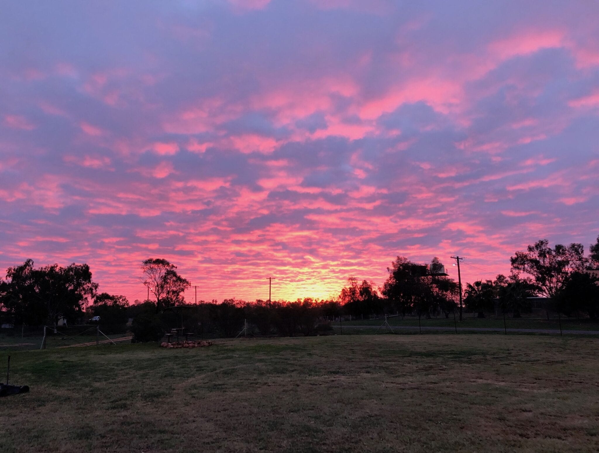
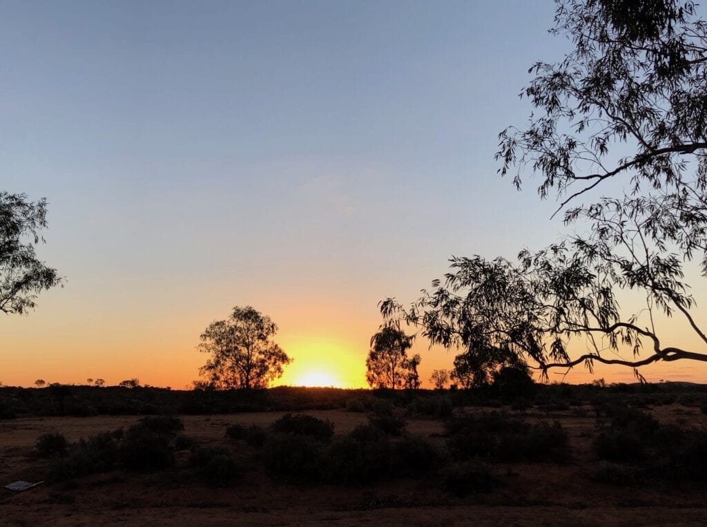
As well as being one of the hottest towns in the state, Wanaaring is also the only NSW town on the Paroo. Spend a couple of nights here and go for a walk along the river. We were lucky enough to see it flowing… an unusual event out here.
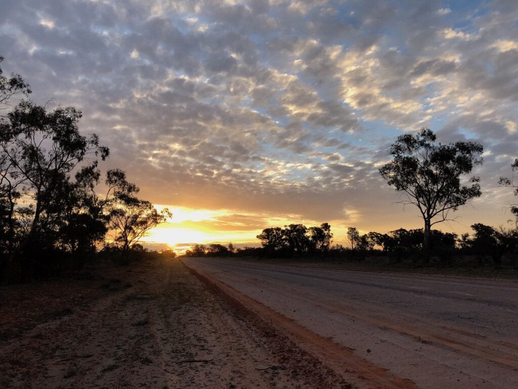
The other standout about Wanaaring and the Corner Country in general? The unbelievable sunrises and sunsets. They are simply stunning, and we never tire of them.
Pushing West
West of Wanaaring, you’re into red sand country, sand dunes and the odd claypan. The vegetation thins out, with sparse ground cover. Like I said earlier, this road can be smooth and fast, horrendously corrugated or somewhere in between.
After a while, you start to feel isolated out here. You get the sense of being the only person left on the planet, and traffic is rare.
Keep in mind though, The Cut Line is a popular route for charity bashes. So you could strike way more traffic than you anticipated!
The Cut Line slices through the landscape, arrow-straight for long stretches. Then suddenly there’s a sharp right-hand turn. This is the Tibooburra Road. The original Cut Line actually continues as a track straight ahead, meeting the Silver City Highway just south of Milparinka.
You can’t access this part of The Cut Line any more, it’s private property.
Staying on Tibooburra Road, pretty soon you’re out of the red sand country and onto vast open plains. You cross a grid into Sturt National Park, a massive National Park covering over 325,000 hectares.
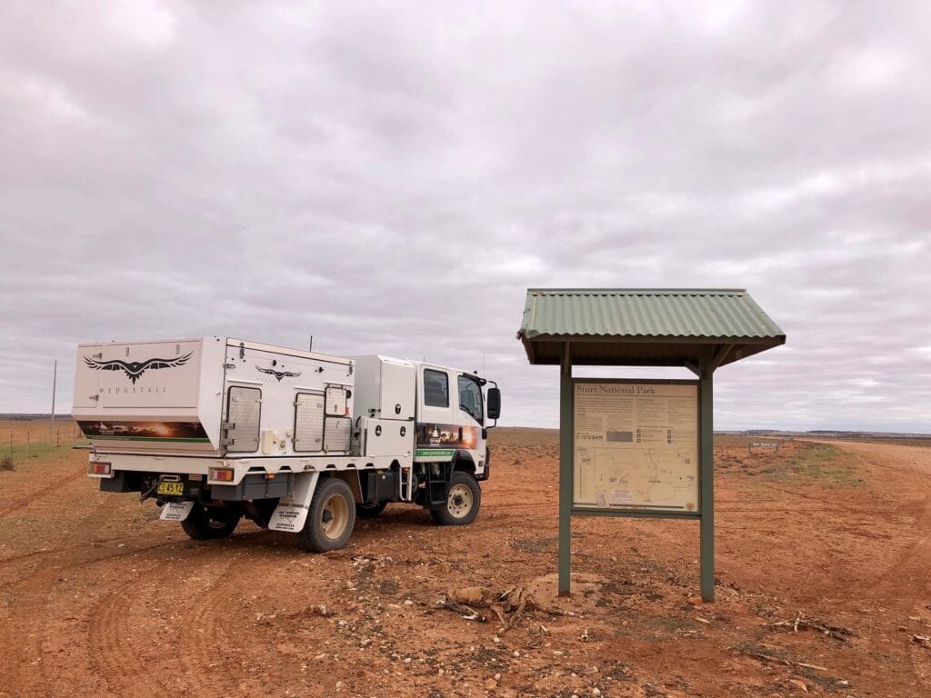
You’ll come to a T-intersection. Turning left you’ll pass the turnoff to Mount Wood Homestead, now within the National Park. It’s worth dropping in here to have a look around.
This place is pretty desolate. It must have been a harsh existence back in the day.
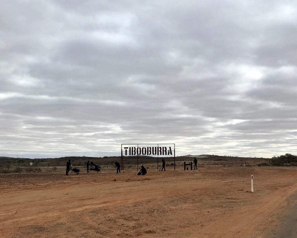
The Journey’s Over…
Back on the road and just over 25km into Tibooburra. Millions of giant granite boulders surround the town, giving it an other-worldly feel. Go out to the Tibooburra Aboriginal Reserve Campground and discover the story of how these boulders came to be here.
Check out the two pubs. They’re both worth visiting… the Family Hotel for the weird and wonderful nudes sketched onto the walls. Apparently artist Clifton Pugh was stranded there during a big rain event and started drawing on the walls.
Across the road at the two-storey Tibooburra Hotel, you’ll get a great feed!
You’ll find a replica of Charles Sturt’s boat at the northern end of town, at the Tibooburra Pioneer Park. Now that’s what I call an optimist! Sturt spent a lot of time exploring this region, pushing into arid country in his endless search for the inland sea.
Beside the Corner Country Store is the NSW Nationals Park office. They have a series of detailed displays inside the building… a whole lot of excellent information about and artefacts from the Wangkumara people, some information on Sturt’s expedition, and of course details about some of the local flora and fauna.
… Or Just Beginning!
Tibooburra is a jump-off point to dozens of incredible places:
- Keep heading west to camp at Lake Pinaroo, visit Cameron Corner then the Strzelecki Track,
- Explore Sturt National Park,
- See the Big Quoll, Big Bandicoot, and Big Bilby on the road to Cameron Corner,
- Head north into Queensland’s Channel Country,
- Head south down the Silver City Highway and discover the wonders of Mutawintji National Park,
- Make your way to Innamincka via one of many scenic routes…
The list is endless.
Not only does The Cut Line lead you into the “real” outback, it lands you smack bang in the middle of Corner Country. You really can’t ask for more than that!
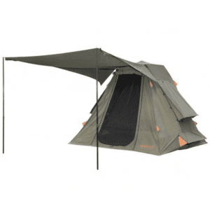
If you’re searching for camping gear and accessories, Wild Earth has a wide range available. Go here to find out more.
The Cut Line passes through Barranbinya, Gunu, Barundji, Wangkumara and Karenggapa Country.
Looking for more NSW Corner Country destinations? Then go here.

Get your Traveller’s Guides
… and a whole lot more at our FREE RESOURCES Page!
Any questions or comments? Go to the Comments below or join us on Pinterest, Facebook or YouTube.
Any errors or omissions are mine alone.
Hello just wanted to give you a quick heads up. The words in your content
seem to be running off the screen in Ie. I’m not sure if this is a formatting issue or something to do with
web browser compatibility but I figured I’d post to let you know.
The layout look great though! Hope you get the issue fixed soon. Kudos
Thanks for letting me know. It might be caused by a recent update. I’ll look into it. Cheers, Andrew
Thanks for the great informative info. Intending to travel this route in Spring 2020 and spend some time in Stuart NP. Then head south from there. Cheers Geoff
Hi Geoff,
Have a great time! Cheers, Andrew
Hi, you’re blog was great, really loved it. I’m intending to travel this route in a week or so. Was there much traffic on this route?
Thanks Peter! Regarding traffic, it’s normally pretty quiet. However, I imagine it’s a lot busier at the moment due to travel restrictions. Cheers, Andrew
what is the best time to travel along The Cut Line.?
i will be coming from Melbourne via the Cameron Corner and then onto Bourke.
how far off are they from finishing the bitumen.?
Thanks
Michael
Hi Michael,
The best time is between May and October, in the cooler months. We just travelled along there (December, 2020) on our way from the east coast to west of Tibooburra. It’s hot! The road varies between good and very rough.
The road between Wanaaring and Tibooburra (230km) is still dirt and can be very rough. The road between Wanaaring and Bourke still has about 80km of dirt and can also be rough. I imagine the Bourke-Wanaaring road will be all tar by the end of 2021.
Cheers, Andrew
Hi,
Thanks for all the great info! Just wanted to ask how long the drive takes? I’m considering doing the drive from Tibooburra to Bourke around July 2021, how long would you estimate that to take?
Cheers,
Zayn.
Hi Zyan,
No worries, glad it’s helpful.
Really rough times (depending on how rough the dirt sections are): Tibooburra to Wanaaring approx. 3½ hrs and Wanaaring to Bourke approx. 2½ hrs. Obviously these times depend on many things… road condition, what you’re driving, whether you’re towing and so on. Hope this helps! Cheers, Andrew
Hi Andrew
Travelling Bourke, Wanaaring, Tibooburra towing a caravan that is NOT a off road type. Do not know your definition of rough, would you tow a standard caravan on this journey in April/May.
Ta
Deb
Hi Deb,
Parts of this road can be horrendous. The corrugations, ruts and holes can be massive in places. You can be lucky and drive it just after the grader. In this case, it’ll be fine for an on-road caravan. But don’t count on it. Every time we’ve travelled this road (and that’s quite a few times now), there have been some nasty stretches that would shake an on-road caravan apart. Hope this helps.
Cheers, Andrew