
Isla Gorge National Park – Rugged Ranges, And A Wild Mountain Pass
Isla Gorge National Park lies amongst the Dawson Ranges in central Queensland. This is sandstone country. Over millions of years, erosion has created a wild jumble of sheer cliffs and rugged gorges. Rising high above the surrounding plains, Isla Gorge National Park is an unexpected surprise.
Update 2019: I only recently discovered Isla is pronounced Eye-la. Apologies for the incorrect pronunciation in the video.
Getting There
We checked out two parts of Isla Gorge National Park.
The first part is easy to get to. Travel 60km North from Taroom on the tarred Leichhardt Highway or 40km South from Theodore and you’re at the campground. This doubles as lookout.
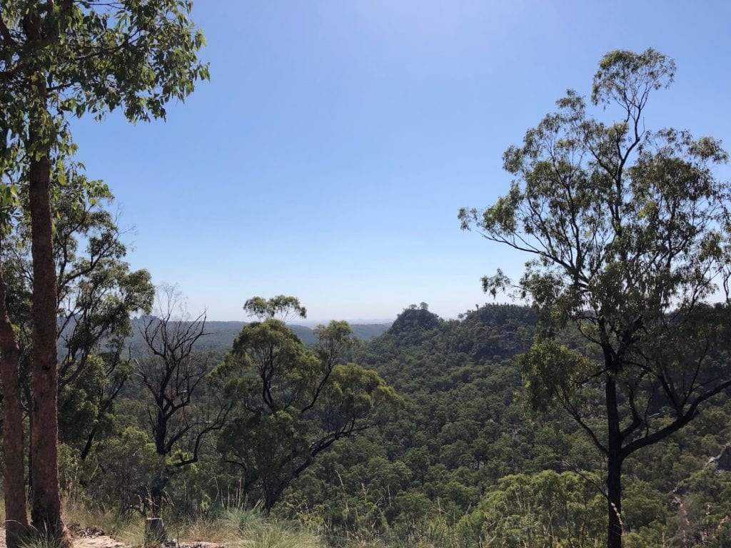
The view is pretty spectacular. Rugged gorges, sheer cliffs and narrow ridgelines with sheer drops both sides, stretch out for miles in all directions.
You can camp here. We were tempted to stay, as the sunsets and sunrises must be truly spectacular. However, we decided to move on. You’ll need to be self-sufficient. There’s drop toilets but no water at all.
We stayed on the Dawson River near Taroom for the night then ventured back up into Isla Gorge National Park.
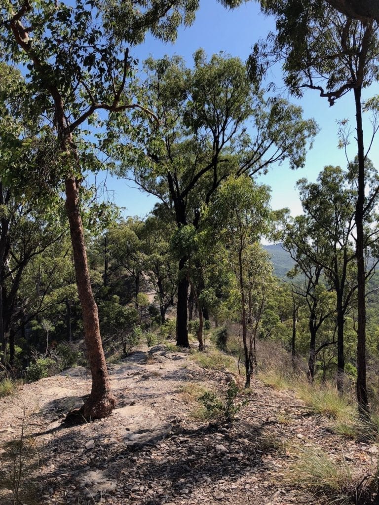
This time we journeyed to the North-Western edge of the Park. There’s a small finger of National Park that includes a hand-built paved “road”. We turned left onto Fitzroy Developmental Road, then off to the right and followed a series of back roads until we reached Flagstaff Road.
Flagstaff Road twists and winds through grazing country then into a heavily wooded state forest, and ultimately into the North-Western edge of Isla Gorge National Park.
It’s here you’ll find the hand-paved road.
Taking On The Mountain
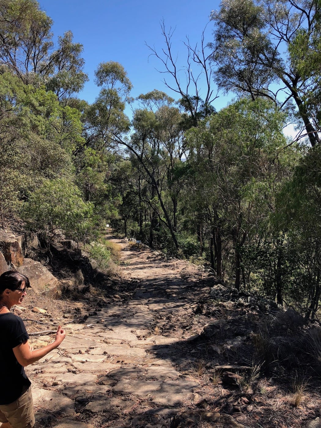
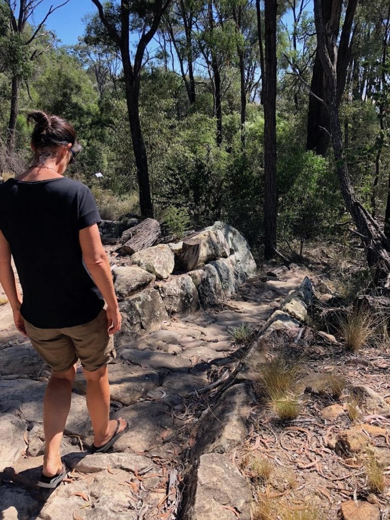
Mountain pass is probably a better description of the hand-paved road. It was built in the 1860s so bullock wagons could cross the sandstone escarpment. You can walk down the road. This gives you a feel for both the steepness and how skilful the road-builders were.
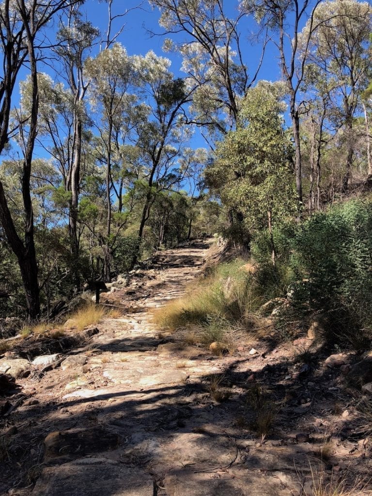
This road is a masterpiece of construction. Huge sandstone slabs were laboriously trimmed then placed by hand to form a road up the escarpment. A short section of about 500 metres remains, the rest has eroded and broken up.
This road is unbelievably steep. Bullock teams would wait for a second team at the bottom. Then they would hitch both teams together and drag huge loads of wool to the top. Twenty or so bullocks would heave and strain to get the wagon to the top. Then they’d unhitch, walk back to the bottom and drag the second load up.
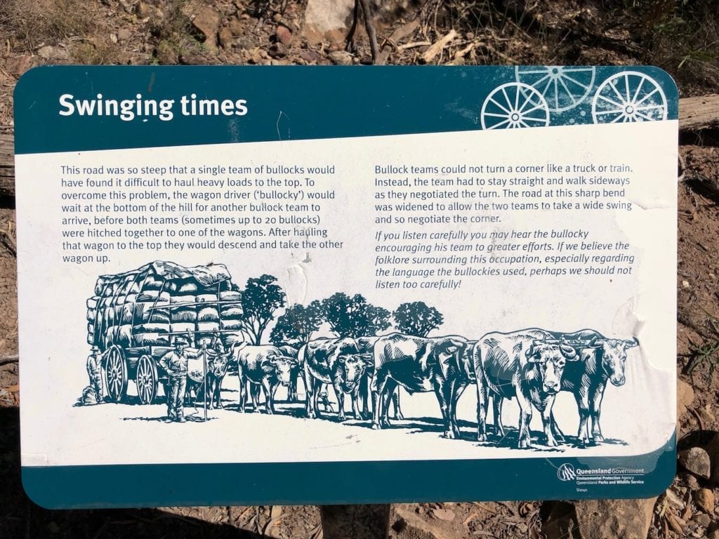
They were carrying mainly wool from Roma to Rockhampton. No doubt, they also carried loads of supplies back. Dragging these huge loads up such a steep and narrow mountain track would have been a pretty frightening experience.
Summing Up
Isla Gorge National Park is fascinating, such a contrast to the surrounding plains. A combination of spectacular sandstone gorges and an extraordinary hand-paved mountain pass make this a place well worth visiting.
Isla Gorge National Park is on Iman Country.

Get your Traveller’s Guides
… and a whole lot more at our FREE RESOURCES Page!
Any questions or comments? Go to the Comments below or join us on Pinterest, Facebook or YouTube.
Any errors or omissions are mine alone.
For more QLD National Parks, go here.
The fit of the stones in the Flagstone road is something else, really interesting to see how this is still around over a century and a half later.
This road was being built around the time of the Hornet Bank massacre, which eventually lead to the near complete extermination of the Iman people. The Iman were regarded as very fierce and would have added another dimension of danger to the crossing.
(btw, Isla is pronounced like the name – eye-la)
Yes it’s a work of art. the people who built this really knew their trade.
Thanks for mentioning the Hornet Bank massacre. They were terrible times, no doubt. Seeing the country, I could imagine there would be plenty of opportunities to set up ambushes.
And I apologise for the mis-pronunciation of Isla Gorge!
Regards, Andrew