
Last time, we had a look around Kununurra and decided we liked it! Go here if you missed it.
The World At Your Feet
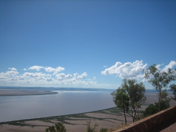
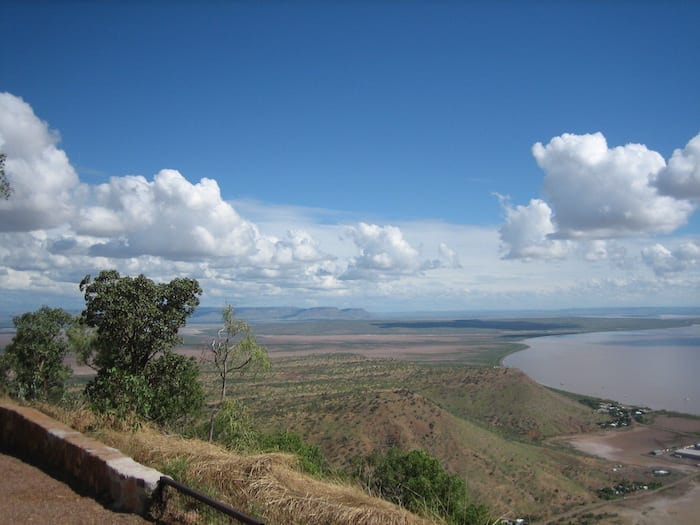
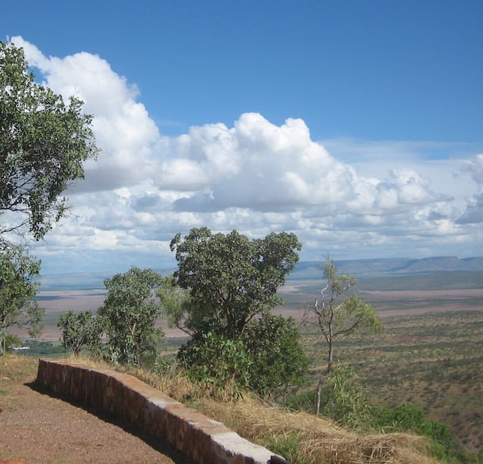
You’re standing on top of the world, trying to absorb an impossibly enormous vista. Spread out beneath you are vast mud flats, cut through the middle by a river so wide that you wonder if it’s a bay.
You are at the Five Rivers Lookout above Wyndham. At about 325 metres high, the lookout sits atop The Bastion. This is part of an ancient mountain range, weathered over time to a just shadow of its former self.
The Ord, King, Pentecost, Forrest and Durack Rivers come together and flow out to sea at Cambridge Gulf. Thousands of hectares of mudflats spread as far as you can see, no doubt submerging in the Wet season.
Stands of mangroves hug the riverbanks. These waters are supposedly teeming with saltwater crocodiles. It’s easy to see why – mangroves, mudflats, an endless supply of food and access to the open sea all make this prime real estate for crocs.
An Incredible Journey
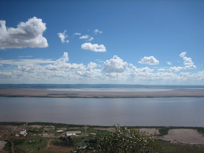
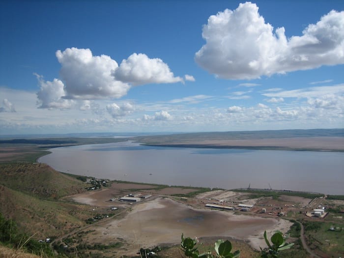
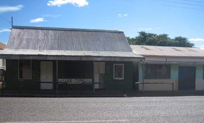
Old Wyndham is tucked beneath The Bastion. It hugs the flat ground between the base of the mountain range and the river. Wyndham sprang from the goldrush at Halls Creek, about 370km to the South.
Irishman Patsy Durack and his family drove over 7,000 cattle from Thylungra on Coopers Creek in Western Queensland into the East Kimberley in the late 1880’s. They took over 2 years to traverse almost 5,000km of virgin lands.
Durack was determined to overcome the extreme isolation of the Kimberley, trying to make the area accessible to Southern markets. The Duracks eventually owned 6 properties and a total of seven million acres in the Kimberley, despite the setbacks.
No doubt Patsy actively promoted the potential of rich goldfields around Halls Creek as a way to open up the lands. His plan paid off. At the mention of gold, Halls Creek was flooded with hopeful prospectors. Hundreds of Chinese walked – or attempted to walk – over 3,000km from the Palmer River Goldfields west of Cooktown in Queensland. No record was kept of how many perished or were killed along the way.
For Patsy though, his gamble had succeeded. Halls Creek goldfields now needed “easy” access and the only practical route was via sea to the north, then inland to Halls Creek. Wyndham grew into a port town, servicing the goldfields. Now Patsy had a port and a means of shipping his livestock to Southern markets.
However, the Halls Creek goldrush was short-lived and Wyndham quickly declined into a small, isolated port settlement. Wyndham was – and still is – incredibly isolated. For Wyndham is over 3,000km from Perth to the south-west and nearly 1,000km from Darwin in the Northern Territory.
Tragic Consequences
The Duracks’ exploits are filled with extraordinary tales of survival and persistence in extreme conditions. However we must remember their pioneering feats came at a massive cost to the people who already called the Kimberley home and had done so for tens of thousands of years.
Extreme isolation and lawlessness meant the Kimberley was a war zone. The First People fought long and hard to drive the invaders out, but were ultimately defeated. Bounties were placed on Aboriginal peoples’ heads – men, women and children, young or old – and they were rounded up, chained together and walked into Derby for the bounty-hunters to collect their rewards.
As a country, we’ve chosen to ignore these atrocities or written them out of white history altogether. It’s time we faced facts.
Wyndham – A Tale Of Two Towns
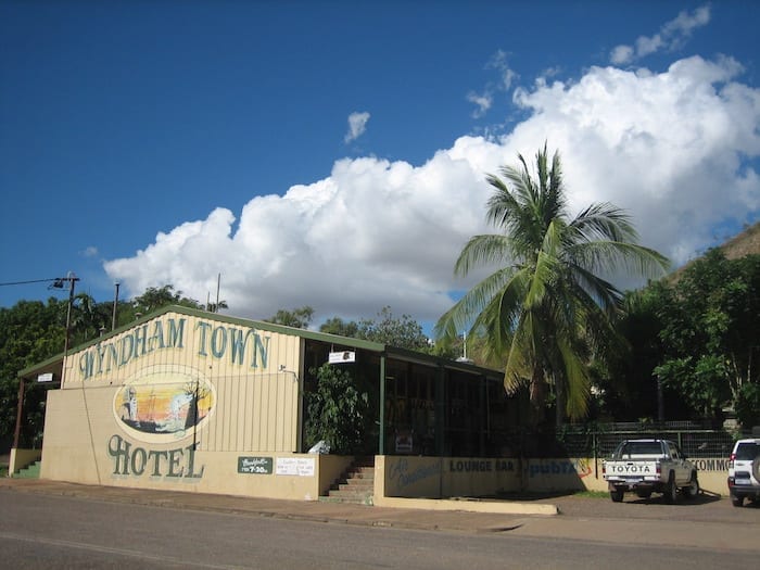
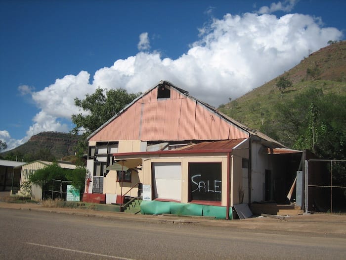
Back to the present day. Wyndham is split into two towns. The old town hugs the base of The Bastion whilst a second settlement has sprung up to the south of the old town a few kilometres back along the road to Kununurra, away from the river and slightly more protected by the mountain range.
Although the term “protected” is probably not accurate. Mudflats stretch to the horizon and the mountain range overlooking the town is mainly rock. So trees are few and far between. To top things off, Wyndham has one of the highest average temperatures of any town in Australia – no mean feat! And I can only imagine how many mozzies and sandflies breed out on the mudflats then swarm into town looking for fresh blood…
Now the town survives mainly on port activities – some mineral exports and the live cattle export trade to Asian countries.
Back To Kununurra – And A Surprise Sighting!
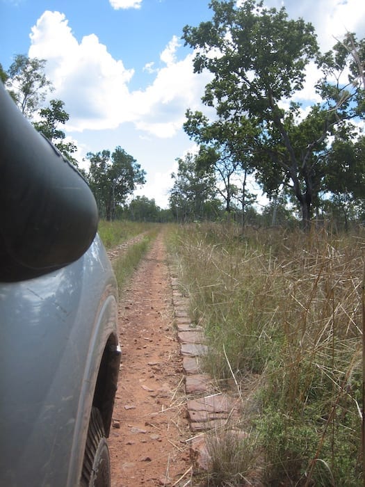
On our way to Wyndham, we had discovered a section of the old Wyndham – Halls Creek Road that we were able to drive along. Built by convicts, it still has kerb stones clearly visible along the edges. These were lain on both sides then filled with gravel in between. This must have been hard work!
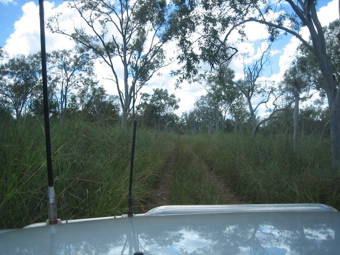
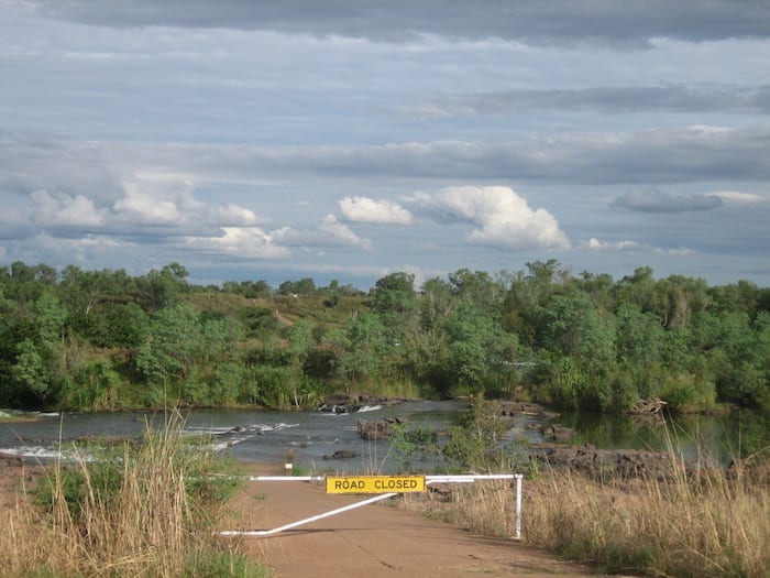
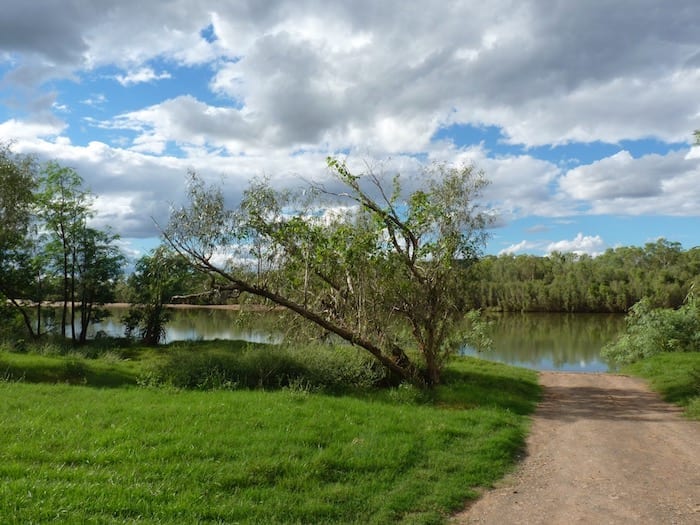
On our way back to Kununurra, we discovered Parry Creek Road, which vaguely follows the Ord River upstream until you reach the western side of Ivanhoe Crossing. With the crossing closed, we veered south, met up with the Victoria Highway, and turned left for an easy run back into Kununurra.
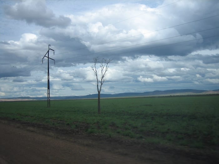
Vast black soil plains with huge mobs of beef cattle are a feature of this journey. This was yet another one of the Durack properties, “Ivanhoe Station”.
However the highlight of this trip was our first sighting of a saltwater crocodile in the wild. We had turned down a track towards the Ord River to see what was there. To our surprise, it was a concrete boat ramp! Not really what we were expecting out here.
Anyhow, we jumped out to stretch our legs. Of course we all wandered down to the boat ramp. Across the river was an enormous saltie sunning himself on a mud bank. Our first reaction was to back-pedal halfway up the boat ramp in unison!
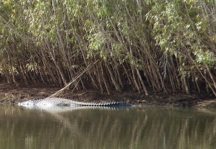
What a sight. He was enormous – frightening and magnificent at the same time. This creature oozed a “don’t mess with me” attitude.
It was a fitting end to a fascinating day.
Next time: Back onto the Gibb River Road, to El Questro Station.
Plan your Gibb River Road Adventure
Download “Gibb River Road – A Traveller’s Guide” for info on what to see, road conditions, fuel and much more.
…at our FREE RESOURCES Page!
Any questions or comments? Go to the Comments below or join us on Pinterest, Facebook or YouTube.
Any errors or omissions are mine alone.
Looking for more Western Australian Destinations? Then go here.