
Note: This article contains an affiliate link to Camera House. If you click through and make a purchase, we earn a small commission at no extra cost to you.
The Oxley Wild Rivers National Park sits on the New England Plateau in north-east New South Wales.
When you take the Oxley Highway from the coast to the New England plateau, you’re in for a wild ride!
The highway follows the magnificent Macleay River Valley then leaves this coastal hinterland, pushing into the steep and rugged mountains of the Great Dividing Range. The road’s a seemingly endless series of chicanes and hairpin bends, clinging precariously to the sides of seriously steep mountains.
With its high annual rainfall and rugged terrain, this region is home to the Oxley Wild Rivers National Park. The national park includes spectacular waterfalls and deep gorges. So we decided to have a look for ourselves.
Whether you’re riding motorbike or driving a car or 4WD, you can see at least some of the delights this park has to offer.
Tia Falls
Tia Falls is in the Oxley Wild Rivers National Park. Tia River’s headwaters are in the cool, wet forest country to the south. This makes Tia River one of the most reliable water sources in the region, and a vital feeder river for the Macleay River which sustains farming and towns like South-West Rocks on the coast.
What to See
You turn off the Highway about 35km east of Walcha, then take a dirt road for about 7km through cleared grazing country. Then you’ll see some bush, the campground and day use parking.
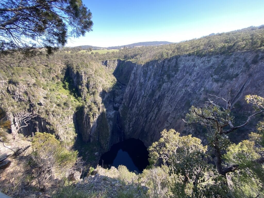
Through the trees, you’ll see a massive gorge perpetually doused in a blue haze. It’s pretty impressive!
The campground drops away to the river and the gorge below. Leading from both the campground and day use area are two walking tracks, the 5km return Tiara Walk and the 800m Tia Falls Lookout Walk. Both are return walks.
The Tiara Walk takes you along the top of the gorge on the north-western side.
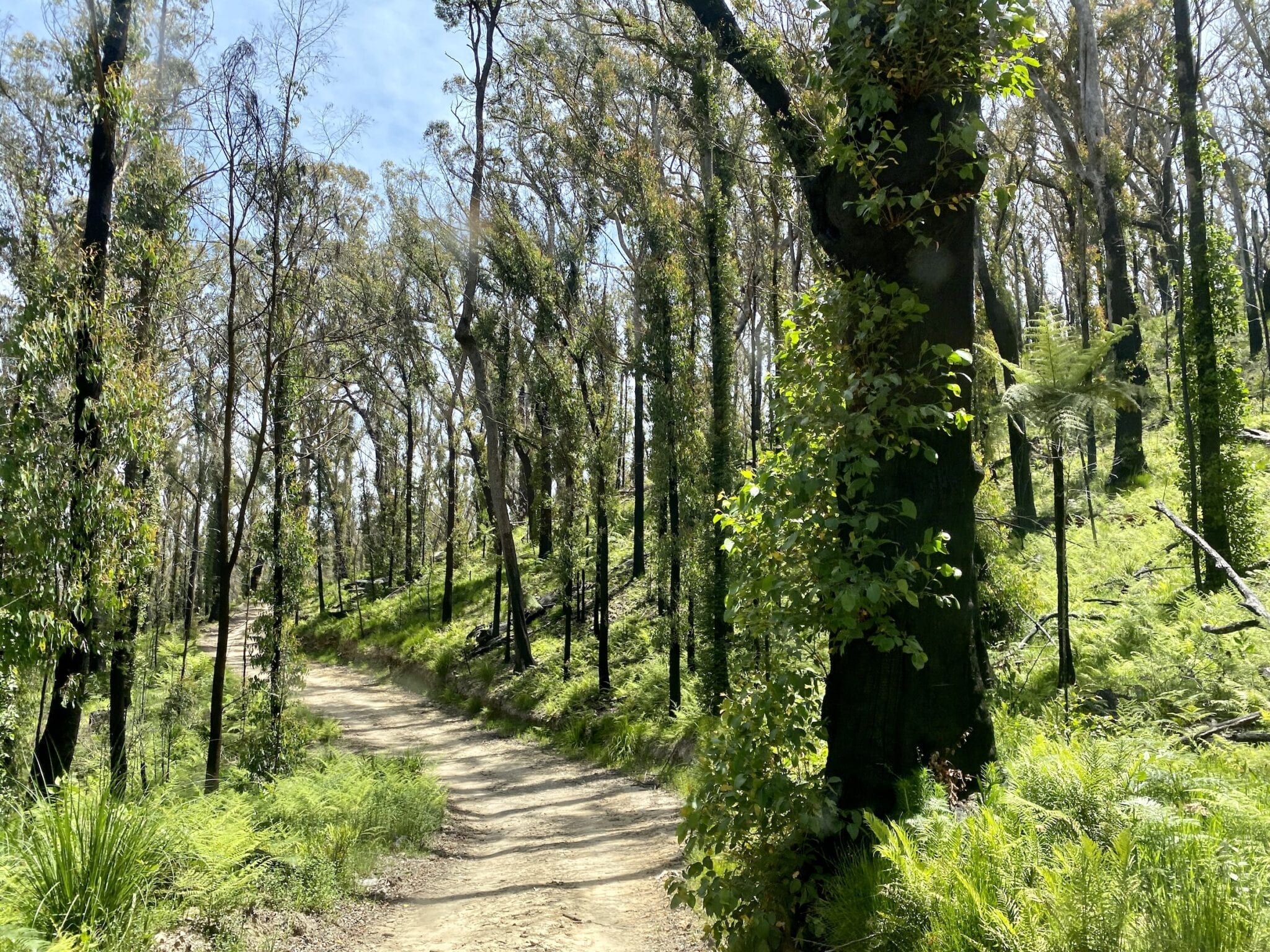
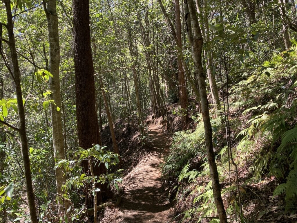
The actual walk meanders through the bush, however it was recovering from massive bushfires when we were there. So the walk itself wasn’t particularly inspiring, although it was interesting to see the thousands of gum and wattle tree suckers pushing their way out of the ground.
And keep your eye out for brush-tailed rock wallabies… they’re very cute.
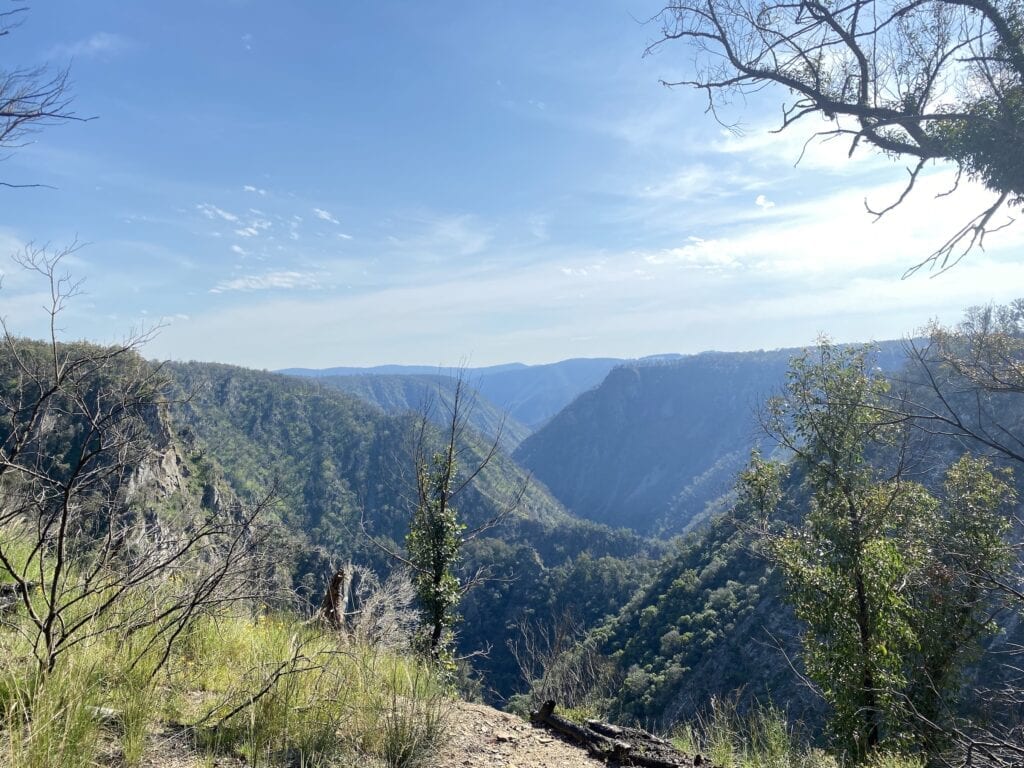
The views of the gorge are something else though. Looking down into the maze of jagged rock reefs, it’s sometimes difficult to figure out exactly what you’re looking at. Rocky ridge lines intersect at all angles, throwing deceptive shadows and confusing the brain.
Your walking efforts are rewarded with two excellent lookouts. The pristine rock pools way below tantalise you on a hot day, inviting you for a swim. Not a good idea though… the gorge walls are treacherous.
The Tia Falls Lookout Walk is much shorter and quite a bit easier. And if you are in a hurry, this is the walk to do.
It sweeps around the edge of the gorge in a big left hand arc, giving you amazing views of Tia Falls in several places. The falls crash over the rocks and change direction midway down, before landing in the gorge floor.
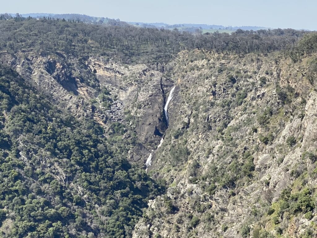
The first lookout gives you a commanding view of the falls, while the second one gives you a sense of how huge this gorge is. You can just pick up river pools way below with the naked eye. We took our binoculars along and saw several beautiful pools way below us.
This really is stunning country… and incredibly rugged.
Camping and Facilities
You can camp here. You’ll need to pre-book on the National Parks website. There’s no mobile phone reception, although you might get an occasional blip on the Tiara Walk, depending on your carrier.
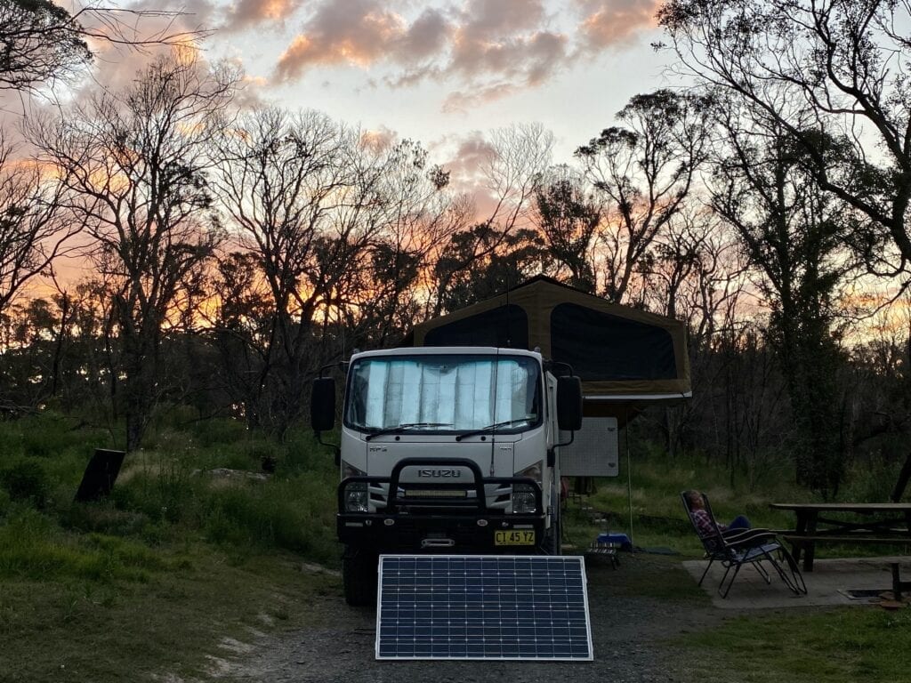
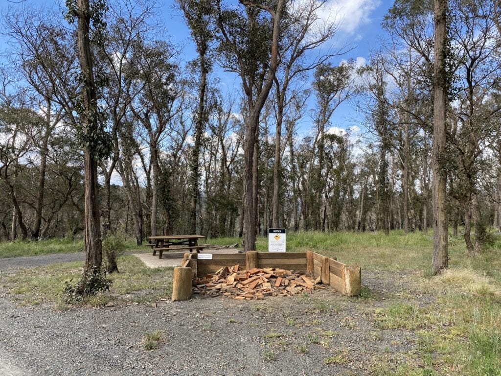
The half dozen or so campsites are large and most have fire pits and a wooden table. National Parks also provide firewood. There’s also a pit toilet.
Getting There
The Oxley Highway finally opens up once you reach the New England plateau. About 35km east of [Walcha], you’ll see the turnoff to the right. Follow the signs along this dirt road for about 7km to the campsite and day use area.
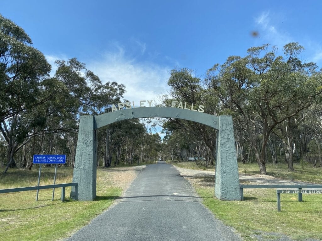
Apsley Falls
Apsley Falls are about 20km west of Walcha. The falls descend into an enormous gorge, which joins downstream with the Tia Falls gorge. These gorges are within the Oxley Wild Rivers National Park.
Unlike Tia Falls, the Apsley River runs through Walcha and plenty of farming country upstream of the falls. So the flow over the falls is minimal, even in a good season.
Still, it’s worth the short drive in from the Oxley Highway.
What to See
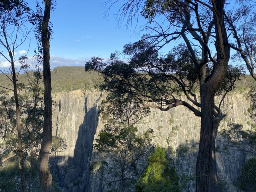
Less than a kilometre in from the highway, you be rewarded with magnificent views of the sheer slate cliffs plunging to the gorge way below.
A walk from the day use area takes you around the edge of the gorge, which wraps around you from left to right. You’re effectively on a point, with the falls to your left and the gorge running in front then turning sharply to your right.
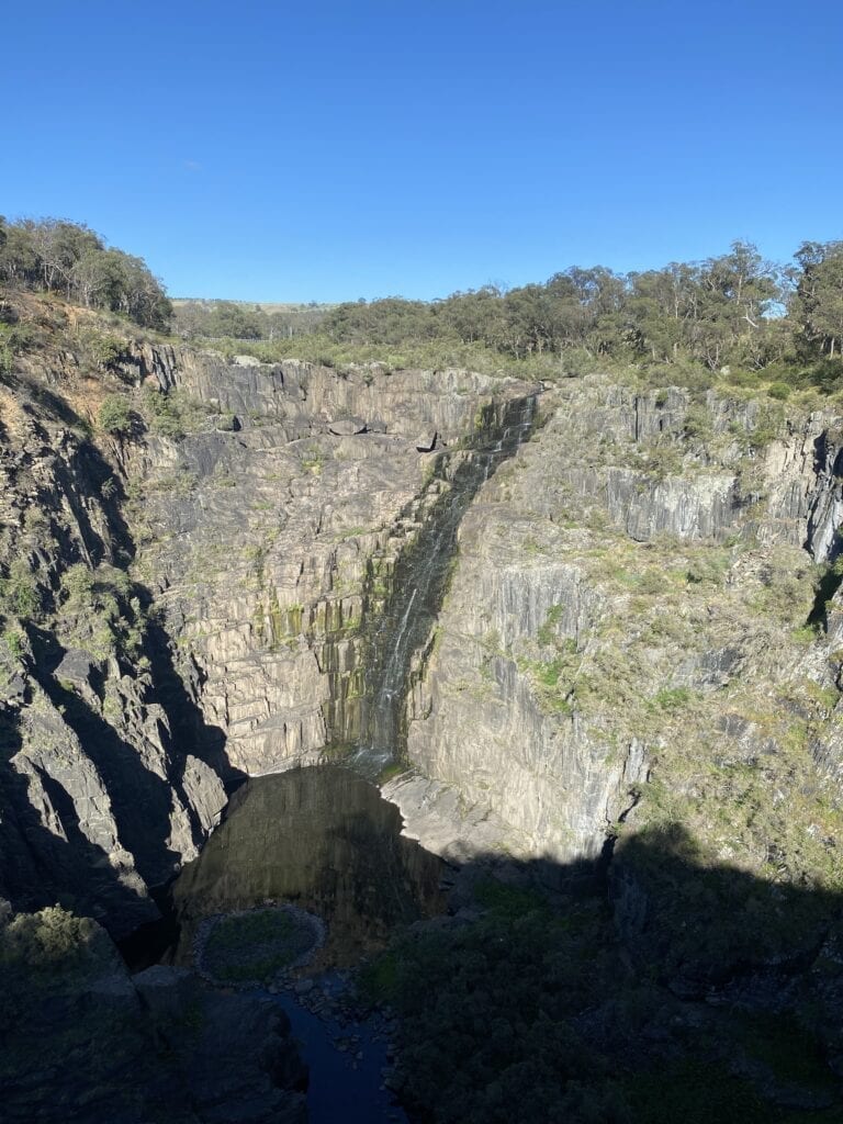
Here you can easily access lookouts which give you great views of the falls and the stunning gorge.
Another walking track crosses Apsley River to your left, then follows the other side of the gorge around to some high points. Here, you can see the lower falls way below. This is called the Oxley Walk (named after explorer John Oxley) and is 2.7km return on a bitumen path.
The Oxley Walk also gives you great views of Apsley Falls. Like Tia Falls, the large pools at the bottom of the gorge are inviting, but inaccessible.
Camping and Facilities
There’s a campground nearby. It has flushing toilets, tables, fire pits and limited firewood provided by National Parks. The campground has about a dozen sites, well separated from each other.
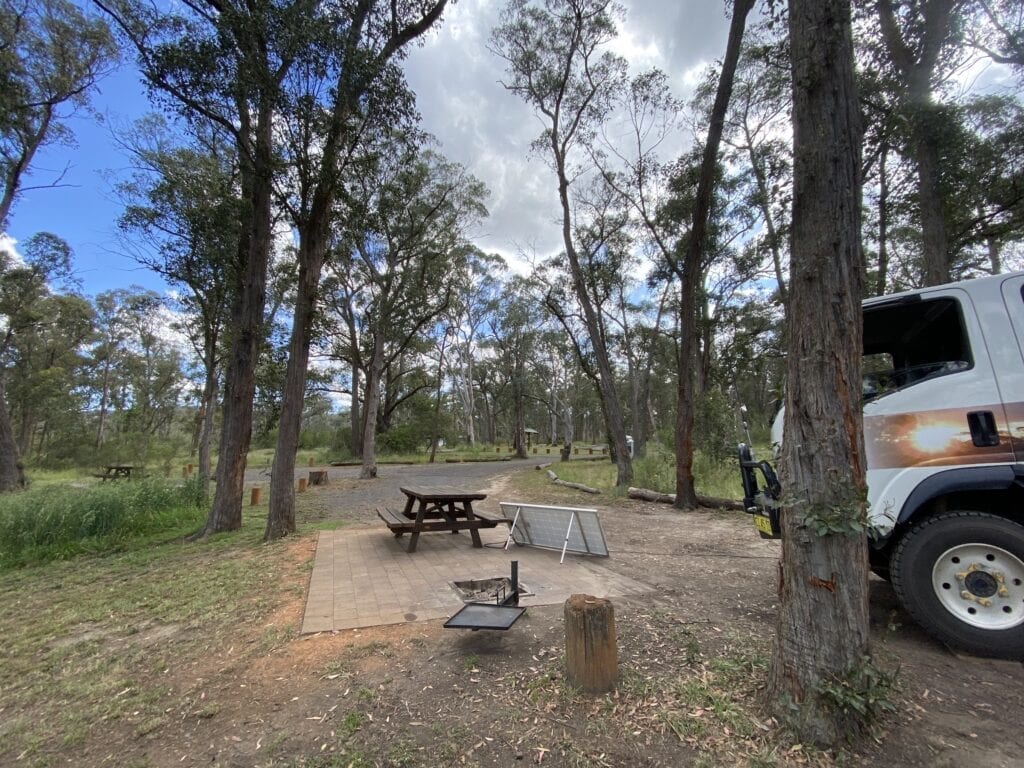
And if you’re lucky enough to find the site that sits right on the edge of the gorge still available, you’ll be rewarded with panoramic views of the gorge from your campsite.
You might get occasional phone reception, depending on your carrier.
Getting There
Apsley Falls is about 20km east of Walcha and less than a kilometre off the road. All access roads are tarred, including at the campsite.
Oxley Wild Rivers Drive
If you’re looking for a spectacular drive through Oxley Wild Rivers National Park, you can cut through from the Oxley Highway north to the old Armidale-Kempsey Road.
The Drive
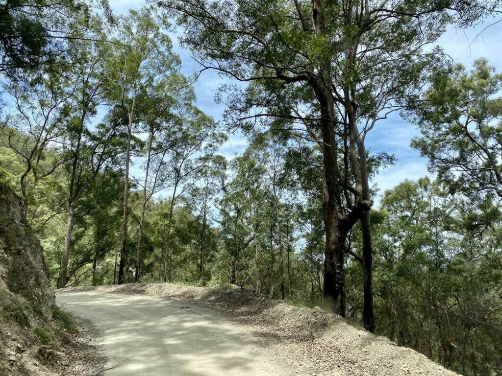
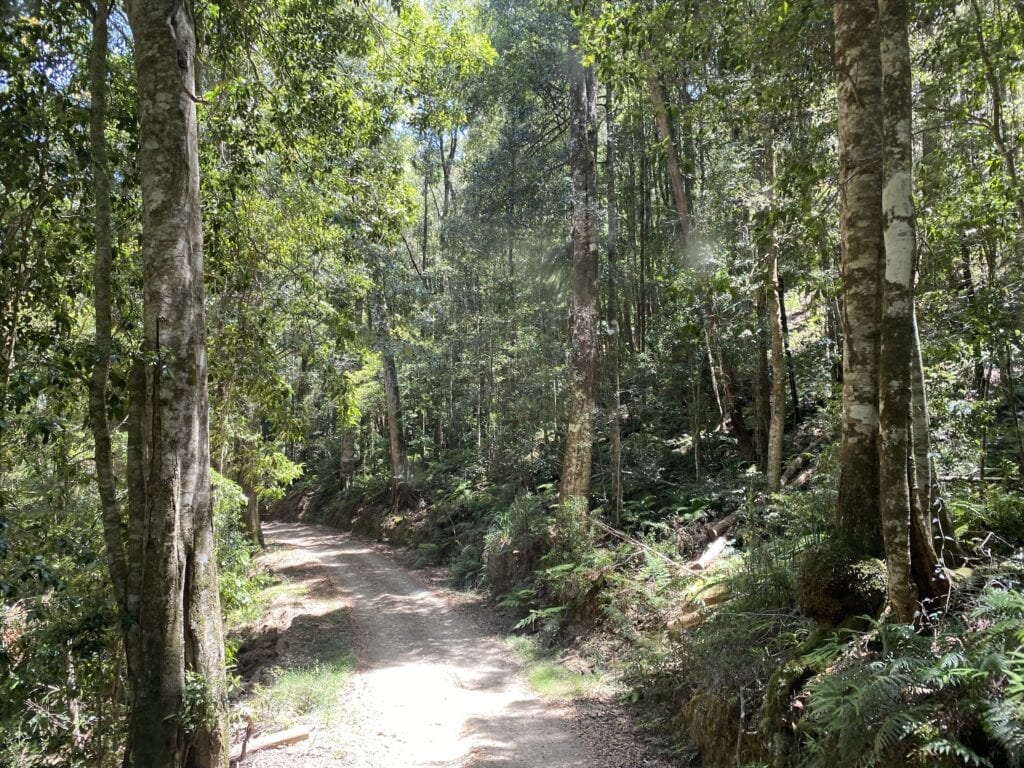
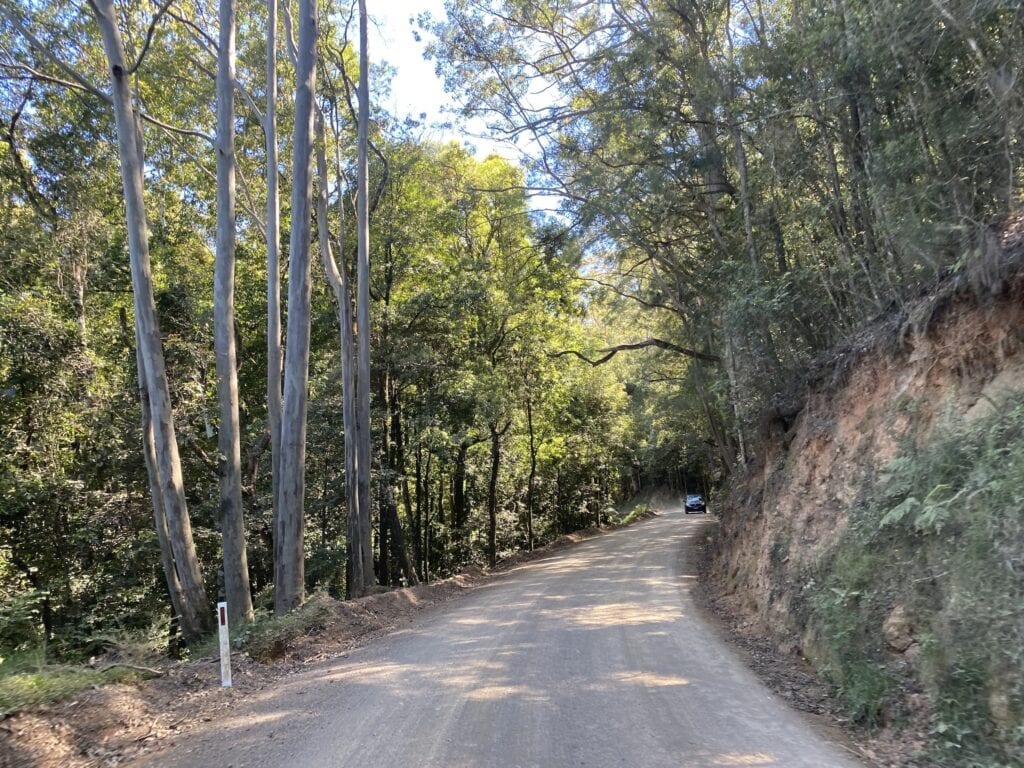
If you really want to see up close just how rugged this landscape is, then you’ll love this drive through the heart of Oxley Wild Rivers. It’s a slow, winding dirt road with some steep sections, but you could do it in a high clearance all-wheel drive.
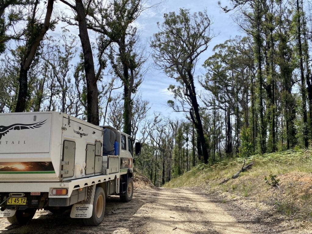
We passed through a year or so after the region was devastated by massive bushfires. Fortunately, the understory had started to grow back and many trees were sprouting shoots up their trunks, as gum trees do!
However, some places were nothing more than bare ground and forests of dead trees. The intense heat has scorched everything and it would be miracle if these parts ever recover.
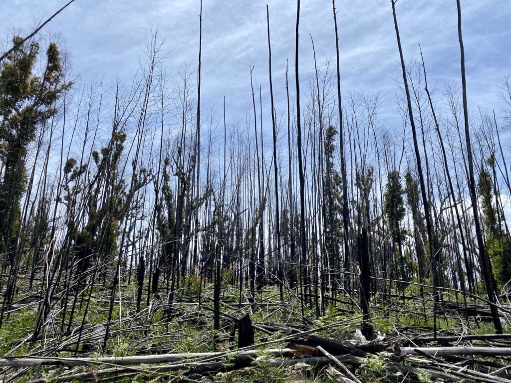
The fire had burnt through pretty much the entire way along this drive. What we did notice was the almost complete absence of life… very few birds, no reptiles and a lone wallaby.
Despite this, it’s still an excellent experience.
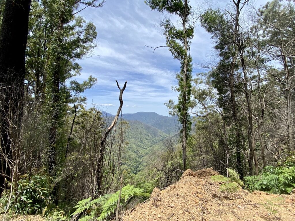
The landscape is incredibly rugged. You’ll spend the whole time either climbing steeply or descending. At one stage you’ll be over 1,150 metres above sea level at Kemp’s Pinnacle and it’s nothing to drop several hundred metres in one descent.
The track mostly clings to the side of near-vertical mountainsides or snakes along the top of ridgelines. The views to the distance are fantastic… classic Australian bush scenery.
Just after Kemp’s Pinnacle you drop way down into a beautiful narrow valley, into cool rainforest. The fires had somehow left this small valley untouched. It gave us a rare glimpse of the dense rainforest canopy you’d normally see in the more protected gullies and valleys.
After this, it was another wild climb ever-upwards. And this northern end is where you’ll see some truly breath-taking views.
The roads clings tenaciously to ridgelines, with massive drops either side at narrow saddles joining the mountain ridges. You look straight across at the mountains on the other side of the deep gullies and concentrate hard on trying not to look straight down!
Pretty soon, you’re out of the National Park and into state forest, then private land. You drop more than 750 metres in one long downhill stretch. After a drive through a pretty valley, you’ll cross the Macleay River then hit the old Armidale-Kempsey Road.
Camping and Facilities
You’ll need to book these campgrounds online before you arrive. The steep terrain along this drive means you’ll be in and out of mobile reception, depending on your carrier.
Mooraback Campground
Mooraback Campground has grassy campsites and is accessible by 2WD vehicles. There’s a loop walk and another walk to Platypus Pools. If you’re patient, you might see a platypus late afternoon or early morning.
There’s drop toilets, picnic tables and fire pits. National Parks supply some firewood, but bring your own to be certain. Bring your own water and take all rubbish with you.
Youdales Campground
Youdales Campground is on Kunderang Brook. Access is low range 4WD only, via a steep track. When you book online, you’ll get a code for a locked access gate. The locked gate prevents unsuspecting day trippers venturing down the track, then getting stuck.
This campground sits at the edge of Kunderang Brook and is a peaceful bush camp in the wild gorge country. There’s drop toilets, picnic tables and fire pits. National Park supply firewood, but bring your own just in case.
While water is available in the creek, it’s probably wise to bring your own. Take all your rubbish out with you.
Daisy Plains Campground
Daisy Plains Campground was closed when we took this drive. It’s actually in Carrai State Forest on the northern side of Oxley Wild Rivers National Park.
Check the National Parks website when you’re about to take this journey for updated information on this campground.
Getting There
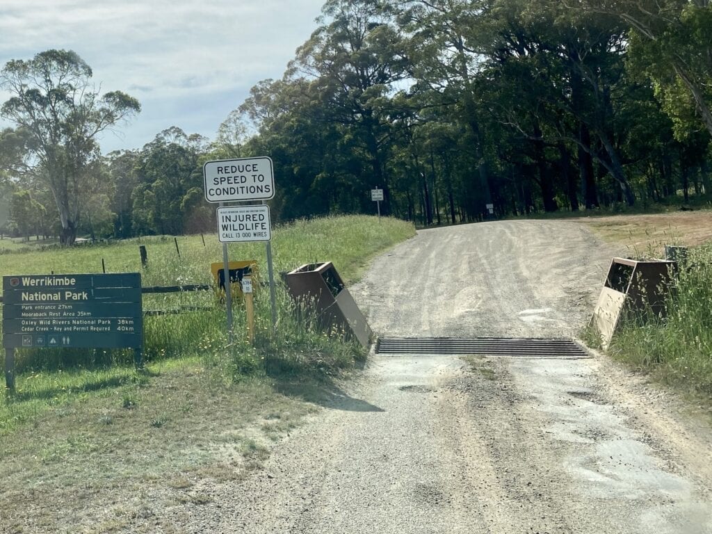
About 55km east of Walcha, turn off onto Kangaroo Flat road just east of Yarrowitch. You’ll see a sign to Werrikimbe NP. Confusingly, this region is home to three adjoining national parks… Oxley Wild Rivers, Werrikimbe and Willi Willi.
After about 20km, you’ll come to a fork in the road. Veer right onto Mooraback Road. There’s a signpost pointing to Werrikimbe National Park.
Once in Werrikimbe National Park, Mooraback Road takes you into Mooraback Campground. You actually turn right off the track to the campground. The road continues on, becoming Racecourse Track. Here, the track narrows and is less used.
The next important turnoff is when you meet Coachwood Road. Racecourse Track continues straight on, but you need to hook a very sharp left onto Coachwood Road.
There’s one other intersection worth mentioning.
As you exit Oxley Wild Rivers National Park at the northern end, you’ll merge onto Carrai Road coming in from your left. This road comes from Daisy Plains, which has a campground. However, it was closed due to fire damage when we passed through there.
Side Trip – Ellenborough Falls
Ellenborough Falls are in the Manning Valley and quite a diversion off the Oxley Highway. They’re not in Oxley Wild Rivers National Park. However if you’re in the region, then they’re well worth the effort.
What to See
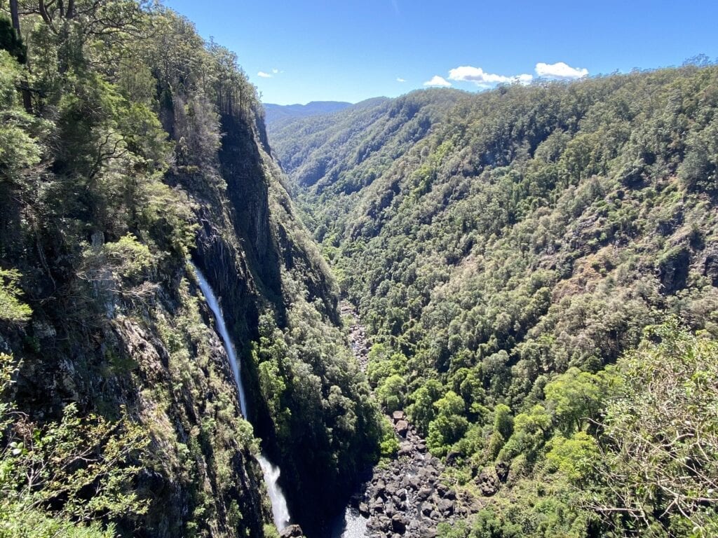
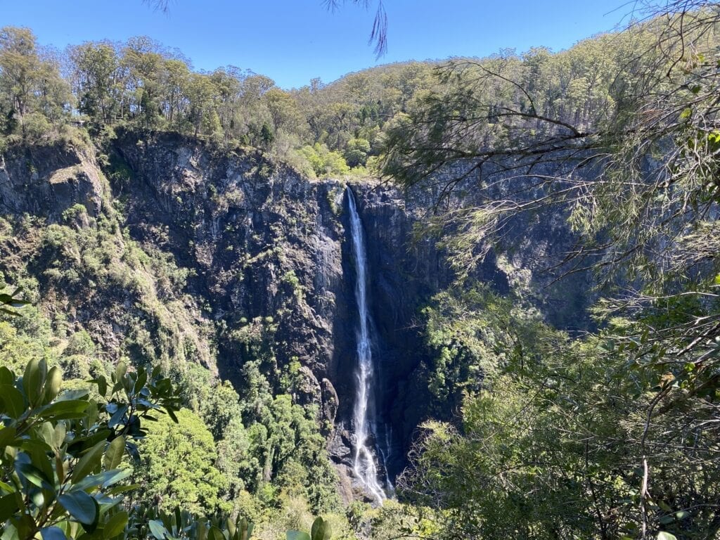
Ellenborough Falls is the second highest waterfall in the Southern Hemisphere. It plunges over a cliff into a deep rainforest gorge, free-falling 200 metres.
The car park is at the top of the waterfall, giving you beautiful views of the gorge way down below. Once you’ve digested the information on the interpretive signage shelter, check out the view from the viewing platform… it’s breath-taking.
The massive gorge opens up before you, covered in thick rainforest. To your left, the waterfall tumbles to the valley floor, pounding the huge basalt rocks at the bottom. This view alone is worth the drive here.
Four walks from the car park give you plenty of options. Two are short, while the other two are quite a bit longer.
One short walk takes you to Ellenborough River, a few hundred metres upstream from the cliff edge. Or you can take another short walk down to a viewing platform, above the point where Ellenborough River disappears into the abyss.
Two longer walks start at the car park.
One leads you about 700 metres around to the right, to the Knoll. The track winds around the sheer gorge to a viewing platform directly opposite the waterfall. This fairly easy walk is well shaded under the beautiful rainforest canopy.
You’ll pass huge tallowwood and box trees, reaching straight up towards the sky. The understory is alive with all manner of lush ferns, those scruffling noises of creatures unseen, and the ever-present rainforest smell of decomposing plant matter.
The other walk branches off the Knoll walk and drops down to the lower falls. Be aware, it has over 600 steps so you’ll need a reasonable level of fitness. By all accounts, this walk is well worth the effort. Unfortunately it was temporarily closed for routine maintenance, so we didn’t get to give our calf muscles a workout!
Camping and Facilities
There’s no camping allowed at Ellenborough Falls. They have a large car park, toilets and undercover seats for a picnic lunch. There is mobile phone reception in the car park.
Getting There
From the south, turn off the Pacific Highway at the signs to Wingham. Follow the tourist drive signs. This takes you through lush green farming country, then the road turns to dirt and winds up a mountain range.
Watch out for on-coming traffic, especially logging trucks.
Eventually you’ll reach the tiny village of Elands. Ellenborough Falls is a couple of kilometres further on.
From the Oxley Highway driving west, turn left at the signs to Comboyne and Elands. Again, this tarred road turns to dirt until you arrive at Elands.
If you’re driving east on the Oxley Highway, turn right at Knodingbul Road. The turnoff is about 87km east of Walcha. Dirt roads take you through the Bulga State Forest and you’ll arrive at Ellenborough Falls from the north. These state forest roads can close without warning, so have a backup plan in case they’re closed (as they were when we were there).
In Summary
The Oxley Wild Rivers National Park gives you several opportunities to see this rugged country up close. As you’re marvelling at the scenery, imagine how attractive this region must have been to the First Nations people. They had all the resources they needed and could move into the tablelands in the warmer months, then retreat to the coast in the cooler months.
Whether you choose to camp at the waterfalls or take the drive through the park, Oxley Wild Rivers is incredibly beautiful country.
The Oxley Wild Rivers National Park is on Biripi and Dainggatti Country.

Get your Traveller’s Guides
… and a whole lot more at our FREE RESOURCES Page!
Any questions or comments? Go to the Comments below or join us on Pinterest, Facebook or YouTube.
Any errors or omissions are mine alone.
Looking for more great articles on NSW National Parks? Then go here.