
Note: This article may contain affiliate links. If you click through and make a purchase, we earn a small commission at no extra cost to you.
Cordillo Downs Road (or Cordillo Road as some maps show) is a 300km rough dirt road from Innamincka in South Australia to the Birdsville Developmental Road in Queensland.
Often used as a “shortcut” between Innamincka and Birdsville, this road’s renowned for its endless rocks and stones.
And it’s hardly surprising.
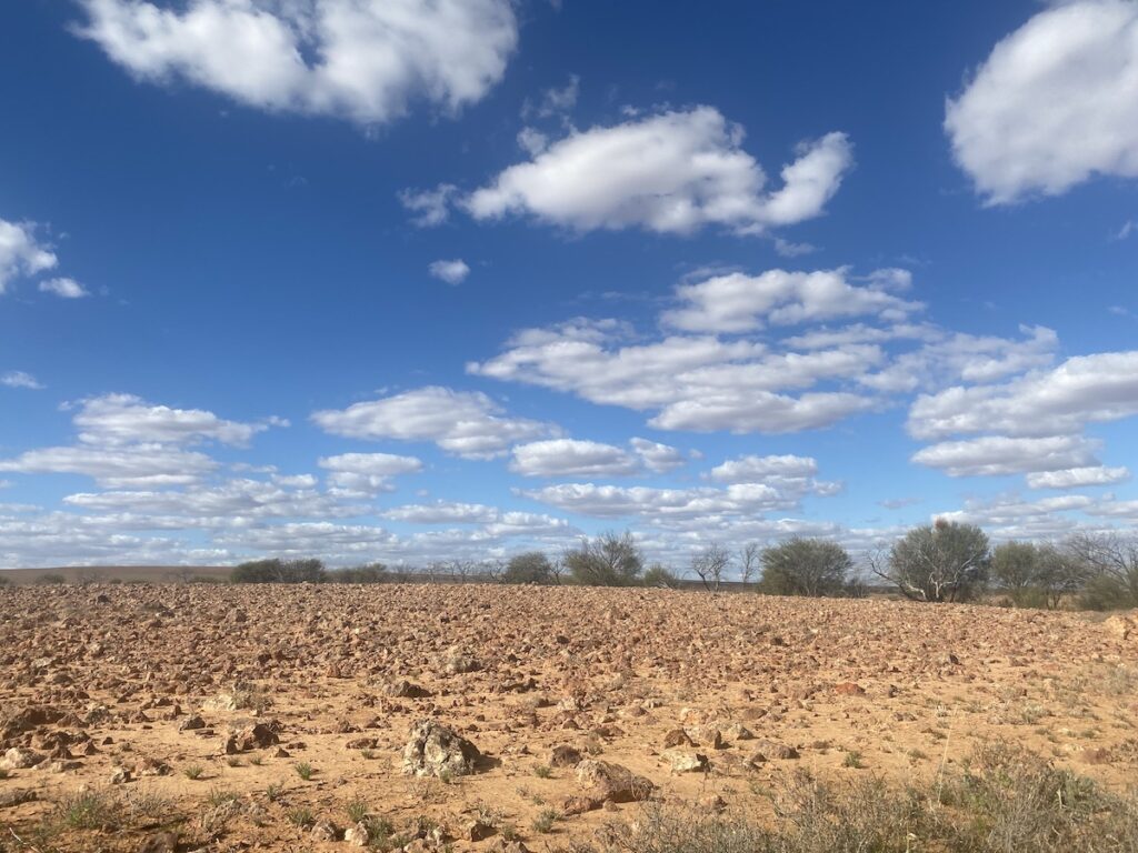
Cordillo Downs Road crosses the vast Sturt Stony Desert, an endless plain of gibbers. You’ll also travel through the Strzelecki Desert. But there’s more to this journey than gibber plains…
Innamincka Regional Reserve
The settlement of Innamincka and much of Cordillo Downs Road is within the curiously-named Innamincka Regional Reserve. It covers 1.3 million hectares of arid zone and desert land.
I have to admit, I really don’t quite understand South Australia’s regional reserves. The Reserve was proclaimed in 1988 under the National Parks and Wildlife Act to recognise it as “a place of major conservation importance”.
Fair enough. But it also permits on-going mining and agricultural activity. Meaning oil and gas fields, plus pastoral leases running large mobs of cattle.
In other words, business as usual.
Perhaps the original idea was to find ways for agriculture and mining to operate sustainably, with minimal environmental impact. I really don’t know. Although, I suppose it does give National Parks some control over what areas can’t be touched – in theory at least. If you know the answer, please enlighten us in the Comments below.
Does this mean you need a permit for Cordillo Downs Road?
Yes, you need a vehicle entry permit. Get your permit online here. Or the Innamincka Store has a QR code in the window. You’ll need a phone with a Telstra SIM card.
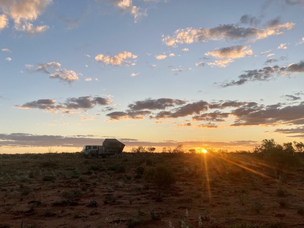
Camping is free. It’s simply a case of pulling off the road somewhere along the road.
A Slow Start
Heading north out of Innamicka, you cross a causeway over Cooper Creek. We were fortunate to see Cooper Creek in flood a few years ago. However, it was just a small trickle, with a large billabong upstream of the causeway.
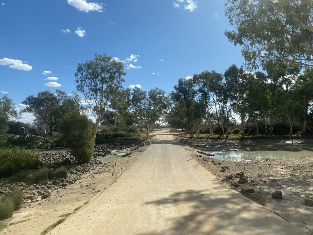
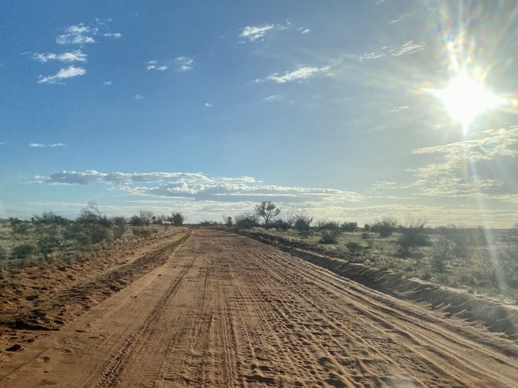
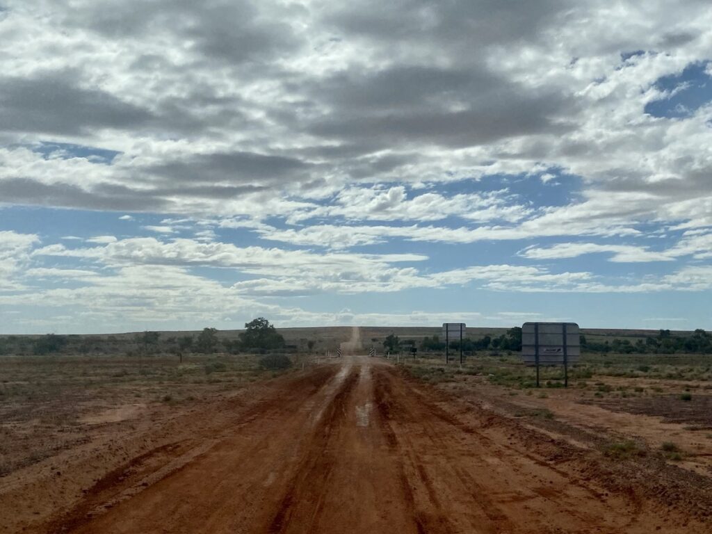
Once across the creek, you’ll be on the floodplain for a while. This is heavily corrugated and slow going. It’s an appropriate introduction to Cordillo Downs Road!
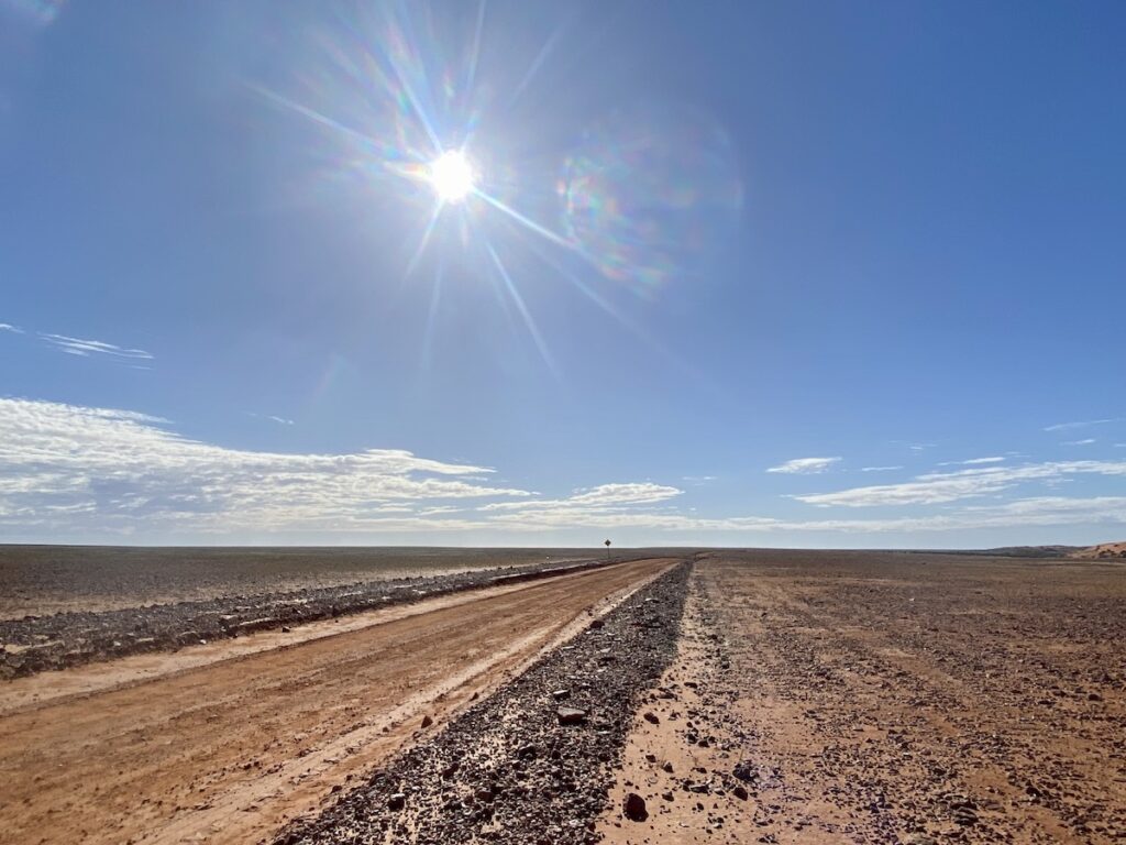
The road slowly climbs out of the floodplain and into gibber country. Low hills and ranges mean the road goes over endless watercourses. Combine a zillion small gibbers with watercourses and you inevitably get lots of corrugations!
The theme of gibbers and watercourses describes much of Cordillo Downs Road.
It’s rough and slow. The road surface is covered in semi-exposed stones and corrugations are a constant companion. If you’re the driver, you won’t be doing much sightseeing!
Treat the road with respect. Slow down, take it easy, expect the unexpected. Would I tow a caravan along Cordillo Downs Road. Not a chance, unless it was a Bushtracker or similar.
This road will shake and batter an on-road, semi off-road, or cheaply built camper or caravan to pieces.
On our trip, we found the 130km section within the Innamincka Regional Reserve to be in better condition than further north past Cordillo Downs. So be prepared for a slow trip!
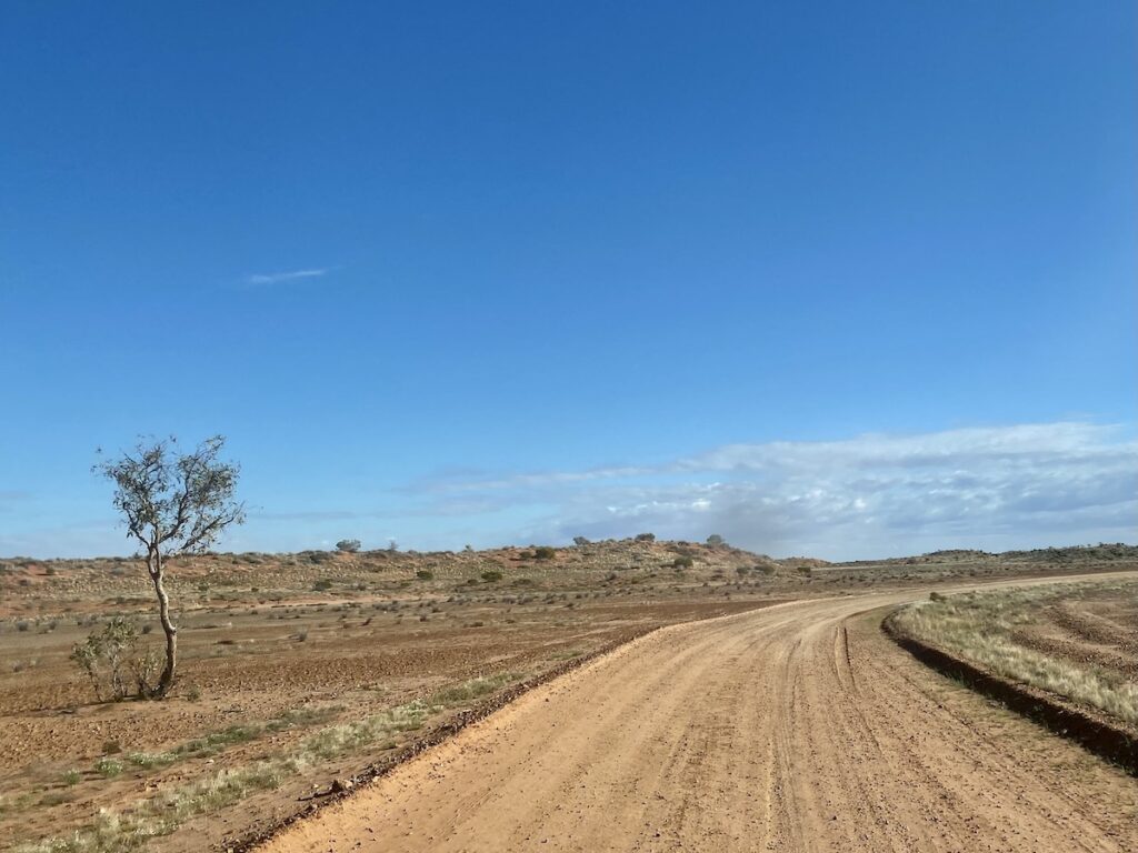
Among The Dunes
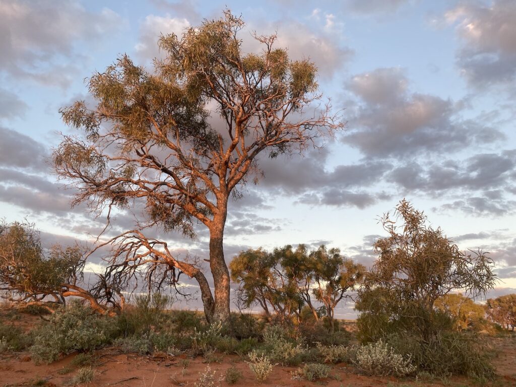
Near the top of the Reserve you drive off the gibbers and into incredibly beautiful sand dune country. Large dunes run north-south, with the road running between the dunes.
This was hands-down our favourite part of the trip. The dunes and swales were covered in grasses, wildflowers, bushes, and even trees in some swales. The huge dunes towered over us, begging to be explored.
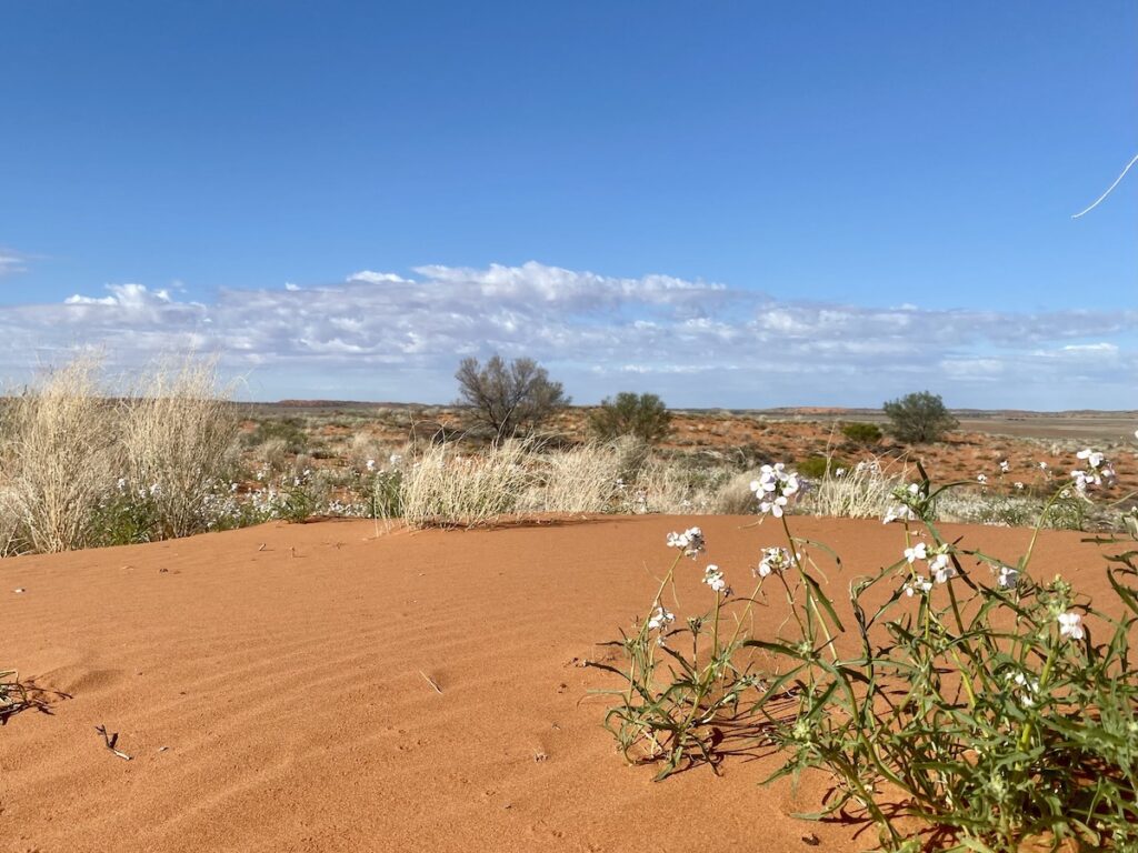
So we spent a little while looking for tracks in the sand. We found lots of lizard tracks, some small mammal tracks, and unfortunately feral cat tracks. It was great to see some small mammals are hanging on here, despite being ravaged by cats.
There are other short sections of sand, mainly around major watercourses. They’re heavily corrugated, but take you through scenic country.
Before long, we were out of both the sand dunes and the Reserve, and back onto the gibbers in Cordillo Downs Station.
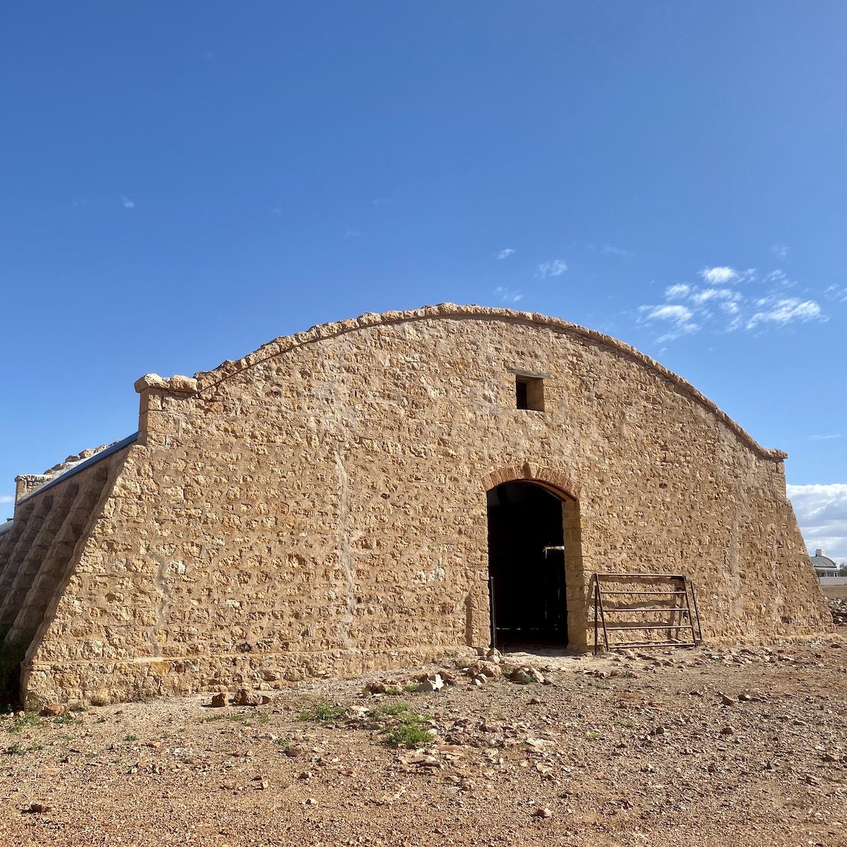
Cordillo Downs
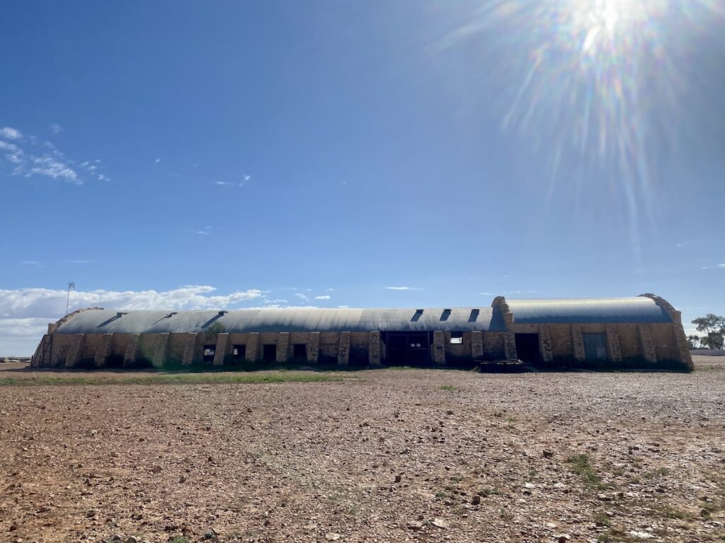
Cordillo Downs Station is famous for its stone woolshed. The once-massive Beltana Pastoral Company took up the lease in 1875. Just thirteen years later, 82,000 sheep were shorn by hand in the woolshed.
While it’s hard to imagine the hardships faced by those who lived and worked here, it’s not so difficult to imagine the effect 82,000 sheep would have had on such fragile country. Before it was settled, the country would have looked very different to what it does now.
By 1942 all the sheep were gone, replaced by cattle. This was mostly due to the number of sheep killed by dingoes. Fortunately, Cordillo Downs switched to cattle, instead of fencing to exclude dingoes as was done in western NSW.
Now the Brook family owns Cordillo Downs. It covers around 78,000 square kilometres and runs about 7,000 head of cattle in a good year.
The woolshed was built in 1883 from local stone, mainly due to the lack of available timber. By using a curved corrugated iron roof, they didn’t need a timber support frame… a clever solution to the lack of timber.
In its glory days, the Cordillo Downs woolshed boasted 120 stands and had its own wool scour to clean the wool. It was then baled and shipped to faraway England.
A few years ago, the Brook family co-ordinated the restoration of the woolshed. Specialist stonemasons arrived from Scotland, repairing the shed to ensure it would survive into the future. Arriving at Cordillo Downs must have been like being transported to the moon for these Scottish tradespeople!
The shed’s now used for storage. You can walk around the shed and into one end. Please respect the owners and don’t venture into the closed-off part of the shed.
Cadelga Ruins
Cadelga Ruins was once Cadelga Downs, but was abandoned in the 1930’s. It sits beside Cadelga Waterhole and would be an ideal spot to stay overnight.
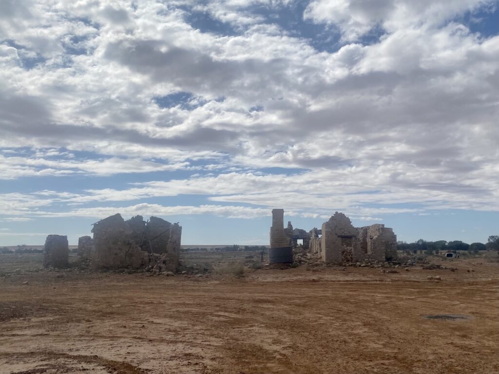
Now part of Cordillo Downs, the ruins consist of two decaying stone buildings. Off to one side is a meatsafe built from wire netting and a timber frame. Beasts would be killed and dressed, then hung in the meatsafe to set.
Now just a timber frame covered in netting, it probably had some sort of thatching for shade. This would have been available from the trees of the nearby waterhole.
Be super-careful here… the ground is littered with wire. Keep your vehicle well away from the ruins. Otherwise you might be in for some unscheduled tyre-changing practice.
Into Queensland
Less than 15 kilometres further north is the SA/Queensland border. The narrow, bone-jarring road turns into a wide built-up clay “highway” all the way to Birdsville Developmental Road.
It was a welcome sight!
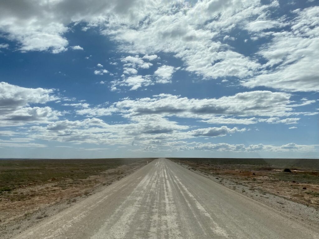
This short 26 kilometre section rises onto a plateau just north of the border. The road could easily lull you into a false sense of security if coming from the north. Don’t be deceived, it doesn’t last long if you’re heading south.
The standout on this short section of road is the view from the plateau, especially the massive Moonda Lake to the east.
Camping and Facilities
You can camp along the road within the Innamincka Regional Reserve. Don’t stray too far off the road and keep well away from watering points for cattle.
Can you camp at Cordillo Downs Station? No. There’s a gate either side of the station. Don’t camp within these gates (15km apart), however they don’t mind you camping beside the road, anywhere outside this zone.
The other two camping places which spring to mind are on Cadelga Waterhole at the ruins and among the sand dunes at the top end of the Reserve. However, you really can’t go wrong… camping anywhere along this road is a great experience.
There are no facilities along Cordillo Downs Road. You’ll need to be fully self-contained.
If you’re searching for camping gear and accessories, Wild Earth has a wide range available. Go here to find out more.
Cordillo Downs Road Conditions?
In one word – rough.
Rocks, washouts, more rocks, endless watercourses, even more rocks, corrugations, rocks… that about sums it up!
Take it easy and you’ll be fine. This is not a road to take lightly, especially if you’re heavily loaded or towing something heavy. Relax for just one second and it’ll catch you out.
Having said this, it’s an excellent trip.
The scenery is ever-changing, even across those vast gibber plains. And the sand dunes at the north end of the Reserve are absolutely brilliant. If we had I time over again, we’d push on further and camp among the dunes.
Would I do the drive again? Probably not. Arrabury Road to the east is an easier drive and equally scenic, just in a different way.
The other obvious choice is Walkers Crossing Track from Innamincka to Birdsville Track. It’s top of the list for us. The only problem is, it’s closed more often than open.
Cordillo Downs Road suffers frequent road closures too. And it’s easy to see why. Numerous sections cross clay floodplains at creeks and would be impassable with just a few millimetres of rain.
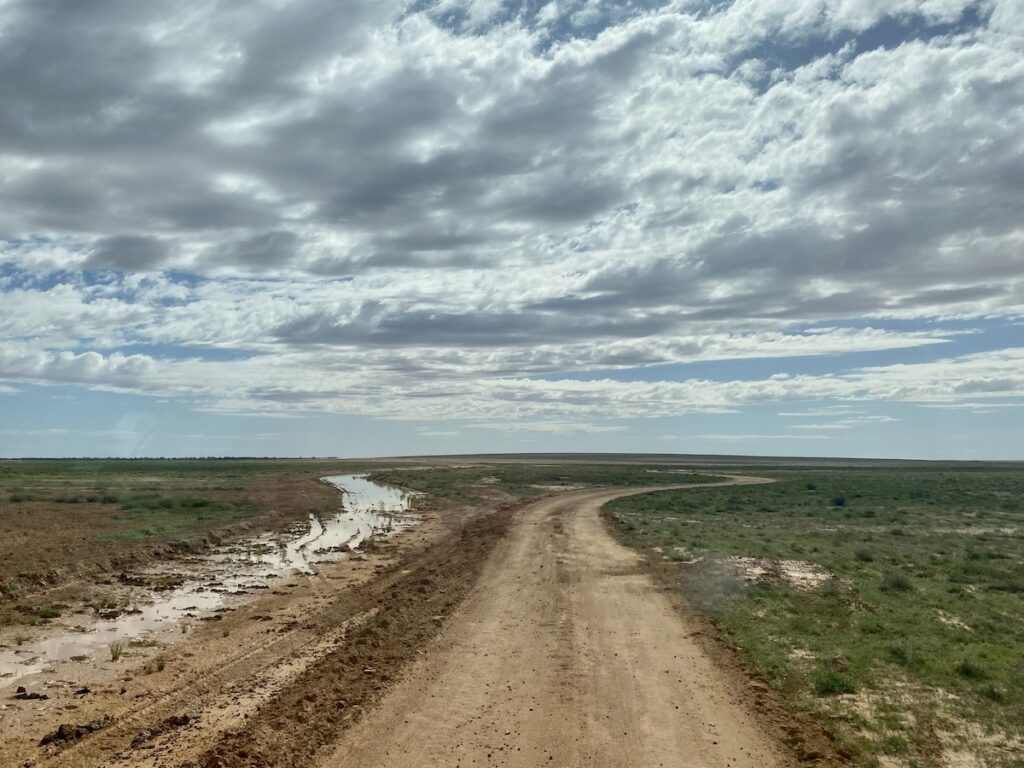
We encountered many go-arounds (diversions around wet sections) where the road was under water. Drive into these and you’ll sink like a stone.
Cordillo Downs Road is a must-do road, it’s on the list. Just be sure to treat it with respect.
Cordillo Downs Road is on Yawarawarka Country.
Looking for more South Australian Destinations? Then go here.

Get your Traveller’s Guides
… and a whole lot more at our FREE RESOURCES Page!
Any questions or comments? Go to the Comments below or join us on Pinterest, Facebook or YouTube.
Any errors or omissions are mine alone.