
If you’re looking for a better way to see the big tree country in South-West Western Australia than punching along the bitumen, then Chesapeake Road is a great option.
Chesapeake Road runs between Walpole and Northcliffe, from the South-Western Highway to Windy Harbour Road.
How To Get There
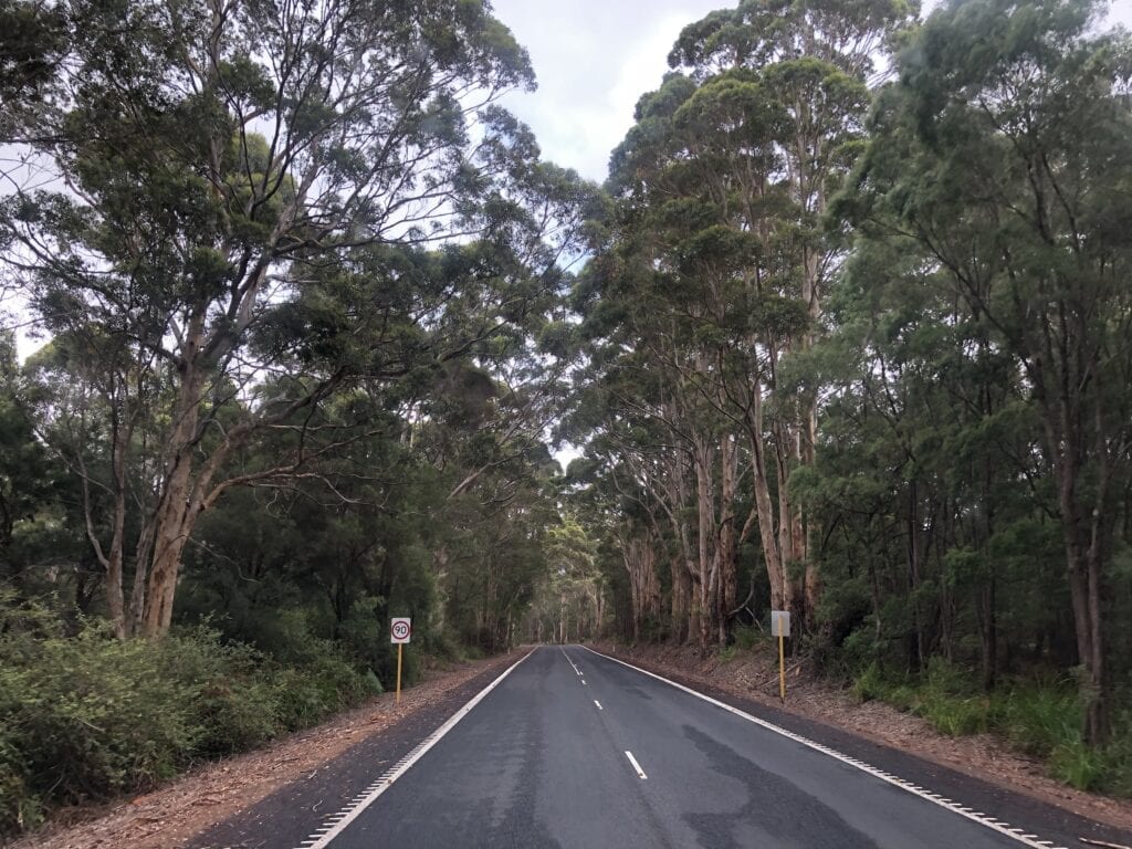
From Walpole, follow the South Western Highway North-west for 26km then turn left onto Broke Inlet Road. After 8km, turn right onto Chesapeake Road.
From Northcliffe, drive south on Windy Harbour Road for 6km then turn left onto Chesapeake Road.
What You’ll See
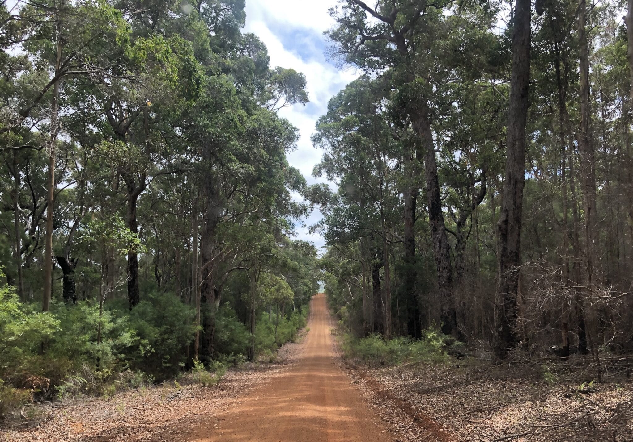
Chesapeake Road is an old logging track, which cuts through Shannon and D’Entrecasteaux National Parks. We drove it from east to west.
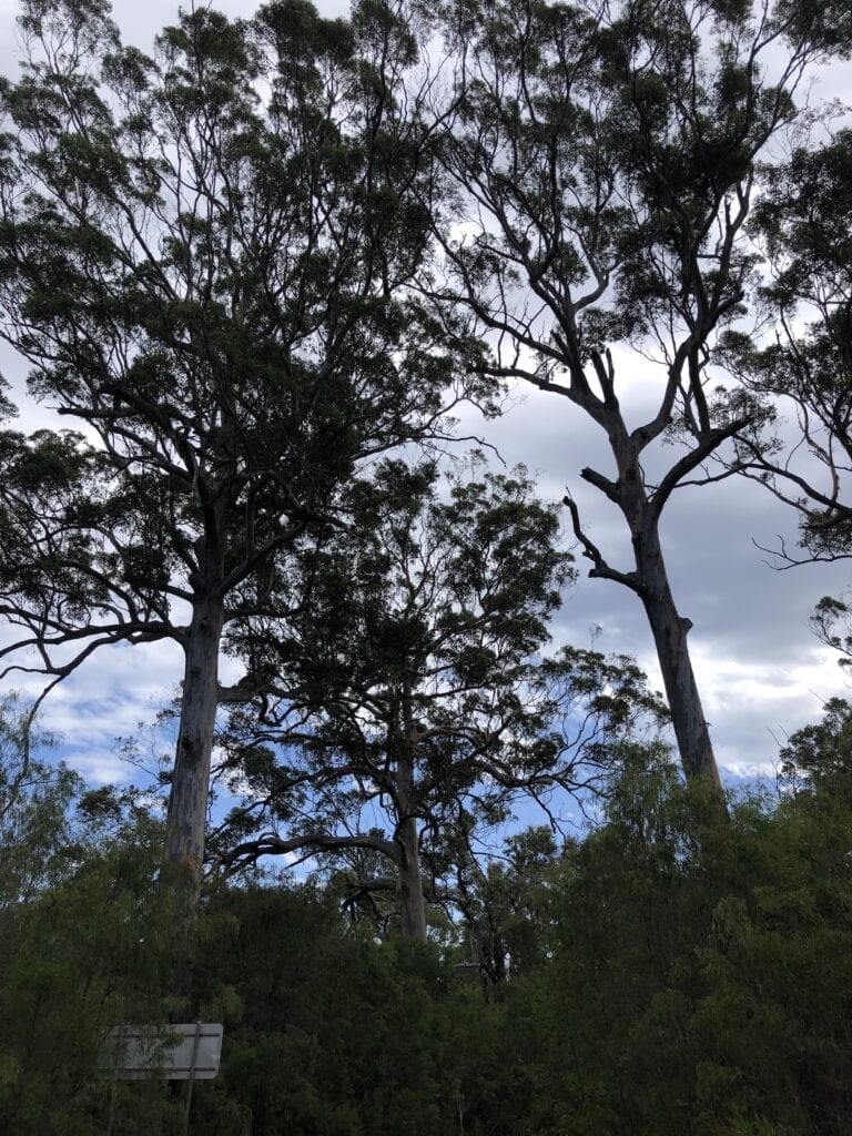
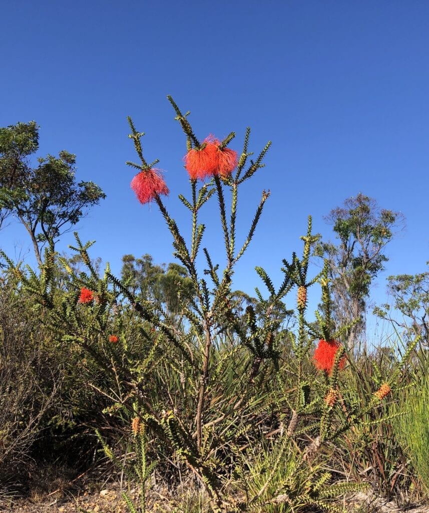
Heading west on Chesapeake Road, you’re into tall tree country. Giant Karri trees occupy the gullies, pushing arrow-straight towards the sky.
These magnificent stands are interspersed with typical coastal heathlands. The vegetation is surprisingly thick. You’d be flat out walking through it in places.
The track occasionally forms a tunnel through the trees, with branches overlapping way overhead. It truly is a beautiful drive.
After about 29km, you’ll come to a turnoff. This is Gardner River Road, which heads north and is well used.
Continue straight along Chesapeake Road, even though it says “No Through Road”. The bridge over Gardner River is slowly falling apart and has large logs placed at either end… presumably to stop vehicles from falling through the deck! Apparently there are no plans to replace this bridge.
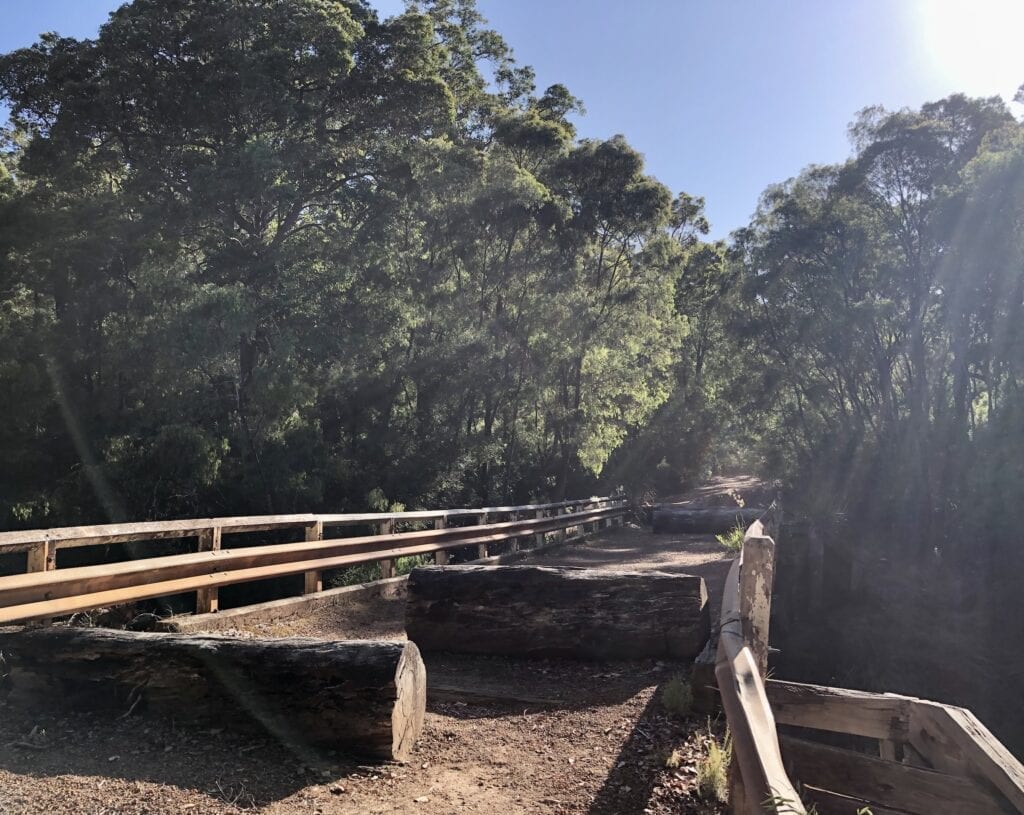
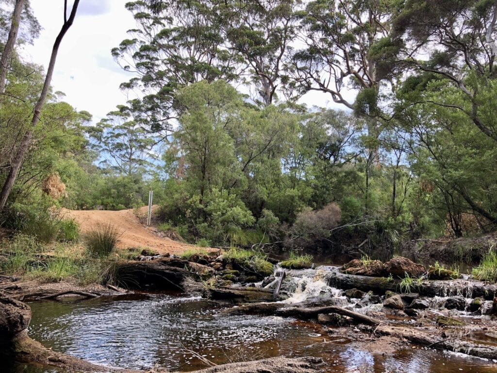
You’ll come to a “Road Closed” sign. However a well-formed detour to the left takes you down to the Gardner River causeway where you can cross. Be careful here after rain, it could be impassable. If in doubt, turn around and take Gardner River Road instead.
We camped at the causeway, which at the time was only ankle deep. A conventional car could have crossed it with care.
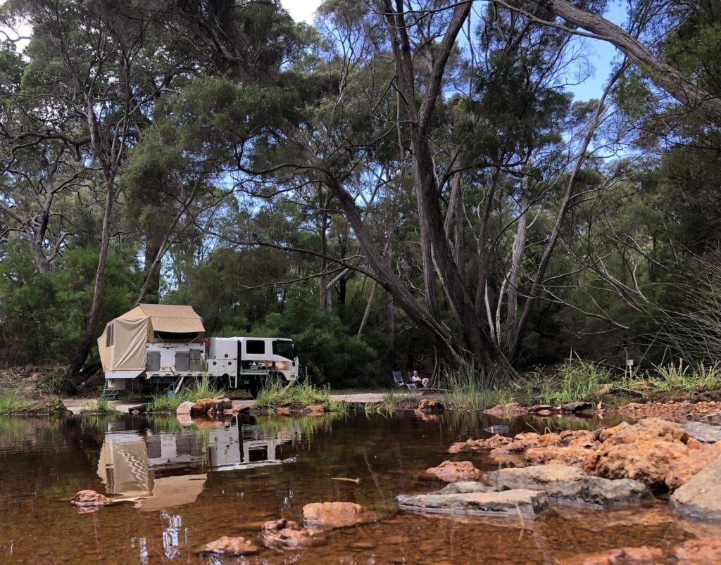
This is a brilliant bush camp. We had it all to ourselves. The continual noise from the small rapids at the causeway was a perfect accompaniment to the tranquil surroundings.
Like most creeks and rivers in South-West Western Australia, the water in Gardner River is almost black. This is the tannin from the ti-tree and is natural. If you can find a spot deep enough to swim in, the natural oils from the ti-tree will take away all your aches and pains.
It’s quite protected from the winds. Tall trees provide plenty of shade. We highly recommend pulling out your camp chair and gazing mindlessly at the water until you fall into a kind of relaxed trance. Magic!
Then when darkness falls, gaze at the stars through the canopy of large trees and imagine you’re the only person on earth. Gardner River really is one of those places where you’ll feel like you’re a million miles from anywhere.
Just a stone’s throw away, the Bibbulmun Track crosses Chesapeake Road. This is a walking track all the way from Albany to Perth. If you’re a keen hiker, you’ll find lots of information on the Bibbulmun Track here.
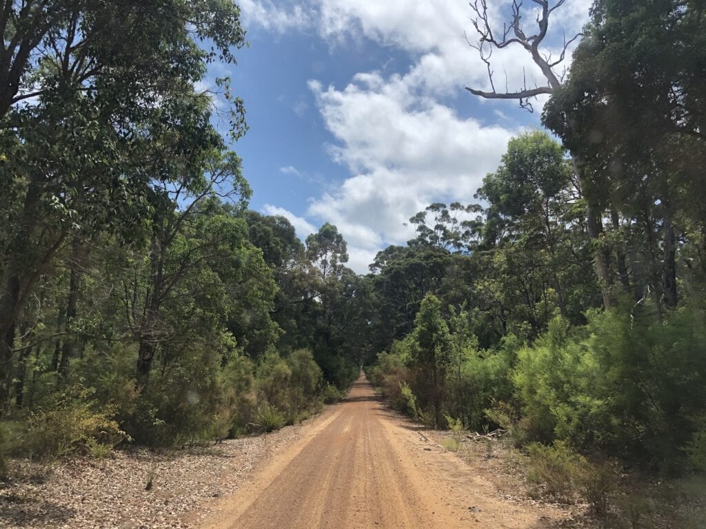
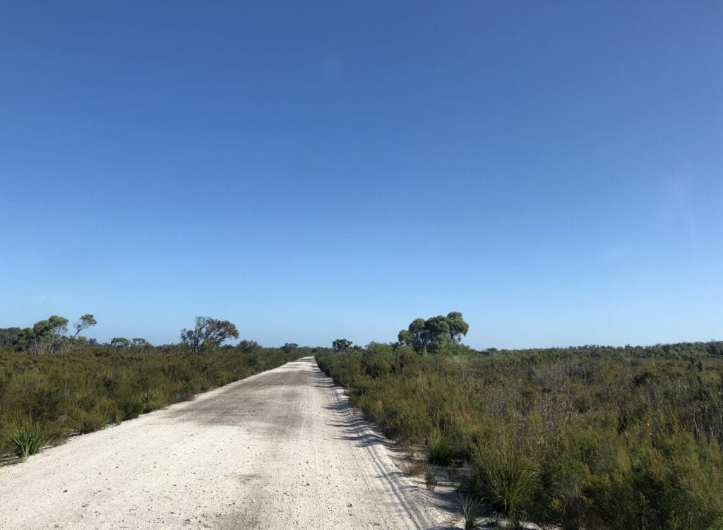
Once over the Gardner River and heading west, the country becomes low coastal heathlands. The vegetation is quite thick, but the sandy country means you don’t see many large trees.
Road Conditions
This is a road of two parts.
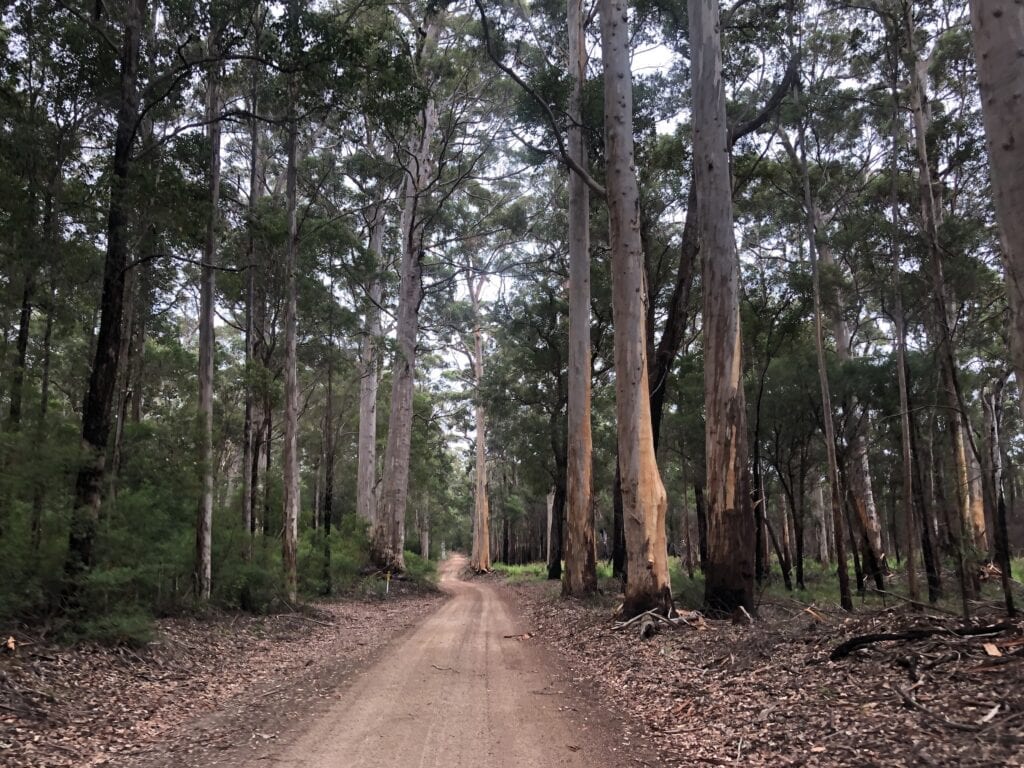
From Broke Inlet to Gardner River
In the dry, you could travel this road in a conventional car if you were careful. Some parts are corrugated and there’s a few potholes. However, the road’s generally in good condition.
Watch out for oncoming vehicles. They’re hard to see over the numerous crests and curves.
From Gardner River to Windy Harbour Road
The road deteriorates badly on the western side of Gardner River. It’s not suitable for conventional cars or caravans. There’s sections of large corrugations and deep potholes. The potholes make it difficult (impossible in a truck!) to get up enough speed to get on top of the corrugations.
Avoid this section after rain. It would be quite swampy in places.
Facilities
None. You need to be entirely self-sufficient.
Camping
If you’re into beach camping:
- Windy Point at Broke Inlet.
If you’re into bush camping:
- Coodamurrup Hut Historic Site (4WD only).
- Gardner River crossing.
Side Trips
Broke Inlet
Make sure you take a side trip into the shanty town of Broke Inlet. It’s at the Walpole end of Chesapeake Road.
Broke Inlet could be lifted straight out of the pages of a Tim Winton book. Winton evokes images of windswept fishing shanties along the wild coast of South-West Western Australia, often occupied by the dispossessed or those escaping their past.
It’s easy to imagine Broke Inlet giving Winton the inspiration for his huts in the scrubby coastline, often hiding dark secrets and quirky characters.
During the week it’s an eerie ghost town of fishing shacks hiding under the trees. Broke Inlet is a remnant of the past, when every man and his dog had a fishing shack at their favourite fishing spot.
Somehow Broke Inlet has survived. Over the holiday season, no doubt this would be a busy place.
Gardner River Mouth
You can drive from the western end of Chesapeake Road down a sandy 4WD track to the mouth of Gardner River. From there, follow the track until you come out at the outskirts of Windy Harbour.
We didn’t take this track, so can’t vouch for its condition. However, both ends were two wheel tracks in the sand through coastal scrub. Ask around at Windy Harbour or the Information Centre at Walpole.
I’d suggest if you’re not experienced in driving through soft sand, then it would be wise to give it a miss.
Windy Harbour
Despite its name, we struck an absolutely perfect day… a gentle breeze and quite warm.
Windy Harbour is another fishing village. It’s a step back in time to rambling fishing shacks, sandy tracks onto the beach and even a tractor to tow your boat through the soft sand to the water!
It has a laid-back, casual feel. A classic 1970’s-style fishing village.
A small caravan park looks neat and tidy. If you’re a keen fisher, then you’ll no doubt love Windy Harbour.
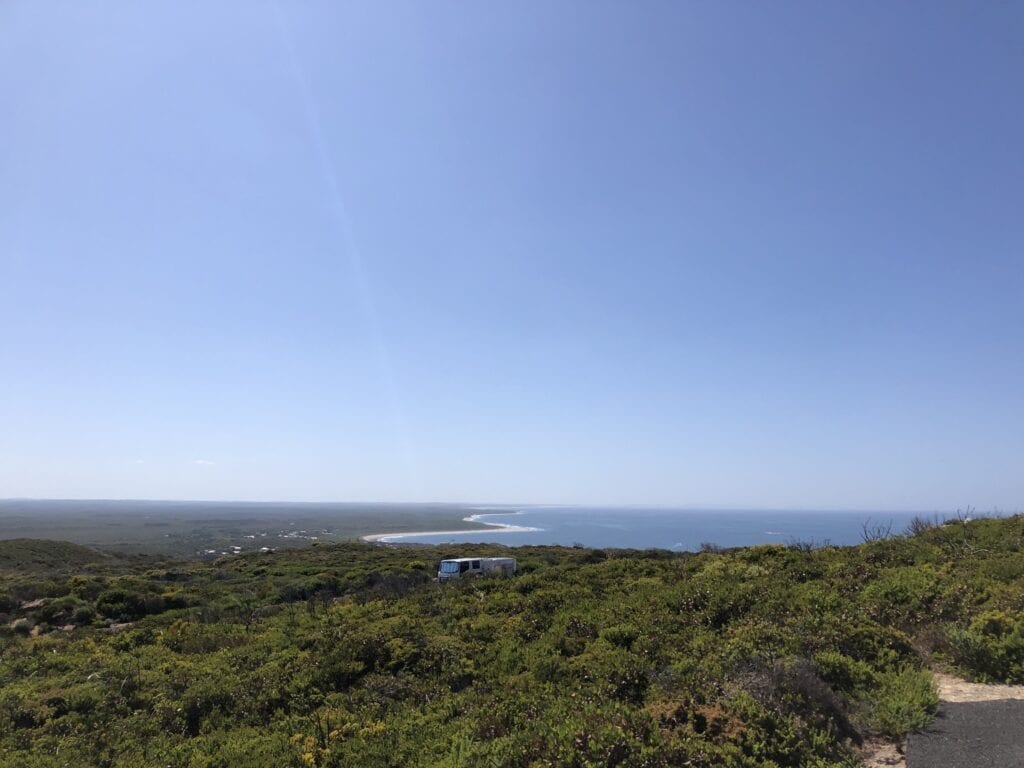
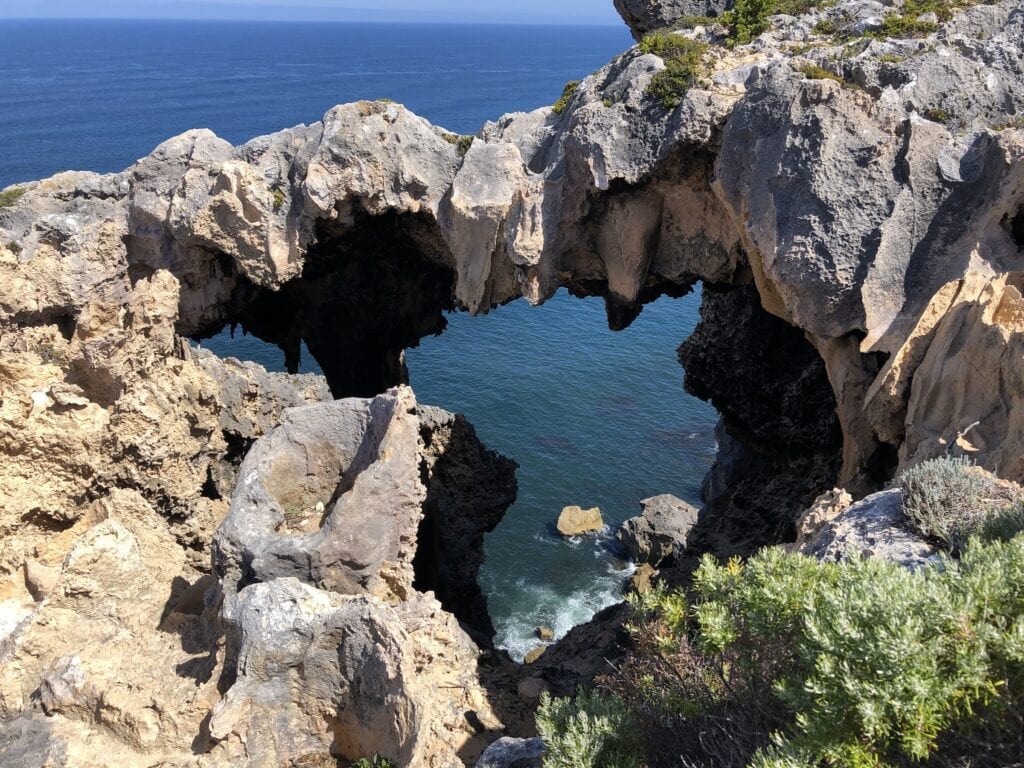
For the rest of us who couldn’t catch a cold, drive up to Point D’Entrecasteaux. You can take three walks here.
The Pupalong Loop Walk is an easy stroll around the top of the Point, an imposing limestone bluff plunging into the wild Southern Ocean. There’s no doubt about it, Western Australia has the rugged coastline market well and truly cornered!
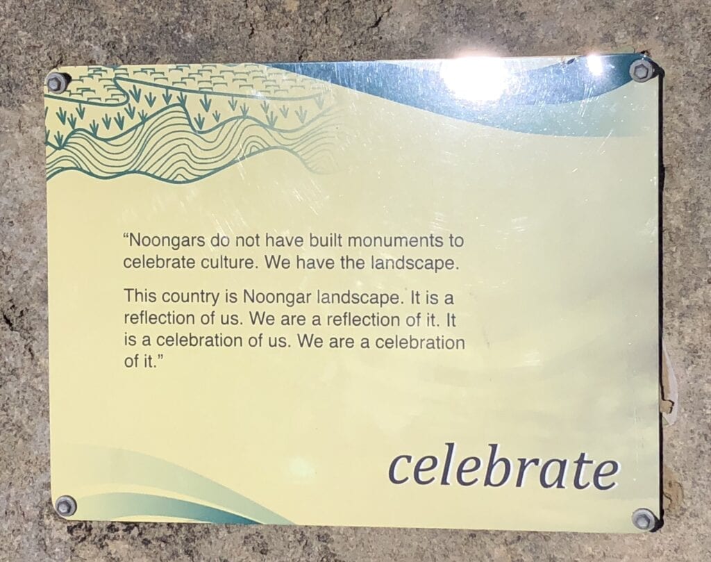
This walk has some excellent interpretive signage on the importance and meaning of Country to the Noongar people. We particularly loved this quote, “Noongars do not have built monuments to celebrate culture. We have the landscape”.
A couple of lookouts let you gaze straight down into the rather scary ocean pounding into the limestone cliffs.
The highlight is Nature’s Window, an archway which directs your gaze down into the sea below. While there, we watched seals chasing a school of fish just offshore. These beautiful creatures are so incredibly graceful and agile in the water.
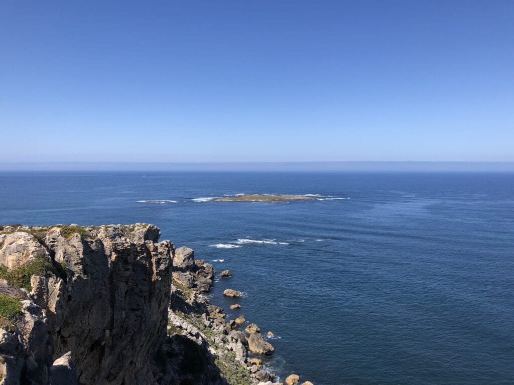
The Cliff Top Walk is exactly that.
It meanders along the cliffs, giving you a feel for the size of these cliffs and the wild winds and oceans that shape the very landscape around you. This takes about an hour and is an easy walk.
Finally, the Coastal Survivors Walk will take you back to Windy Harbour via cliffs and sand dunes. Interpretive signage teaches you about the local flora and fauna, how they have adapted and thrived in this harsh landscape.
This Walk is more demanding and takes a couple of hours.
In Summary
While only a short drive, Chesapeake Road is an excellent alternative to the blacktop. If you’re a keen fisher you’ll be in fishing heaven, with plenty of side tracks where you can throw in a line.
And if you’re after a beautiful drive through the South-West forests, you’ll love the scenery and the solitude.
Chesapeake Road is on Noongar country.

Get your Traveller’s Guides
… and a whole lot more at our FREE RESOURCES Page!
Any questions or comments? Go to the Comments below or join us on Pinterest, Facebook or YouTube.
Any errors or omissions are mine alone.
Go here for more incredible Western Australian destinations.