
Mount Moffatt section of Carnarvon National Park is but a stone’s throw from its celebrity cousin at Carnarvon Gorge. Yet it’s a world away from the crowds of Carnarvon Gorge.
And a quiet, peaceful place wouldn’t be the same without a challenging drive in. Mount Moffatt and Carnarvon Gorge are about 20km apart as the crow flies. Yet you need to drive over 300km in a huge loop between the two.
And that gives you a clue about how rugged this country is.
Rugged sandstone gorges and sheer white sandstone cliffs cut through the land. The Mount Moffatt section sits at around 700 metres, peaking at 1,232 metres on the north-eastern Consuelo Tableland.
Little wonder this part of the Great Dividing Range has earned the title of the “Roof of Queensland”.
Getting There
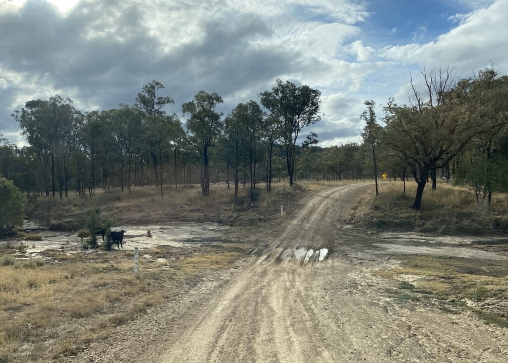
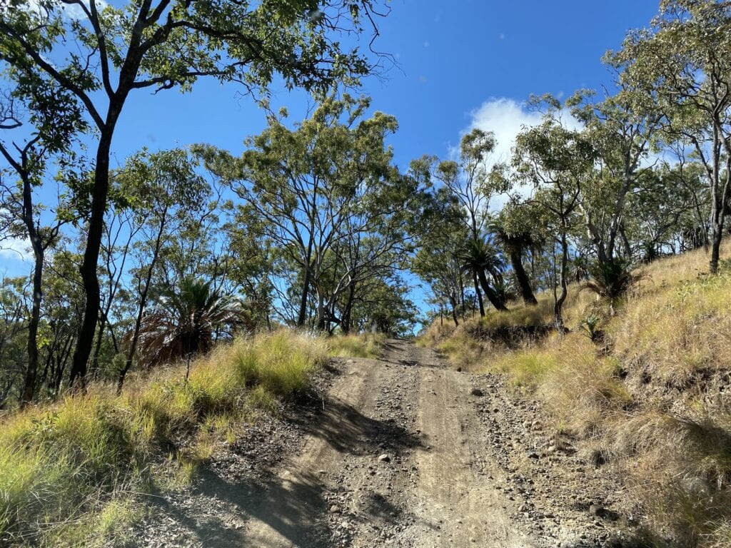
The country surrounding Carnarvon National Park varies between black soil, sandstone and sand. So be prepared for every driving condition.
Queensland National Parks recommend 4WD access only and you’d be wise to heed their advice. You can tow a camper or off-road caravan into Mount Moffatt, but take it slowly.
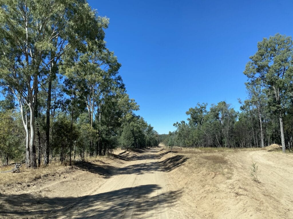
Once you’re in the Park, the Mount Moffatt Circuit Drive has several sections of soft sand. Nothing to be concerned about, but unsuitable for a soft roader as the wheel tracks can be deep.
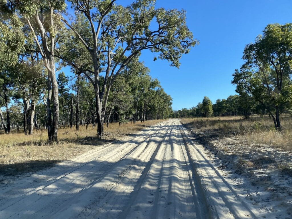
The High Country Drive is definitely high clearance 4WD only, especially the section beyond the Rotary shed campground (see map below).
And if you get even the slightest hint of any rain, don’t go near the place. The black soil turns into the slipperiest, gooiest mess imaginable after just a small amount of rain.
There’re two ways you can get into Mount Moffatt.
1. From Mitchell
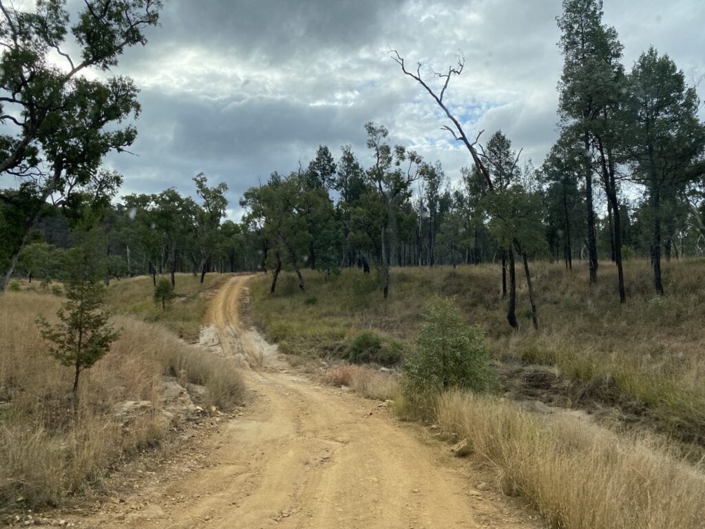
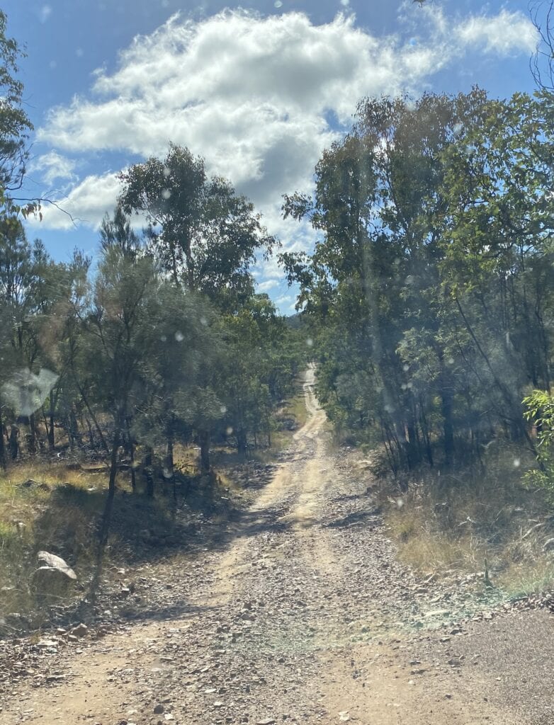
You can take the Mount Moffatt Road north from Mitchell, which is about a 200km trip. Mount Moffatt Road varies from okay to rough and rocky, with lots of nasty washouts.
In some parts it’s little more than a rough track.
Watch out for cattle, they’re everywhere out here.
2. From Injune
You have two options from Injune. The first is about 50km of tar to Womblebank Station, then you turn right onto Mount Moffatt Road, which is about another 100km on a mostly rough road.
The second option is via Westgrove Road then onto Mount Moffatt Road, also about 150km. Westgrove Road was in good condition when we travelled it. However, it had just been graded. I imagine this road would normally be rough, and full of long stretches of bulldust and sand.
So whichever way you choose, take it easy and keep a careful eye out for rough, rocky patches, bulldust holes and soft sand sections.
Fuel
A word of warning. Make sure you have enough fuel for at least 600km. Once in Mount Moffatt, you can easily cover over 100km, plus it’s 300-400km there and back.
With Injune (150km) and Mitchell (200km) the nearest fuel stops, you’ll be a lot of trouble if you run out of fuel.
Camping and Facilities
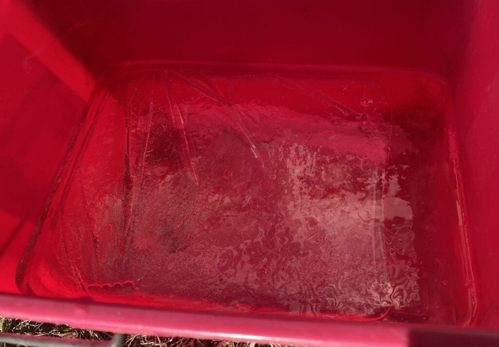
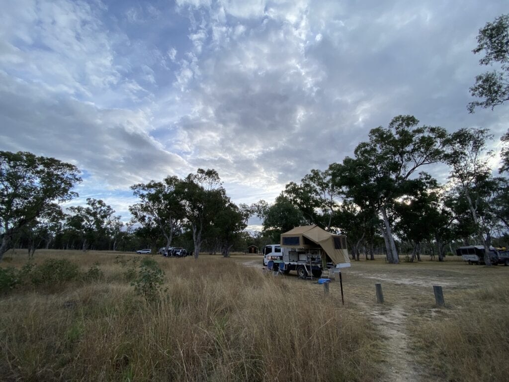
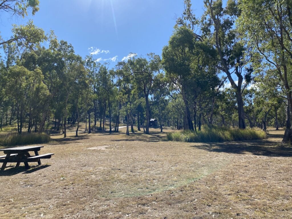
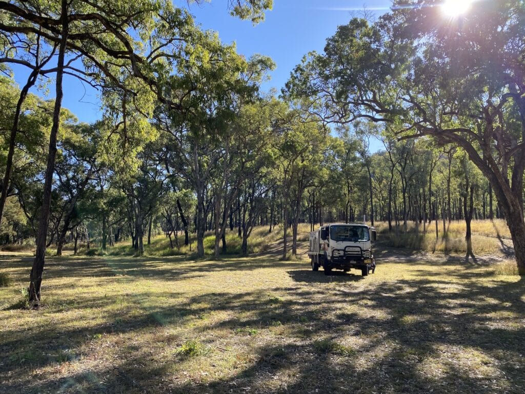
Mount Moffatt has four excellent campgrounds, all carefully maintained. Whoever’s in charge here is doing a great job. They all have drop toilets and three of the four have very limited rainwater. There are no shower facilities.
So allow to be completely self-sufficient, with the exception of toilets. Bring your own firewood and take all rubbish out with you.
We were there in June… it was actually the coldest night of the year! Even at the lowest campground (West Branch camping area), we shivered at just 3°C by 8pm and -4°C at 7:30am the next morning. Be prepared for a cold night.
The days are generally beautiful though, clear skies and sunshine to thaw you out.
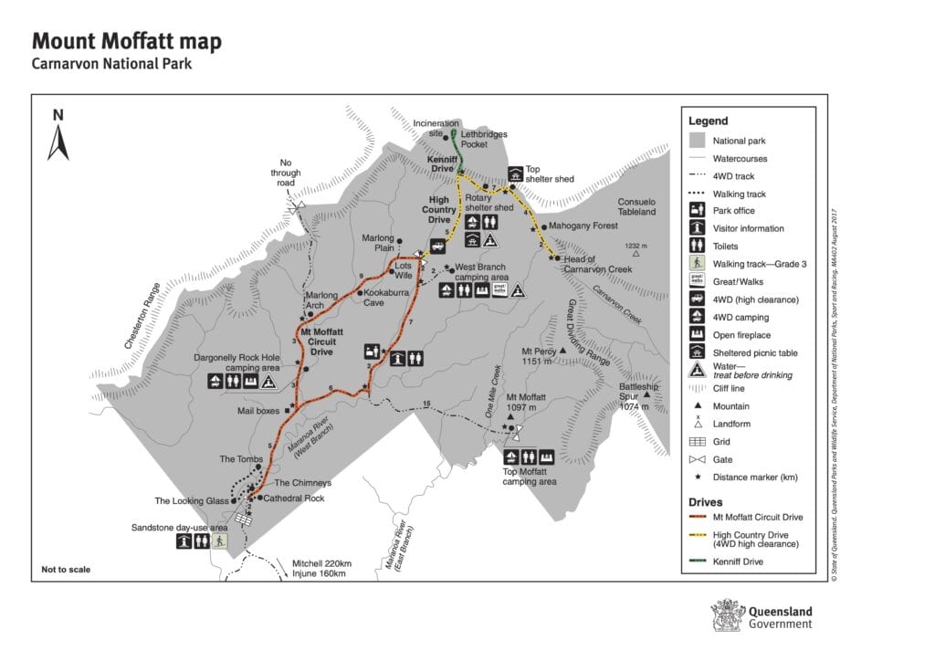
1. Dargonelly Camping Area
The first campground as you enter the Park is West Branch 10km from the park entrance. This spacious campground has plenty of room to spread out.
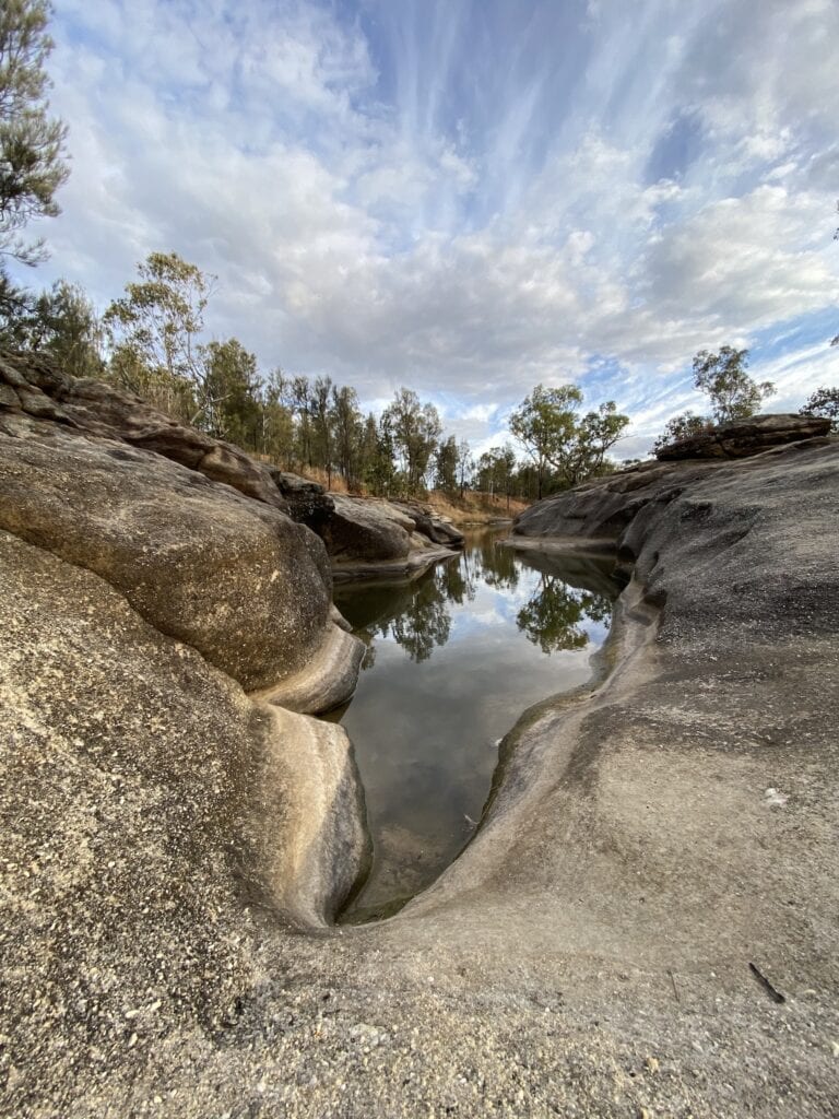
Take a stroll down to the creek and admire the reflections off the pools… a great way to relax and wind down after a long drive.
West Branch has two drop toilets and untreated water on tap (when available). You can find a spot under a shady tree or on the grass in the sun, depending on the time of year.
West Branch is at the lowest altitude of the four campgrounds. So overnight will be “less cold” than the others in winter. Still, a frost is a frost whichever way you look at it…
Dargonelly is probably the best option for exploring the park. It’s just off the Mt Moffatt Circuit Drive, so you have relatively easy access to all the attractions in the Park.
2. West Branch Camping Area
West Branch campground sits on the edge of west branch of the Maranoa River, 24km from the park entrance and 9km from the ranger base. Don’t get too excited though, the river is normally no more than a few small rock pools.
West Branch is quite protected, as it’s surrounded by hills. Just be aware, the sun rises late and sets early here. So it’ll be cold in winter.
And like Dargonelly, West Branch has two drop toilets and untreated water available from a small tank (when available). And you have the option of a sunny spot or some shade from ample trees.
3. Rotary Shelter Shed Camping Area
This campground has sensational views to the south. It sits on a tiny plateau, which is balanced on the edge of a mountainside.
This camping area is along the High Country Drive, a track which winds up onto the Consuelo Tableland. So it’s only accessible with high clearance 4WD. And don’t even consider trying to drag a caravan up there. This drive closes with any sign of rain, so keep a close eye on the weather forecast.
The Rotary Shelter Shed camping area has a drop toilet with a stunning view from the door. There’s also a small rainwater tank with untreated water (when available) at the adjacent picnic shelter.
Being 30km from the park entrance, you’ll take a while to get there. Consider booking one of the other campsites for your first night, then re-locating to the Rotary Shelter Shed camping area the next day.
4. Top Moffatt Camping Area
Top Moffatt sits on the edge of the east branch of the Maranoa River, 28km from the park entrance. Like West Branch though, the Maranoa is nothing more than a few small pools at this point.
It has a drop toilet but no water available.
The campground is shady and protected. The drive in can be narrow and rough… definitely unsuitable for caravans.
When to Visit
Despite the bitterly cold overnight temperatures, winter is the best time to visit. The walks are quite exposed in places, so they’re far more enjoyable in the cooler winter days.
If you must visit in summer, take plenty of drinking water. Despite maps showing lots of creeks and the Maranoa River running through Mount Moffatt, they are mostly dry. So don’t rely on them for water.
Summer temperatures can be over 45°C… not ideal temperatures to be taking long, exposed walks in.
What to See
Rain and wind tend to sculpt sandstone into some weird and wonderful shapes and Mount Moffatt doesn’t disappoint. This Park is full of surprises… which is even better when you’re not surrounded by crowds.
To us, this country is best viewed from the eyes of the First Nations People. They lived here for over 19,000 years, looking after Country and maintaining their sustainable way of living.
Then in the mid 1800’s, white man invaded their lands. The Bidjara mob fought a fierce resistance. But bit by bit, the white man killed them off… either from the end of a gun or by spreading disease.
By 1920 white man had forcibly removed any remaining survivors to missions and reserves, like livestock being moved to another property.
Yes, the settlers had a difficult way of life out here. No doubt they faced huge challenges, hardship and heartbreak. But their story has been told a million times, glorified to the point where they were all supposedly brave heroes.
What a load of rubbish. They were simply part of a monumental land grab.
But this Country won out in the end. The invaders lasted less than 200 years in and around Mount Moffatt.
So it seems only logical to open our minds and try to imagine how the First Nations people lived, to get a glimpse of their connection to Country, to appreciate we’re guests on their Country.
If we do this, then we’ll take a whole lot more away from a visit to this incredible place.
Sadly, you’ll notice in the descriptions below there are no references to the First Nations people’s creation stories. Most of this information died with the people who once lived here.
To begin your exploration of Mount Moffatt, start at the visitor orientation site which is just 2km from the park entrance. Here you’ll see Cathedral Rock and a loop walk covering the Chimneys, the Tombs and the Looking Glass.
1. Cathedral Rock
Cathedral Rock is a huge slab of sandstone towering over the surrounding bush. The sandstone has an unusual rectangular pattern which almost looks like someone has been busy tiling it!
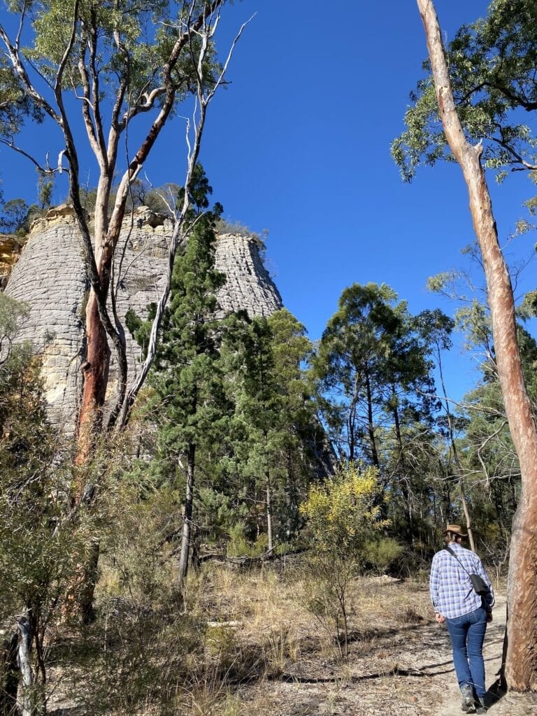
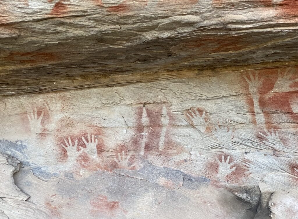
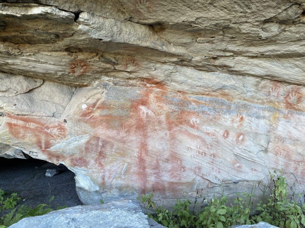
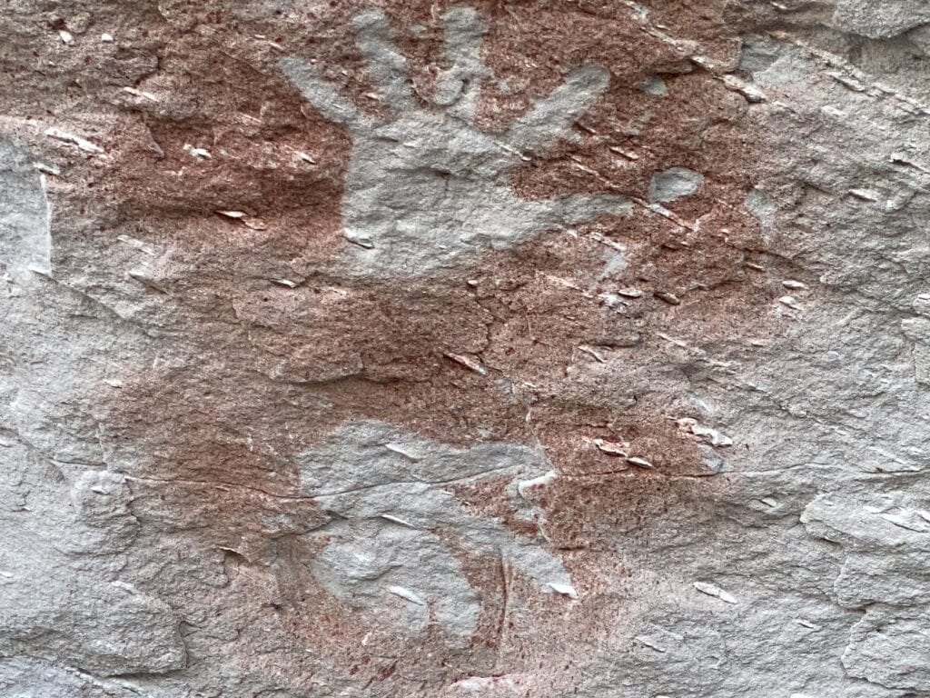
A 200 metre track leads from the visitor orientation site to the base of the rock, then around its base to a gate. Through the gate, up a few rough-hewn steps where you’ll see lots of Aboriginal stencils under an overhang… mainly handprints plus a child’s foot.
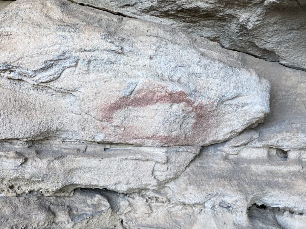
The artists would grind ochre to a fine powder, mix it with water, lay the object to be stencilled against the rock face, then blow the ochre mix onto the rock from their mouths.
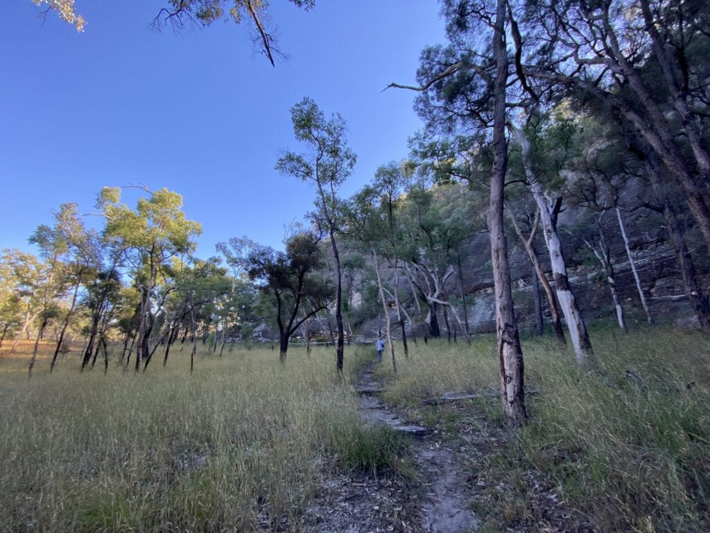
2. The Circuit Walk
Get your walking shoes on and do the Circuit Walk. This is a must-do walk. It’s best walked anti-clockwise, as the interpretive signage makes more sense if you approach it from this direction.
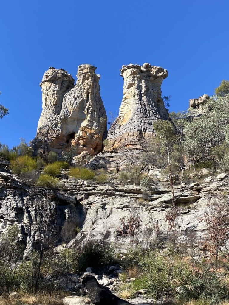
2.1 The Chimneys
First stop is The Chimneys, three sandstone pillars on top of a sandstone bluff which look a lot like industrial chimneys.
2.2 The Tombs
Next stop is awe-inspiring. It’s called The Tombs. This huge sandstone bluff is a sacred burial site. The ancestral beings who created the landscape sleep inside the sandstone bluff.
The Aboriginal people buried their dead inside naturally occurring holes in the sandstone cliff face.
The dead were prepared, wrapped in soft bark cylinders from nearby budgeroo trees, wrapped in marsupial fur, tied with possum-fur twine, then often painted. They were also entombed with gifts like necklaces.
But you won’t find any here now. They were all raided, stolen or destroyed by colonists in the early 1900s.
There are some fascinating and sometimes disturbing observations from people who saw the burial cylinders first-hand in Appendix II of this paper from Flinders University.
A little further along the sheer walls of The Tomb is an incredible display of over 400 rock stencils… hands, feet, arms, the hind legs of a kangaroo to name a few. Most impressive of all is a painting of a standing man, a ghostly imprint that seems to guard the surrounding landscape.
This is a spiritual place and is best summarised by Bidjara man, Milton Lawson on an interpretive sign.
“Before visiting the area now known as The Tombs, we would sit down with the Elders to talk about this place and go through certain processes.
“The Elders taught that harm would come to us if we went near this place with anger or negative thoughts in our hearts.
“So, we would cleanse the mind by reflecting on earth and life”.
Professor John Mulvaney (who was heavily involved in Mungo Man at Mungo National Park) excavated the cave floors at this site in the early 1960’s. He discovered charcoal from campfires carbon dated to about 9,400 years ago.
So the First People’s links to this place go back a long way.
The Tombs is one of those places I’ll never forget. It has a feel to it, a beautiful place to be… serene, peaceful, welcoming, happy. If you’ve ever felt the vibe from Uluru or Kata Tjuta, then you’ll know what I mean.
2.3 The Looking Glass
Moving on from The Tombs, you walk through lightly timbered country to arrive at The Looking Glass. This piece of sandstone has been shaped by wind and rain to form a peculiar round hole in a piece of rock standing high above a bluff.
After a short walk, you’ll be back at the start of the Circuit Walk.
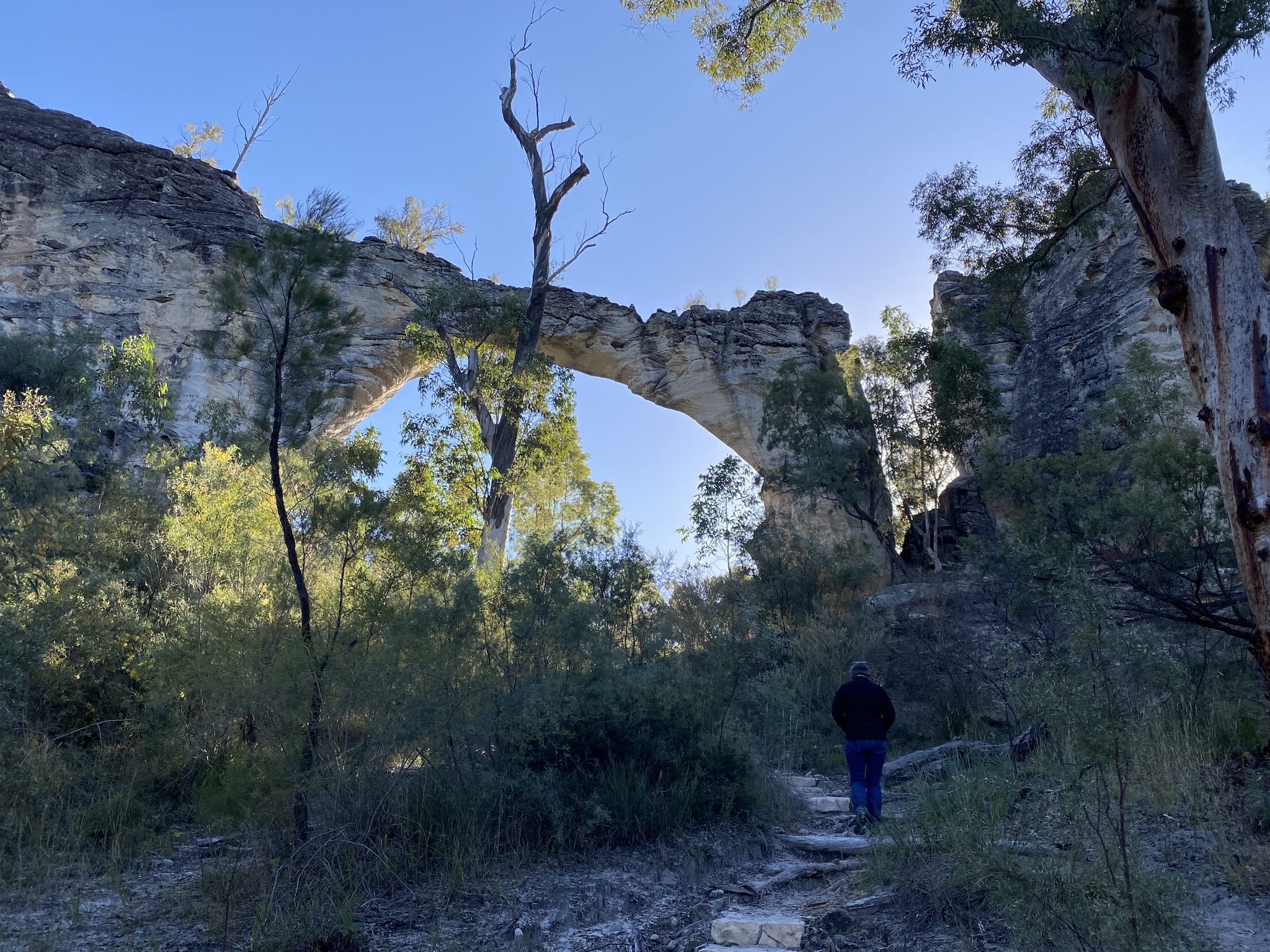
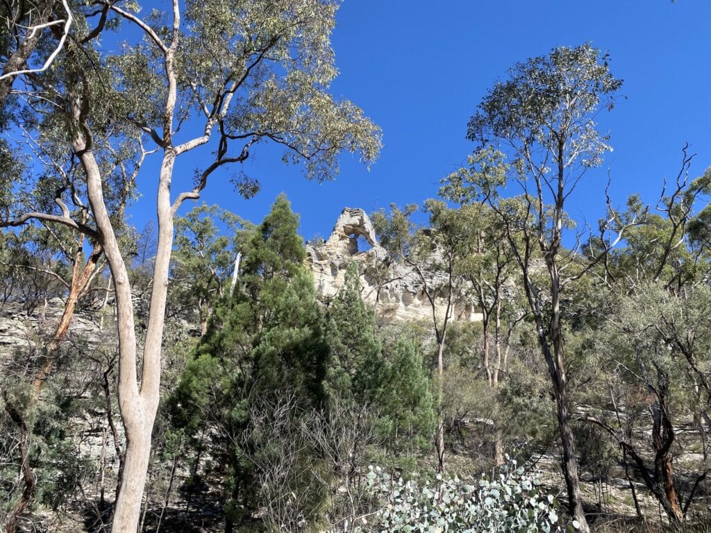
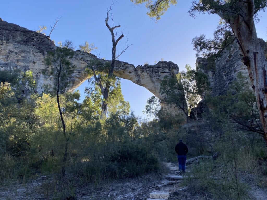
3. Marlong Arch
Jump back in your vehicle and veer left onto the Mount Moffatt Circuit Drive to Marlong Arch. It’s just off the road.
Marlong Arch is a fragile-looking bridge of sandstone. It has been eroded away and arches precariously over your head.
4. Kookaburra Cave
Next stop is Kookaburra Cave. It’s about a half hour return walk from the road. This rugged sandstone bluff reveals another fascinating set of rock art hiding under an overhang.
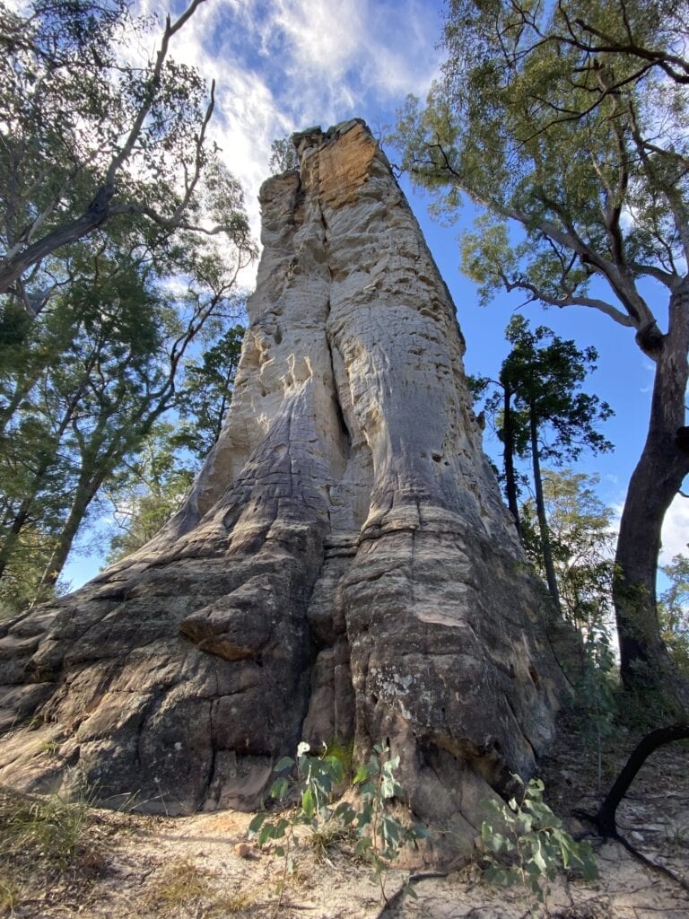
5. Lots Wife
Lots Wife is an imposing sandstone pillar, standing among the trees. It’s the last remnants of a sandstone bluff that once stood here.
6. Marlong Plain
If you stop at the turnoff from the Mount Moffatt Circuit Drive, you can walk across a plain to get a view of sandstone cliffs and ridges. We didn’t do this walk, as we were running out of time.
By all accounts though, it’s an ideal spot to watch the sun setting. Take a torch!
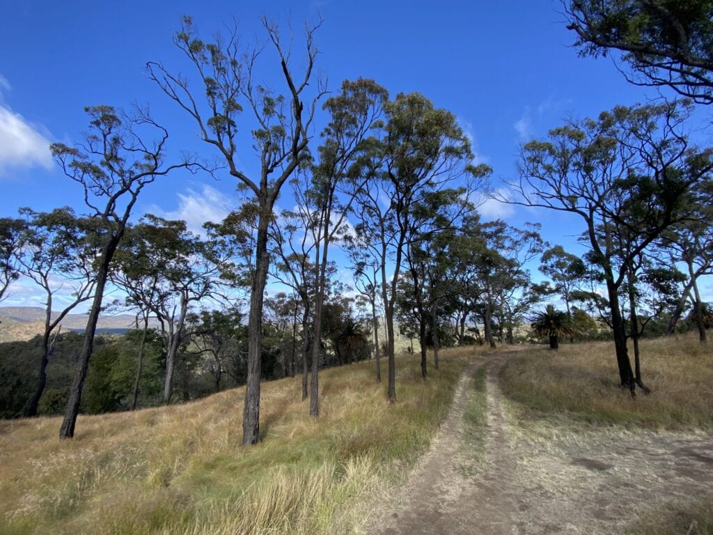
7. High Country Drive
At the top (northern) end of the Mount Moffatt Circuit Drive is the turnoff to the High Country Drive. If you’re lucky, the gate will be open. Treat this track with respect… at the slightest sign of rain it turns into a boggy mess.
Keep an eye out for beautiful tree ferns and grass trees along this track.
7.1 The Incineration Site
After a slow 5km drive, you’ll see a turnoff to the left. This takes you down to what’s ominously named the Incineration Site.
In 1902, policeman George Doyle was murdered along with Christian Dahlke, the manager of Carnarvon Station by bushrangers the Kenniff brothers. The Kenniffs burned their bodies, then stuffed the remains inside saddle bags.
There’s a plaque to George Doyle on the banks of the Warrego River, at the spot where he was incinerated.
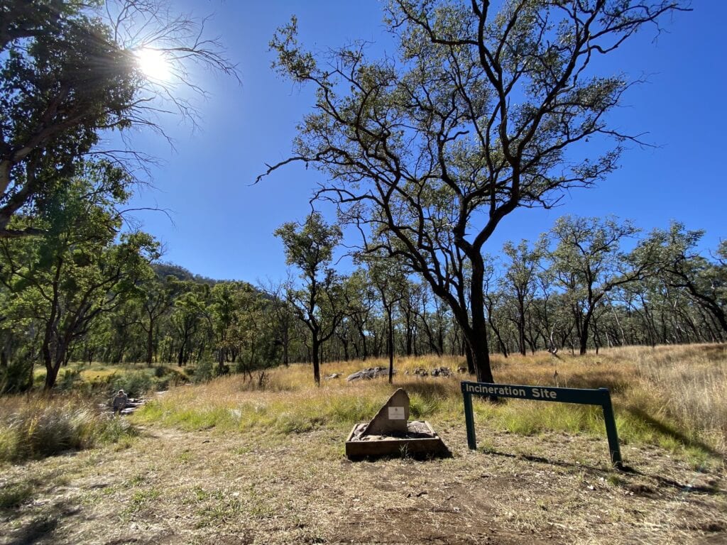
Further along the track is Kenniff’s Cave. However, it’s no longer open to the public due to unstable rocks.
7.2 Rotary Shelter Shed
Turn around and head back to the High Country Drive. Then engage low range and climb up to the Rotary Shelter Shed. It’s fine in the dry but would be treacherous after rain.
Stop and admire the view from the campground. It’s an incredible camping spot… but very exposed to the howling southerly blowing on the day we visited.
7.3 Consuelo Tableland
Continue up the track if you’re an experienced 4WDer and climb up onto Consuelo Tableland.
We stopped and turned around at a particularly steep point. After negotiating one extremely steep jump-up, the next one was even steeper. With our truck being back-heavy, I really didn’t want to lift the front wheels and end up in a pile down the side of the mountain.
We probably would have been okay, but I wasn’t about to find out!
If you’re experienced in steep country 4WDing and you have a capable 4WD, you should be okay. Otherwise, think twice about taking it on.
We stopped short just a couple of kilometres short of the end of the track. Why we didn’t just get out and walk it, I’ll never know! Next time…
By all accounts the view from the top is unbelievable. You look down over Carnarvon Gorge and get a really good feel for how rugged this country is. Like I said, next time!
Wrapping Up
The Mount Moffatt section of Carnarvon National Park is a surprise. Carnarvon Gorge takes all the glory, while Mount Moffatt is largely forgotten. The big plus is the lack of crowds.
Once out of the campground, you probably won’t see anyone else until you get back in the afternoon. Even then, you’ll likely share a large campground with a few others at most.
There’s no doubt, the absolute standout is The Tombs. It sets your mind at peace and allows you to more easily visualise how the First Nations people must have lived on their Country.
So if you’re looking for something away from the crowds, Mount Moffatt is an ideal choice.
The Mount Moffatt section of Carnarvon National Park is on Bidjara country.
Looking for more great articles on QLD National Parks? Then go here.

Get your Traveller’s Guides
… and a whole lot more at our FREE RESOURCES Page!
Any questions or comments? Go to the Comments below or join us on Pinterest, Facebook or YouTube.
Any errors or omissions are mine alone.