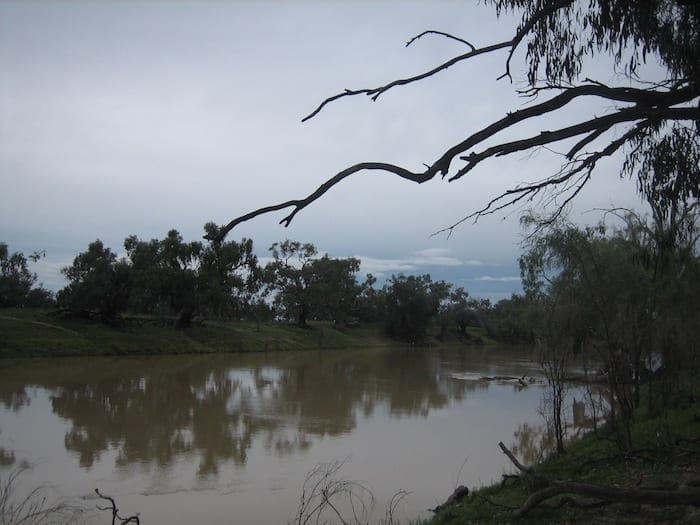
Leaving Louth and heading north for 99km, your next stop on the Darling River Run will be Bourke.
Camping On The Darling River
Some local knowledge pointed us in the direction of Kidman’s Camp at North Bourke. It’s on the western side of the river, a few kays along the Mitchell Highway.
This is an excellent facility… out of town, quiet and very well run. For campers like us, green grass was a welcome sight!
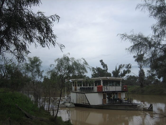
You have access to the Darling River and can jump on board the PV Jandra for a cruise along the river. This is run by Bourke Shire Council and is a popular tourist cruise.
Back O’ Bourke Centre
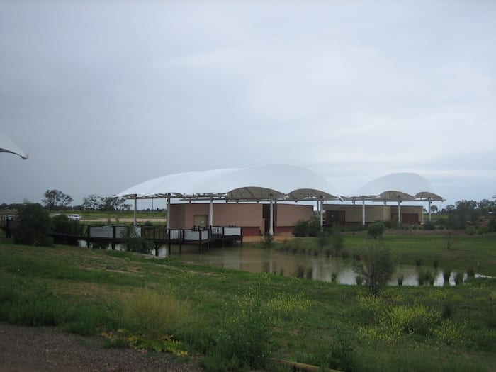
We spent quite a few hours at the Back O’ Bourke Centre. This is at the northern end of town, on the Kidman Way. Set up as an interpretive centre, it’s one of the best we’ve been to.
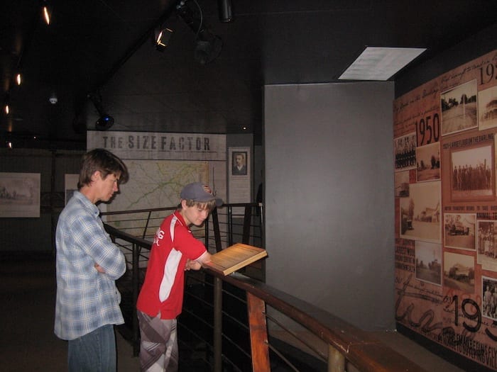
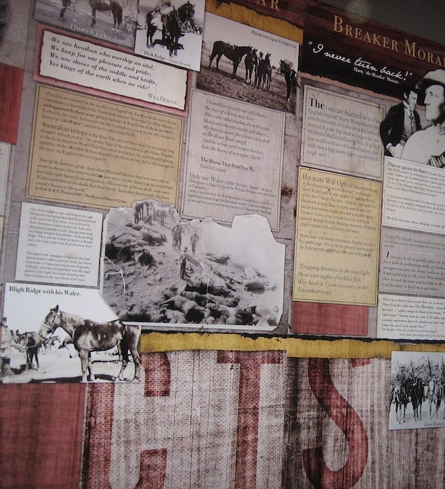
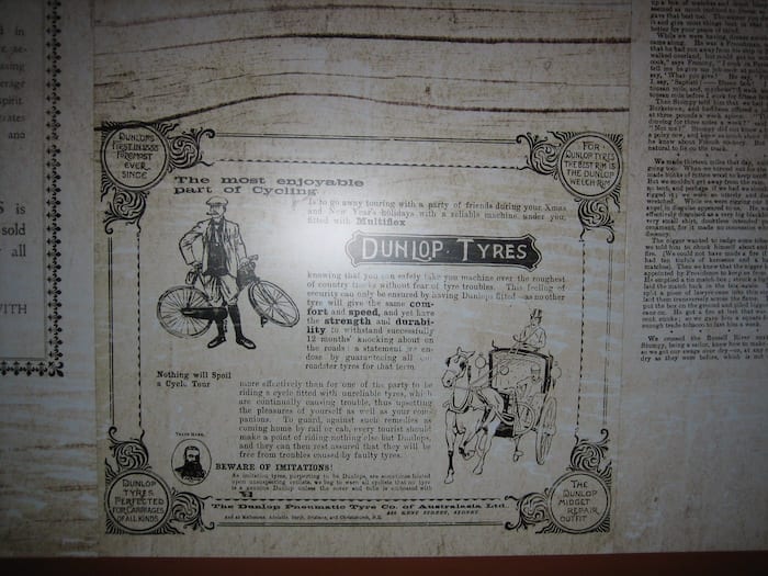
The volume of local history is extraordinary, and it’s all clearly presented. This centre is a real credit to the town and the instigators of this concept.
The Tourist Information Centre now resides inside the Back O’ Bourke Centre.
The Wharf and Weir
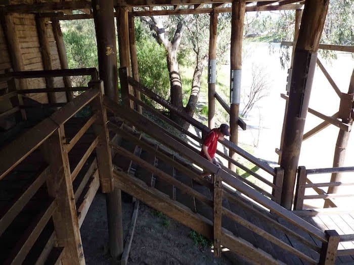
We visited the replica wharf on the Darling River. Bourke was a major port when paddle steamers ran along the Murray-Darling. This wharf has three levels, presumably to cater for differing water levels in the river.
Loads of wool were overlanded by bullock wagon, horse teams and camel teams from hundreds of kilometres away and then shipped down the river. Of course the paddle steamers also brought in any supplies that were required.
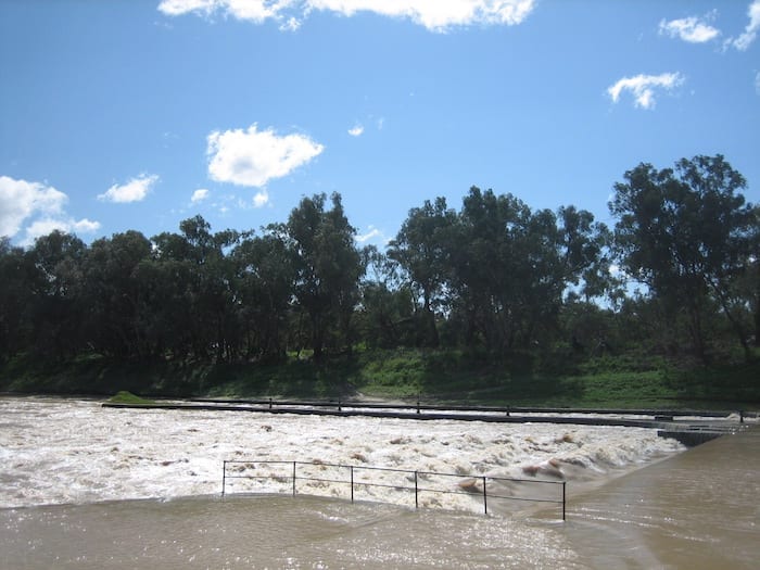
Bourke lock and weir is just downstream of the town. It was built in the 1890s to provide the town with a consistent water supply. Thankfully it is the only weir on the Darling River. To give you an idea of how flat this country is, the weir backs upstream about 40 km yet the weir is only 4 metres high.
Buildings In Bourke
Two notable buildings in Bourke are the Court House and the Port O’ Bourke Hotel.
The Court House is unique in Australia. It’s the only inland maritime court and remains so to this day. Obviously, this is a throwback to the days when the river was a crowded transport route.
The Port O’ Bourke Hotel (what’s with all these O’s?) has been extensively refurbished and has a huge variety of old photos on the wall. This photos give you a window into life on the river, the township and surrounding properties. You could easily spend half a day just taking in these amazing images.
Bourke Cemetery
Bourke cemetery is a fascinating place. It has a section for Afghan cameleers who are buried facing Mecca. These cameleers were the long distance transport drivers of their day.
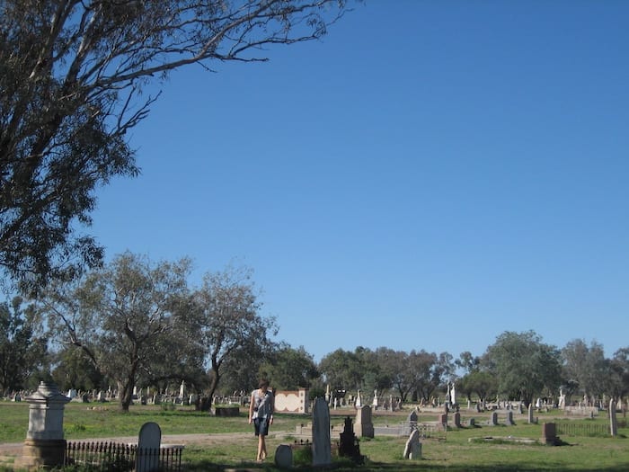
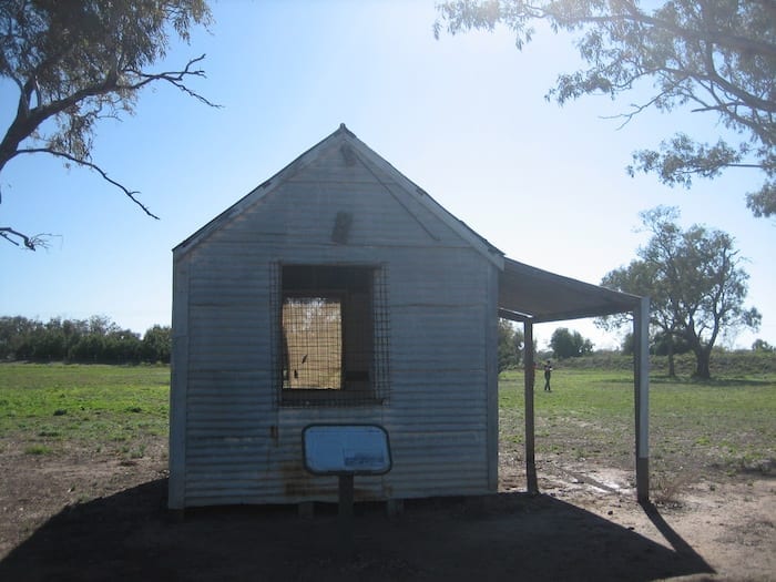
The Afghans were the backbone of the transport industry, guiding teams of camels across some incredibly remote country, often enduring extreme climate conditions. A small mosque was built in the 1900s, inside the grounds of Bourke cemetery. It has been preserved and serves as a reminder of how important these Afghan people were to early Australian transport.
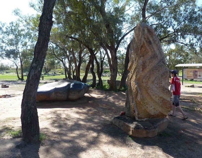
The famous eye surgeon Fred Hollows is also buried here and he has a special spot under some trees.
That Crooked Bridge…
The original bridge over the Darling River was built in the late 1800’s. It was the first bridge over the river and of course opened up access to the west. Speaking of opening up, this bridge featured an opening section to allow tall paddle steamers to pass.
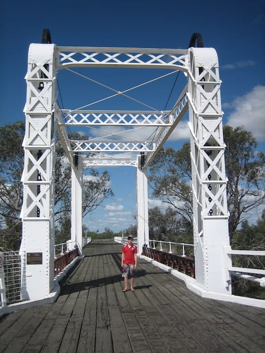
Today it sits in semi-retirement, serving as a pedestrian bridge. On the western side, it has a noticeable bend to the left as you look west. Why?
Well, the first thing you see directly in front of you is a pub. Maybe they were trying to avoid the pub? Nope. It’s actually quite clever.
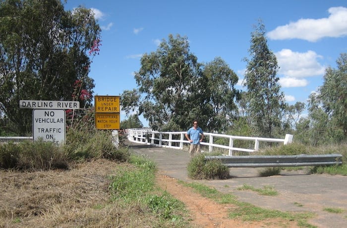
You see, one of the main transport routes followed the Darling River down the western bank from the north. This road met another road that travelled north-west (to Hungerford) from the bridge, at a T-intersection.
Now if you were driving a team of bullocks, horses or camels and hauling a heavy load, you’d need a huge turning circle. Because there wasn’t enough space to get around that T-intersection and then straighten in time to line up with the bridge, they built a bend into the bridge! So the teams would come sweeping around the left hand bend, swing onto the bridge and then follow the bend to straighten out as they crossed the bridge. Ingenious!
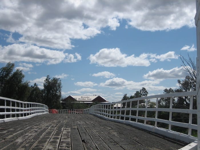
Mind you, why they didn’t just move the T-intersection 500 metres west, I’ll never know… clearly a government department was involved!
Parting Words
Clearly Bourke has a bad reputation for crime, there’s no escaping this fact. However, as a traveller you’re in a privileged position. You can enjoy the history and remain blissfully ignorant of the town’s problems if you so choose.
Just take a minute to reflect back to a time before the whitefella arrived. Gaze over the river and imagine what a great life it would have been – unlimited food, water and shelter. Dozens of generations of your family living on the river and managing it.
Then imagine how you’d feel if this was all taken from you overnight.
There are some good things happening in Bourke. The community is clearly determined to provide quality tourism to travellers and they have succeeded.
Bourke is on Ngemba and Yuwaalaraay Country.
Get your Traveller’s Guides
… and a whole lot more at our FREE RESOURCES Page!
Any questions or comments? Go to the Comments below or join us on Pinterest, Facebook or YouTube.
Any errors or omissions are mine alone.
Looking for more New South Wales Destinations? Then go here.

