

The Birdsville Track is one of the best-known Outback tracks in Australia. This track is etched firmly in the minds of Australians as one of the most remote and desolate tracks in the country.
It stretches 520km from the South Australian desert settlement of Marree, north to Birdsville in far South-Western Queensland. The Birdsville Track travels through remote and inhospitable desert country.
Images of famous Birdsville mailman Tom Kruse digging his truck out of deep sand, Afghan cameleers venturing north from the South Australian township of Marree into the vast unknown, or shimmering gibber plains all spring to mind.
A lot has changed over the years though.
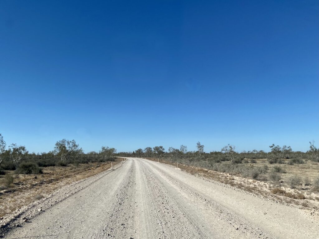
The Birdsville Track is no longer an endless ribbon of wheel tracks weaving among the sand dunes. It’s now a well-formed road, a vital transport route for the people who live and work in this unforgiving landscape.
These days, you can drive the Birdsville Track in one long day or more comfortably in two short days.
But it’s still remote and still a trap for ill-prepared travellers. Searing heat, dust storms and an unpredictable road surface mean you need to be well-prepared… or face a long wait for assistance.
So how did the Birdsville Track come to be? Why make a track through some of the most inhospitable country in the Australian Outback?
- A Brief History of The Birdsville Track
- Taking Precautions
- The Drive is The Attraction!
- Birdsville to Walkers Crossing Turnoff
- Walkers Crossing Turnoff to The Inside Track Turnoff
- A Cautionary Tale of The Inside Track
- In Hot Water
- Mungerannie Hotel
- Crossing Cooper Creek
- A Spa in The Desert
- On The Home Stretch
- Frequently Asked Questions About The Birdsville Track
A Brief History of The Birdsville Track
Parts of the Birdsville Track were originally a stock route, first used in the 1860’s. But there’s no reliable surface water along its entire length, resulting in many tragic deaths of both people and livestock.
Eventually the South Australian government decided to do something about this. They sunk bores about every 50km, deep into the Great Artesian Basin. Several of these are still visible along the route, still bringing scorching hot artesian water to the surface.
Drovers walked mobs of a thousand cattle or more from western Queensland, the Northern Territory, South Australia and even western New South Wales down the Track, to the railhead at Port Augusta.
Then in 1884, the Ghan railway reached Marree. Marree became the railhead servicing vast stations to the north… and a vital supply line for the tiny township of Birdsville.
Afghan cameleers would load their huge camel teams (up to a hundred camels in a team) at Marree then travel north, supplying properties and Birdsville with vital supplies and equipment.
In the mid-1880’s, mailmen started delivering mail along Birdsville Track by horse and coach.
Technology eventually caught up with the mailmen and cameleers. In the 1920’s, the motor vehicle first appeared on the Track. Trucks became the favoured form of transport, eventually replacing the camel teams and the horse-drawn mail coach.
Tom Kruse did his first fortnightly Birdsville mail run out of Marree in 1936. The owner of the mail run was Harry Ding from “nearby” Yunta (over 500km to the south-east of Marree). Along the way, Tom delivered to more than 20 stations.
Eventually, Tom bought the business from Harry and continued the Birdsville mail run, until handing the driving over to Monte Scobie in 1953. Tom sold the business in 1963.
By the 1970’s, technology again caught up with the Birdsville mail run. Planes replaced trucks, being a more efficient means of covering the vast distances quickly.
Nowadays, the Birdsville Track is still a vital transport link. Road trains service the stations, Birdsville and beyond. And locals use the Track as an access route.
But now, curious travellers make up the bulk of traffic… people like you and me.
So what can you see along the way?
Taking Precautions
Before we head off down the Birdsville Track, you need to know what you’re in for. This is especially true if you’re planning to drive up the Birdsville Track from the south.
You see, it’s now tar all the way to Marree when you approach from the south. This can lull you into a false sense of security.
But once you turn onto the Birdsville Track at Marree, you’re in a whole different world.
Stretched out in front of you is 520km of dirt road driving, through some of the driest and most remote country in Australia. So here’s a few things you should and should not do:
- Make sure your vehicle’s in top condition.
- Carry two spares for both your vehicle and anything you might be towing… and learn how to change a tyre before you leave home.
- Despite what the Facebook “experts” say, the Birdsville Track is not suitable for anything other than true off-road caravans and campers. If you decide to tow something semi off-road on even on-road, chances are you’ll break something.
- Same goes for motorhomes. The Birdsville Track will shake them to pieces.
- There’s no mobile phone coverage on the Birdsville Track. Take a satellite phone or PLB (EPIRB) and tell someone reliable where you’re going.
- If you break down, do not leave your vehicle. Dehydration kills quickly… and most times, you won’t even realise you’re dehydrated before it’s too late.
- Travel in the cooler months, between April and September. Outside of these times, expect temperatures in the high 40s.
- Take plenty of food and water and allow for an extra four or five days’ supplies in case of rain or breakdowns.
- Don’t even think about driving the Birdsville Track in a road car, unless you are highly experienced on outback roads and understand how to nurse a car over rough roads.
- If there’s even a hint of rain forecast, don’t even consider taking the Birdsville Track. It becomes impassible very quickly.
Now, let’s get back on the Track…
The Drive is The Attraction!
If you’re hoping to see lots of exciting attractions, you’ll probably be disappointed. The drive is the attraction out here.
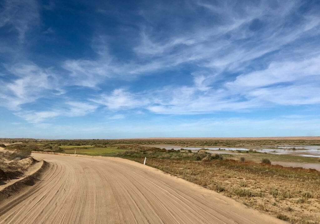
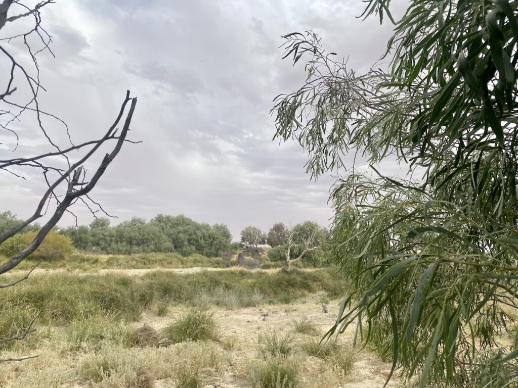
Enormous red sand dunes, vast gibber plains, endless whirly-whirlies dancing across the sand, the magnificent hills of Mungeranie Gap, the miracle of artesian water in an otherwise waterless landscape, the extreme isolation of long-failed shops, even an optimistic venture involving growing date palms.
These are the things you’ll see.
Subtle changes in the landscape, the sudden change in vegetation as you reach Cooper Creek floodplain, the occasional dragon at the side of the road which somehow manages to thrive in this extreme environment.
These are the things you’ll see, as you begin to read the Country.
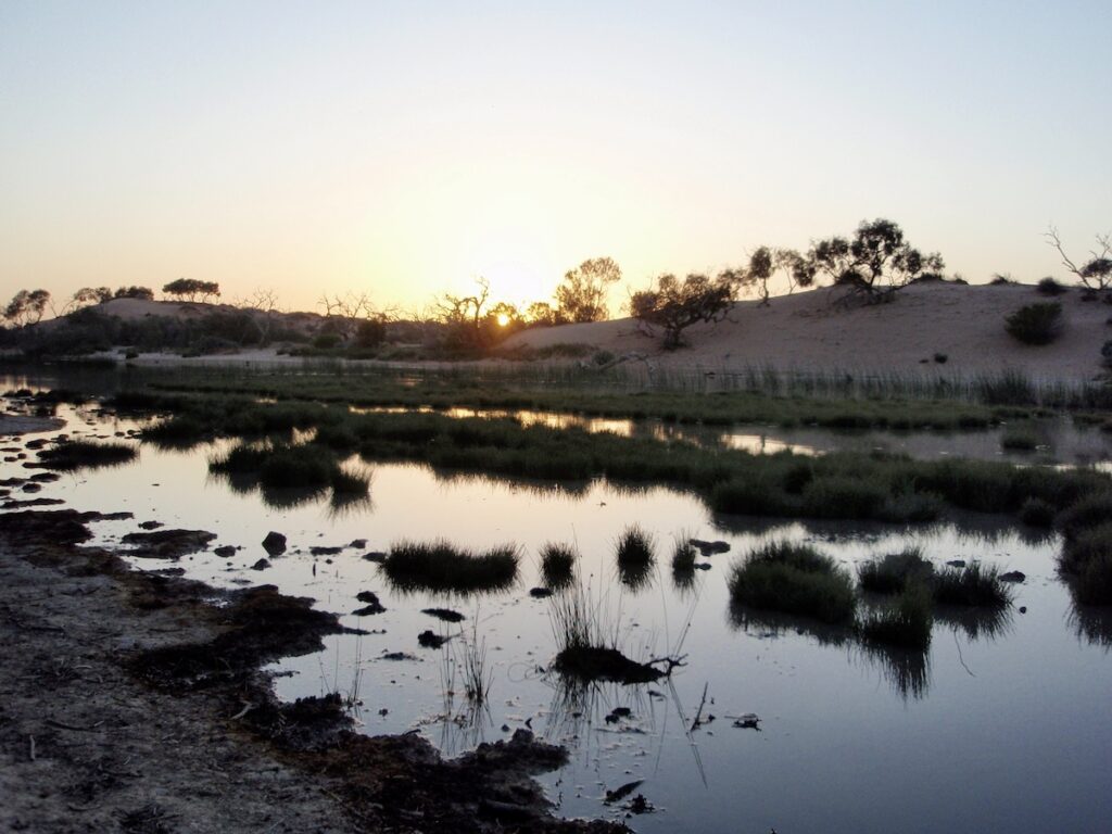
And sometimes, you’ll be treated to something incredibly special – water.
Birdsville to Walkers Crossing Turnoff
A few years, we pointed the truck down the Birdsville Track. We were making for the Walkers Crossing Road turnoff, about 120km south of Birdsville.
The Diamantina had flooded earlier that year, after record rains in western Queensland earlier in the year. So there was plenty of water about.
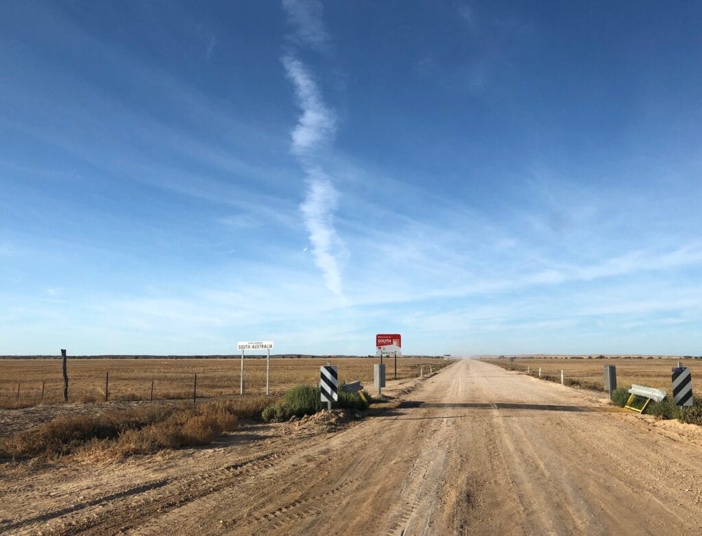
Pretty soon we crossed the QLD/SA border. The track was in great condition, more a wide gravel highway than a track. The Diamantina River was off to our west, so we decided to launch the drone and see what was over those ever-present sand dunes.
The Diamantina floodplain from the air is a spectacular sight!
We pressed on and soon encountered a long detour. The Diamantina floodplain had cut the road, which was either under water or in the midst of a boggy swamp. Seeing lakes and vast swathes of green grass in this red sand dune country sort of messes with your mind.
It is such a contrast to the surrounding country, and so beautiful.
Once past the detour, the sand dunes gave way to gibber plains as the land rose slightly. A little while later, we reached the turnoff to Walkers Crossing Road and a new adventure awaited us.
Walkers Crossing Turnoff to The Inside Track Turnoff
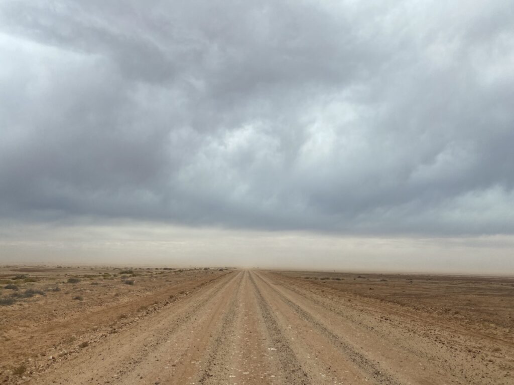
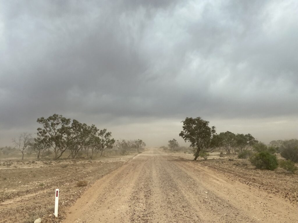
This time though, we continued down the Birdsville Track. Our plan was to camp at Mungerannie for the night. Being late September, it was a hot day. A hot northerly wind blew us down the road, shrouding us in a hazy blanket of dust. A dust storm was building…
South of Walkers Crossing turnoff, you’ll cross enormous gibber plains. Driving across these plains, surrounded by an ocean of gibbers stretching to every horizon is quite surreal.
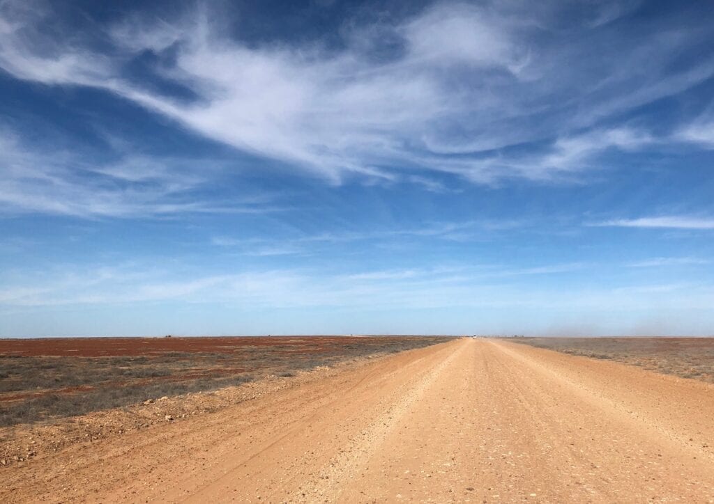
Despite the apparent desolation of these gibber plains, they actually serve two functions.
The stones act as a “blanket” for the soil underneath, protecting it from being blown away by the ever-present winds. In fact, wherever this precious cover is removed, you’ll see erosion.
So what looks like an incredibly harsh landscape is in fact, extremely fragile. Keep this in mind when the mate you’re travelling with decides he’s going to drive off the main track “just because he can”.
The other function? The gibber plains are home to a surprising variety of small creatures. Small mammals like kultarrs, kowaris, dunnarts, hopping mice and the sandy inland mouse… birds like quailthrushes, wrens, finches and woodswallows… reptiles like skinks, geckos, dragons… even a couple of species of frogs, when conditions are right!
Speaking of frogs… pretty soon, you’ll pass the turnoff to the Inside Track. While the Birdsville Track might be hot and dry (like it was when we were there), the Inside Track can be an entirely different story.
A Cautionary Tale of The Inside Track
As you can see below, the Inside Track was quite clearly closed. It had been this way for months.
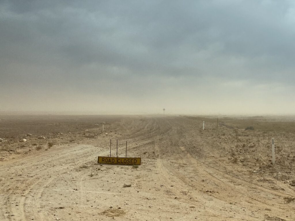
The Inside Track is the original alignment of the Birdsville Track and is about 145km long. The problem is, it runs directly across the humungous Diamantina Floodplain. So when it rains or the Diamantina floods, this track can be closed for many months.
The Diamantina River passes Birdsville then drains into Goyder Lagoon, an ephemeral swamp which covers around 1,300 sq km when filled. Once this fills, it flows into the Warburton River. This splits into the Warburton River/Kallakoopah Creek system, which eventually flows into Kati-Thanda/Lake Eyre.
The Inside Track runs straight through the Diamantina Floodplain.
The “new” alignment of the Birdsville Track avoids the floodplain. It loops around to the east of Goyder Lagoon and the Diamantina River.
When it’s open, the Inside Track is a brilliant drive. It crosses vast black soil plains covered in Mitchell grass, lignum, and canegrass in the swampier sections. You’ll encounter enormous sand dunes, coolibahs in creek beds, serene waterholes along the Diamantina River, and you might even spot a brolga or three.
But if there’s a Road Closed sign at the turnoff, then it’s there for a very good reason. Let me tell you a story…
Before we started down the Birdsville Track, we spent a few days at Birdsville. The talk of the town was all about one extremely lucky person. He had under-estimated the Inside Track.
This man was traveling by himself, doing the Birdsville Track from south to north. He reached the Inside Track turnoff and decided to drive around the Road Closed sign (the same one in our earlier photo).
He had no PLB, no satellite phone, and had told no one where he was going.
After a while, the inevitable happened… he became hopelessly bogged. And with Road Closed signs at both ends of the Inside Track, he had zero chance of another traveller coming to his rescue.
So he decided to walk back to the Birdsville Track.
By sheer chance, a plane was taking a group of sightseers over the floodplain and noticed his car on the Inside Track. After circling around and seeing no signs of life, the pilot called emergency services.
They picked up the man walking on the Inside Track… exhausted and slightly dehydrated, but otherwise okay.
To top off his tale of woe, the man lost his car keys. So the only way to retrieve the vehicle was to drag it out of the bog and onto a tilt tray. When we were in Birdsville, the man was resting up and keeping a very low profile.
He would have been out of pocket tens of thousands of dollars…
- There was a full-scale rescue,
- He had no insurance because he drove on a closed road,
- He would have copped a large fine for driving on a closed road,
- He would have had to pay the cost of retrieving his vehicle, and
- Then there was the small matter of no longer having car keys.
All things considered, he got off lightly. He could easily have died due to dehydration. In fact, he was incredibly fortunate day time temperatures were unseasonably cool when he became stranded.
So if you see a Road Closed sign, don’t drive around it. It’s there for a reason.
In Hot Water
Moving down the Track, your next point of interest is the turnoff to the Warburton Track. Like the Inside Track, this was closed due to boggy conditions at Warburton Crossing.
The Warburton Track joins the K1 Line and the Rig Road in the Simpson Desert, a trek of over 100km. And it’s a popular loop for those who don’t want to do a full-blown Munga-Thirri/Simpson desert crossing.
You’ll notice more dry creek crossings as you head towards Mungeranie. The watercourses are lined with hardy, knarled trees which soak up any trace of subsoil water they can find with their deep root systems.
Mirra Mitta Bore used to be a good spot to stop and take photos. However, it’s now fenced off with dozens of No Entry signs hanging along the fences. As we discovered later, there’s a good reason for this.
The artesian water is around 90°C when it reaches the surface. in 2017, a man fell into the pool at Mirra Mitta and sustained burns to 80% of his body. Fortunately, his friends plucked him out, doused him in cold water and activated their PLB (personal locator beacon). Their quick actions saved his life.
So now it’s fenced off and definitely a no-go zone for travellers.
Heading south, the Mungeranie Hills ease into view. Pretty soon, you’re through Mungeranie Gap and ready to turn off to the famous Mungerannie Hotel.
Mungerannie Hotel
No that’s not a typo. The Mungerannie Hotel is on Mungerannie Station, which is at Mungeranie or Mungerannie. It seems no one’s quite sure whether to use one n or two!
Mungerannie Hotel is on the grandly named Derwent River, which is (or was) a permanent waterhole fed from an artesian bore. Last time we were here, the waterhole was a wetland – an oasis for birds. And they had a spa made from railway sleepers.
So we were pretty disappointed when we rolled into Mungerannie on a hot, dusty day to discover the wetlands were almost dry.
It wasn’t easy extracting the answer to the mystery of the missing wetlands from Phil, the co-proprietor of the Mungerannie Hotel. Phil and his partner Deb run the hotel and are lovely people.
I did glean the dry wetlands had something to do with needing to rebuild the spa, the recent drought and a few other details I couldn’t quite follow.
Phil has a dry sense of humour, a keen wit, and a quirky way of expressing himself. So I’m still not sure whether the wetlands will return or not!
We set up camp beside the now-dry wetlands. Instead of lounging around in the outdoor spa or taking a refreshing dip in the waterhole, we were sand-blasted from the north by a wicked hot wind. Not exactly how we’d planned to spend the afternoon…
Sick of eating sand, we wandered up to the pub.
The pub’s definitely an experience. You’ll find the walls and ceiling covered with hats, plaits, dreadlocks, business cards, drivers’ licences, bras, undies… pretty much everything you can possibly imagine.
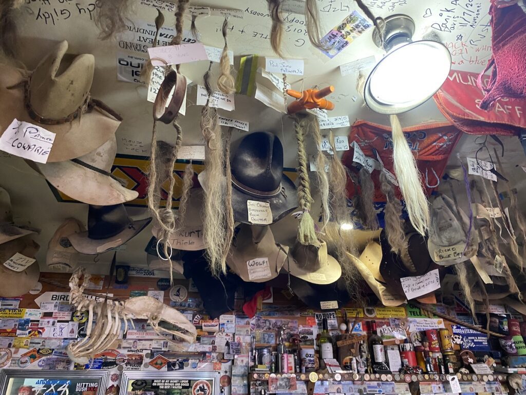
Then outside the pub you’ll see a few old trucks. They’ll give you a taste of how hard a truck driver’s job would have been… open cabs, the engine burning your left leg under a thin steel cover, no power steering, basic seats and definitely no air conditioning!
It’s worth spending a night at Mungerannie Hotel to soak in the atmosphere.
Crossing Cooper Creek
Heading south from Mungeranie, you’ll enter the Lake Eyre Basin which is 15m below sea level at its lowest point.
A bit further south, stop at Old Mulka Homestead and Store ruins. This was established in 1924 and quickly gained notoriety as the loneliest store on earth. And it’s easy to see why.
The homestead and store sat on a desolate plain, surrounded by gibbers and saltbush. You’d have to be pretty fond of your own company to live here.
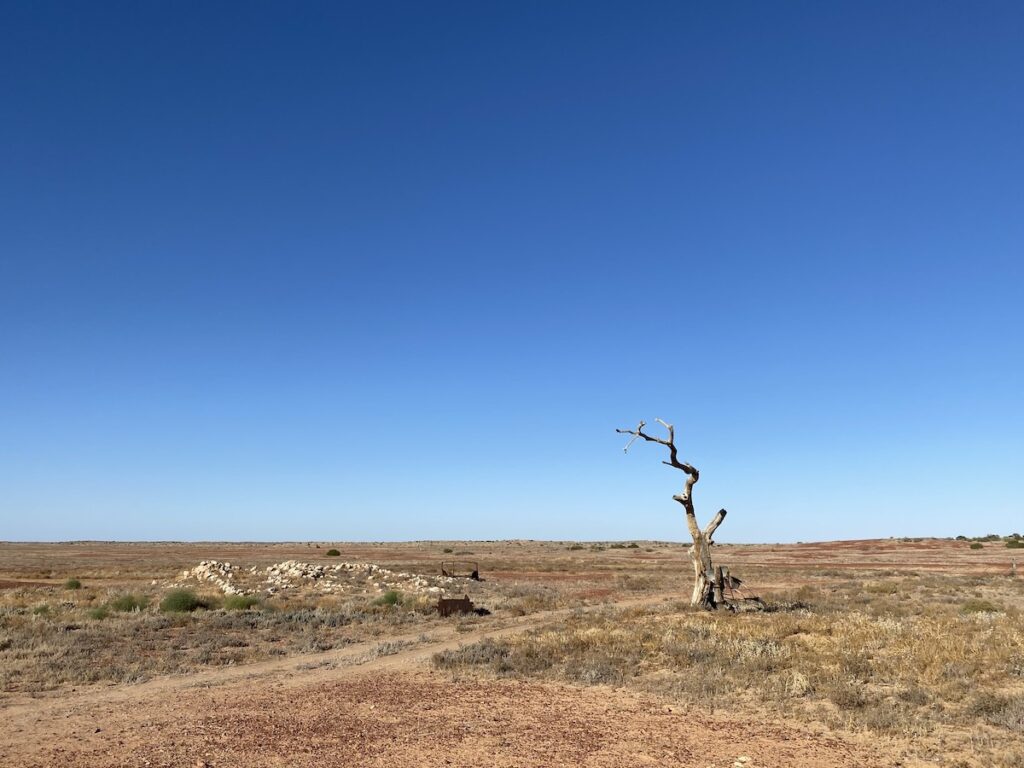
Just south of Old Mulka are the Natterannie Sandhills. These tall, narrow sandhills were the scourge of both drovers and people like Tom Kruse. The soft sand and meandering swales meant they were difficult to cross.
Cattle would often spread out and get lost in the maze of dunes and swales, especially during sandstorms. And the steep sand dunes were a nightmare for heavily loaded trucks, which would bog deep into the soft sand.
Now, it’s an easy drive across the sandhills on a well-formed road.
Perhaps the best known part of the Birdsville Track is where Cooper Creek crosses the Track. The only way across is via a ferry when the Cooper floods, a 42km diversion to the east.
The floodway is over 5km wide and cuts the Birdsville Track for months at a time.
Just south of Cooper Creek is the M.V. Tom Brennan, a tiny barge used in the 1950s and 1960s to float supplies and mail across the floodway.
A Spa in The Desert
Heading south, you’ll pass Etadunna Homestead then Dulkaninna Homestead. Just south of Dulkaninna are the Dulkaninna Wetlands, which come right to the edge of the road.
About 30km further on, you’ll pass Clayton Homestead then the Clayton Wetlands Campsite. This unique campsite boasts hot showers, flushing toilets and even a spa!
The people at nearby Clayton Station have kindly provided these facilities. So make sure you leave some cash in the donation box and leave the place as (or better than) you found it.
Pretty soon, you cross the Dog Fence. This fence runs more than 5,600km along the QLD/NSW border, down the SA/NSW border, then heads west around the northern end of Lake Torrens, finally meeting the ocean between Nundroo and Yalata in South Australia.
Lake Harry’s off to your left (east), an ephemeral lake. At the southern end are the ruins of a farm established in the 1890s to grow dates.
In theory, this area was the ideal climate for growing date palms. With artesian water available, over 2,600 date palms grew happily here for a while. But a series of bad seasons combined with birds stripping the palms bare, meant the project was doomed to failure.
On The Home Stretch
After Lake Harry, it’s a short run into Marree. Spend some time wandering around Marree. It’s a town with a fascinating past.
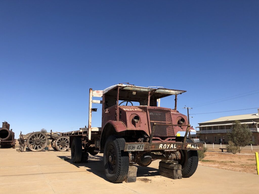
And make sure you get a photo of Tom Kruse’s mail truck. This old Blitz wagon has seen more than you and I will see in ten lifetimes.
Marree is also intrinsically linked to the Old Ghan Rail Line. Once a railhead servicing stations and towns to the north, Marree lost this mantle when the Old Ghan was extended through to Alice Springs. Then when the rail line was re-aligned further west, Marree shrunk to a sleepy outback township.
The Birdsville Track is a fantastic drive through South Australia’s Outback. It’s a must-do journey for many people… and it’s easy to see why.
Once you head south out of Birdsville or north from Marree, the vast open plains make you realise you’re just an insignificant dot on the planet. Spare a thought for those hardy people who lived and worked here in the days before reliable 4WDs and air conditioning.
This harsh yet beautiful landscape is truly unforgiving. Prepare for the worst and hope for the best… just don’t underestimate how unforgiving the Birdsville Track can be.
The Birdsville Track is on Yarluyandi, Ngamini, Dieri, Dhirari and Kuyani Country.
Looking for more destinations and road trips in and around Birdsville? Then go here.
Frequently Asked Questions About The Birdsville Track
No, the Birdsville Track is unsealed for its entire 520km length from Birdsville in Queensland to Marree in South Australia.
It depends entirely on how recently it has been graded. When we last travelled the Birdsville Track, it varied from smooth gravel to rough and rocky in places. This is typically what you’ll encounter. And expect bad corrugations in some sections.
The entire Birdsville Track is dirt, 520km from Marree in Outback South Australia to Birdsville in far south-west Queensland.
It is suitable for off-road caravans only. While many people drag semi off-road or even on-road caravans along the Birdsville Track, it’s not advisable. The constant pounding from the rough surface will likely damage your caravan.
You’ll see endless “experts” on social media advising that it’s fine to take any caravan along the Track. But unless you’re a) a bush mechanic, b) don’t care whether your caravan gets damaged, or c) prepared for breakdowns… then don’t listen to them.
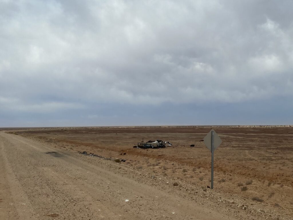
If you’re looking for a trouble-free trip, don’t drag anything other than a true off-road caravan or camper along the Birdsville Track. You don’t want to end up like this…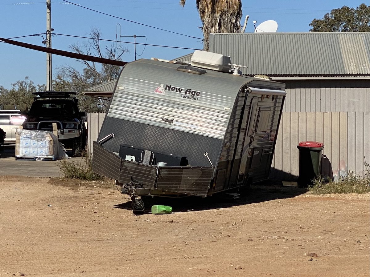
Yes, it is a gazetted road. However, check with your insurer prior to leaving, to ensure your vehicle’s covered when travelling in remote areas.
Fuel is available at Birdsville, Marree and Mungerannie Roadhouse.
You can, however it’s not advisable. The issue is ground clearance. You’ll encounter rocks along any of the roads leading into Birdsville, which can pierce your engine or transmission sump or cause other major damage.
The rocky road surfaces also play havoc with tyres. Ensure you fit suitable tyres (all-terrain tyres) and carry two spares.
If you’re an experienced dirt road driver, you’ll be fine if you’re careful. However, it’s not advisable to drive to Birdsville in a 2WD.
If you’re not an experienced dirt road driver… forget it, especially during the extremely hot summer months.
You can camp at six places along the Birdsville Track.
☞ Marree has the Marree Caravan and Campers Park, Marree Drovers Run Tourist Park, The Marree Hotel and Mobil Marree Outback Roadhouse. Go here for more details.
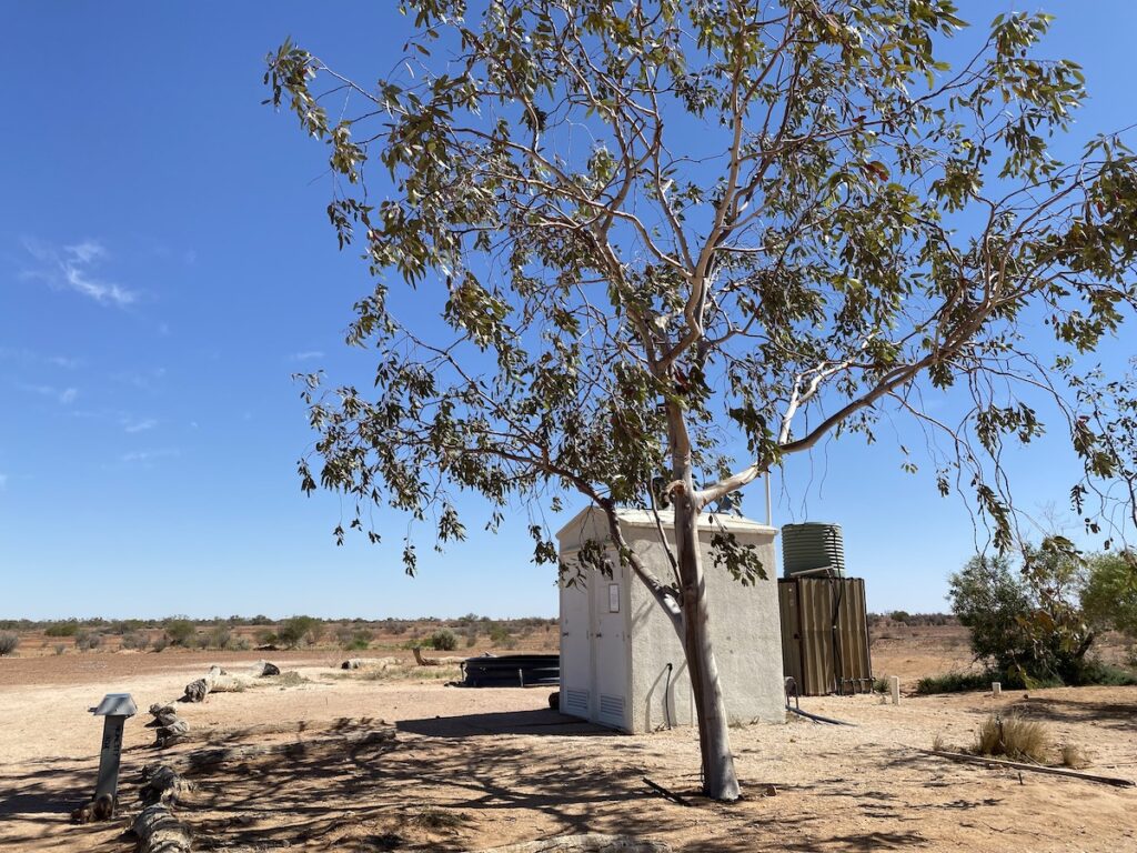
☞ The Clayton Wetlands Campsite is 54km north of Marree and 466km south of Birdsville. This bush camp has flushing toilets, shower and even a bush spa. It operates via an Honesty Box system, so make sure to take some cash.
☞ Cooper Creek Campground is 135km north of Marree and 385km south of Birdsville on the Cooper Creek floodplain. It has a toilet and the most shade you’re likely to find along the Birdsville Track (with the possible exception of Mungerannie Roadhouse).
☞ Mungerannie Hotel and Roadhouse is 205km north of Marree and 315km south of Birdsville. It has camping along the wetland. There are shady spots along the edge of the wetland and plenty of additional camping spots if these are already occupied.
☞ Tippipila Creek Bush Camp is 337km north of Marree and 183km south of Birdsville, on the northern side of Tippipila Creek. It has a flushing toilet.
☞ Birdsville has the Birdsville Tourist Park and bush camping along the Diamantina River.

Get your Traveller’s Guides
… and a whole lot more at our FREE RESOURCES Page!
Any questions or comments? Go to the Comments below or join us on Pinterest, Facebook or YouTube.
Any errors or omissions are mine alone.