Narawntapu National Park sits on the northern coast of Tasmania, roughly in the middle. It’s a stones throw across the bay from the scenic town of Port Sorell.
Even better, its just down the road from Devonport where the Spirit Of Tasmania docks. Head straight to Narawntapu from the ferry for a few days of peaceful camping, Tassie style.
How do you say Narawntapu? Well, “Na-roun-ta-poo” is close to the mark. The kids will have fun with this one!
How To Get There
The western end of Narawntapu National Park is a stones-throw across the bay from Port Sorell. However, you need to do a big semi-circular loop around the bottom of the bay.
The visitor centre is at the western Bakers Beach section. It’s about 40 km (40 mins) from Devonport, 30 km (30 min) from Port Sorell, and 80 km (1 hr, 10 mins) from Launceston.
Camping And Facilities
Narawntapu National Park has four campgrounds, with varying levels of facilities. They’re all accessible from the western (Bakers Beach) end of the National Park.
Fires are seasonal in all campgrounds. Bring your own firewood, do not collect it from the National Park.
You need to be fully self-sufficient in water. Water’s available, but you have to boil it first.
Being so close to civilisation, you’ll have phone reception in most places. But if you’re planning on the more remote walks like Point Vision Track then let someone know where you’re going. Don’t fully rely on having phone reception.
Springlawn Campground
Springlawn Campground is beside the Visitor Centre at the main Park entrance. It has powered sites, showers (tokens available from Visitor Centre), flushing toilets, and a dump point.
Some sites are wheelchair accessible, as are the amenities.
Bakers Point Campground
Bakers Point Campground has over thirty unpowered sites. They range from large areas for groups, down to single sites for people with tents.
This campground faces south-east, away from the prevailing westerlies. So it’s generally popular.
Perhaps the main reason it’s so popular is the boat ramp. People come here to fish. We didn’t see too many (as in zero) fish being hauled out of the water. But then again, that’s not necessarily the point. It’s more about relaxing and making memories.
The campground has drop toilets, rubbish bins, and a dump point. There’s also a day use area, which gets a workout on weekends.
Koybaa Campground
Koybaa Campground is around the corner from Bakers Point Campground. It’s for people with tents and has a walking track to the water.
This smaller, less popular campground has drop toilets.
Horse Yards Campground
Strangely, horse riding is allowed within Narawntapu National Park. Just before the Visitor Centre are horse yards and a small camping area with drop toilets.
You’ll need to be self-contained. The campground is fairly exposed, so it’s not really a great choice unless you have horses.
What To See and Do at Narawntapu National Park
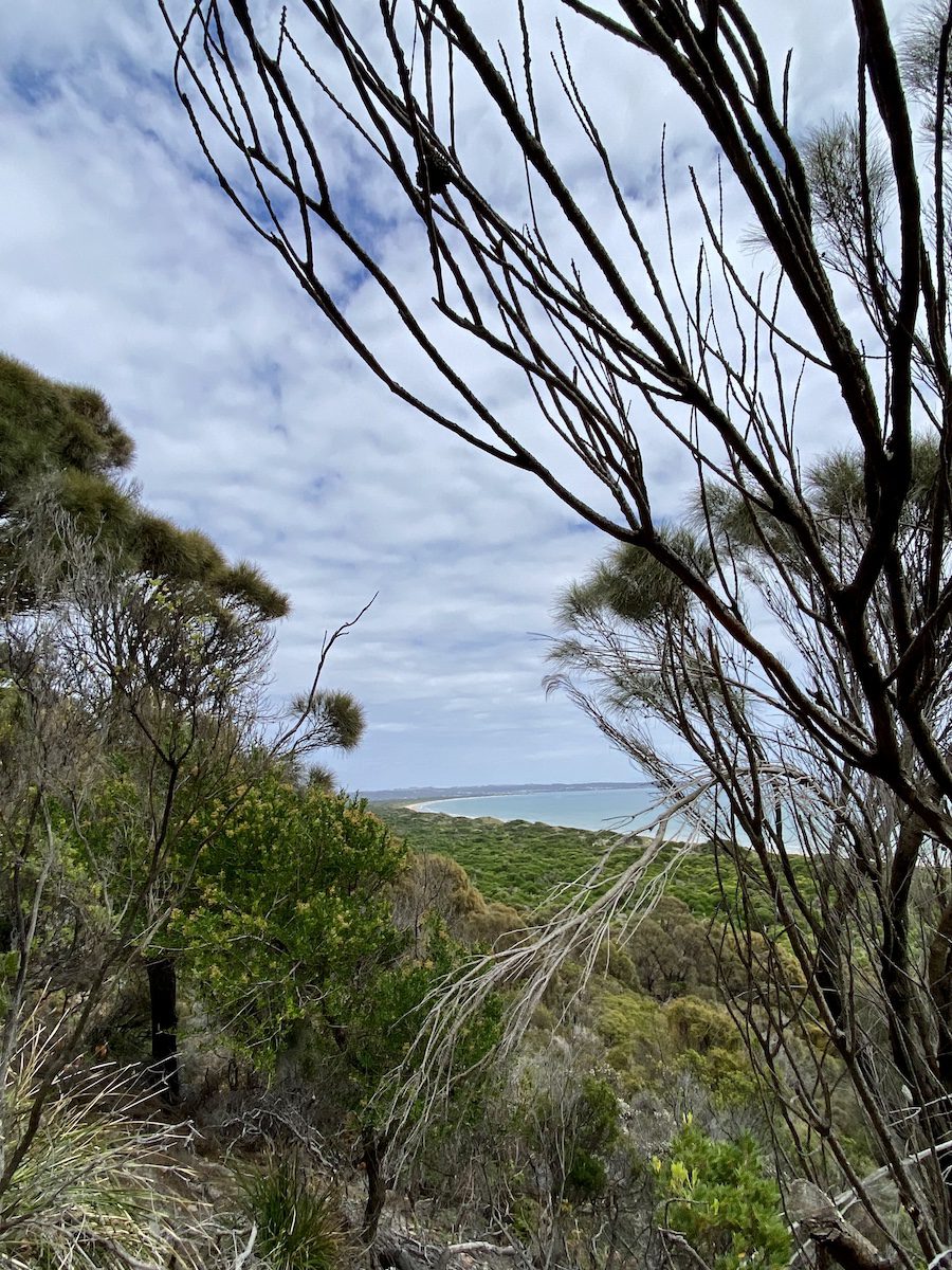
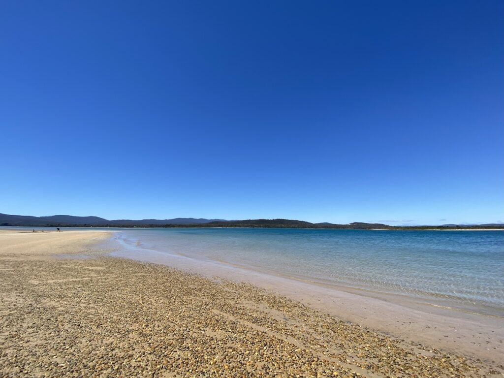
The Park features a blend of coastal heathlands, open grasslands, wetlands, and dry sclerophyll forest. It takes in an extensive stretch of coastline. Sweeping white beaches line the edge of the notorious Bass Strait along a wild and spectacular coastline.
Asbestos Range lies partly within the National Park. The Park runs in a narrow nor-east strip from Griffiths Point, east to West Head. The two main beaches are Bakers Beach and Badger Beach.
Normally, coastal heathlands aren’t our favourite places to camp. The low scrubby heathlands don’t really do much for us. We’re more comfortable camping on an inland river or in the vast stretches of the mainland’s deserts.
But Narawntapu National Park is different.
A Wide Variety of Plants and Creatures
The coastal heathlands are home to a wide array of flora, including stands of paperbarks, stunning banksias, and eucalypts. They attract a wide variety of beautiful birds and unique mammals.
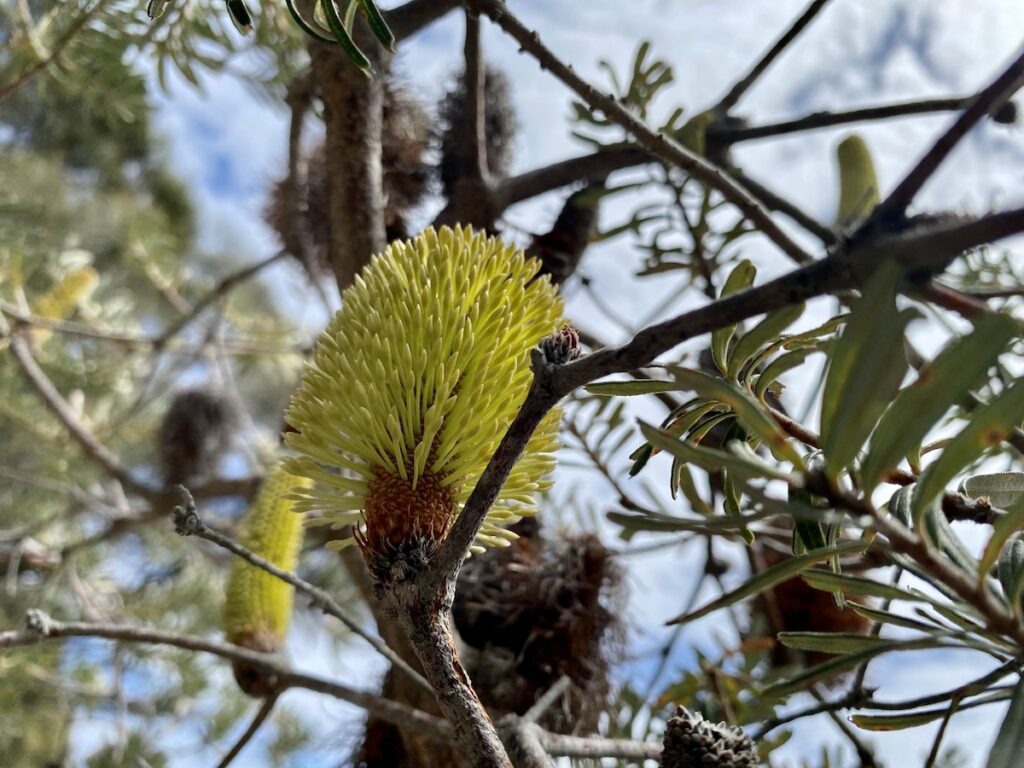
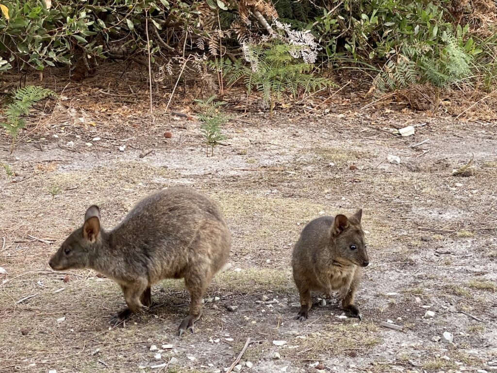
Plump Bennett wallabies share their home with pademelons… cute little hoppers with short tails. And tell-tale diggings in the bush are a sure sign of southern brown bandicoots.
In the more open country, Forester kangaroos bask in the sun. They have a distinctive look, with chubby cheeks and a thick, dark coat.
Not so long ago, wombats dominated this landscape. The mix of open grasslands and coastal heathlands were an ideal combination for these loveable creatures.
However, mange decimated the wombat population. Mange is the animal form of scabies, a horrible disease introduced by white settlers.
It’s thought white people brought the parasitic mite to Australia, passed it onto domestic animals, which passed it onto native animals.
Mange causes hair loss and hard, crusty skin lesions which become intensely itchy, often getting infected. Over time, the animal loses condition and will eventually die a slow and painful death.
While there’s no way eradicate mange, it can be treated. But finding and treating nocturnal wild animals living in burrows? It’s a near impossible task. Once a wombat gets mange, chances are it won’t survive.
On the bright side, we did see the occasional fresh wombat scat. So it seems there are at least a few wombats left.
And if you’re a bird lover, then you’ll appreciate the wetlands. Settle into the bird hide and see what’s about on the beautiful wetland. This region’s a major stopover for migratory birds… and home to locals like herons, ducks, and grebes.
There’s no better way to see wildlife than by taking a few bushwalks. Narawntapu has a selection for you, ranging from an easy stroll across grassy plains to a full-on walk along the rugged coastline.
Walks in Narawntapu
The best part about Narawntapu National Park walks is the options you have. We chose the Archers Knob walk, which itself can be split into several shorter or longer walks.
1. Archers Knob Walk
Archers Knob Walk starts at the visitor centre at Bakers Beach. It goes north-east to Archers Knob, a low mountain just inland from Bakers Beach.
We honestly weren’t expecting much. In our experience, coastal walks on flat ground usually involve endless monotonous heath with lots of wind!
But this is entirely different.
The walk’s actually quite protected. Many different plant varieties crowd the edges of the track, protecting you from the wind and sun. The paperbark groves are particularly stunning, forming quite a dense canopy overhead.
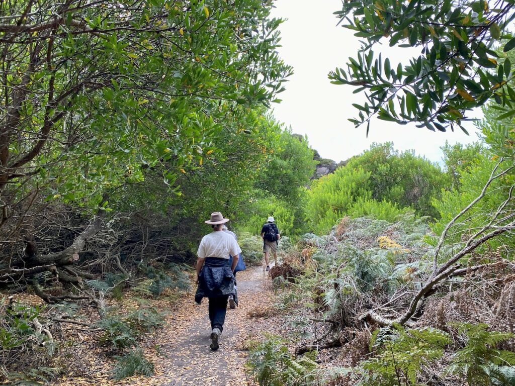
Along the way, turn off to the bird hide on the edge of Spring Lawn Lagoon. Even if birds aren’t your thing, the walk itself is worth the short diversion. A boardwalk leads you through a grove of paperbarks and across swampy ground to the hide.
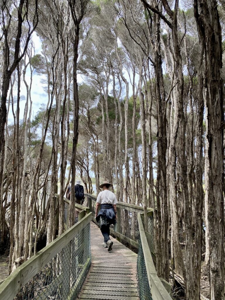
Then once at the bird hide, have a look across the lagoon and see what birds you can spot.
The track continues, meeting the edge of the hill and following along its base for a while. Then it turns and you climb 114 metres to the top.
It’s a pretty easy climb, although there’s no break until the top. This section is exposed, so take plenty of sun cream.
Once at the top, you’ll get sweeping views of Bakers Beach and Bass Strait to the north. To the west and south west lie Springlawn Lagoon, the Springlawn Plain, and the shallow waters of Port Sorrell.
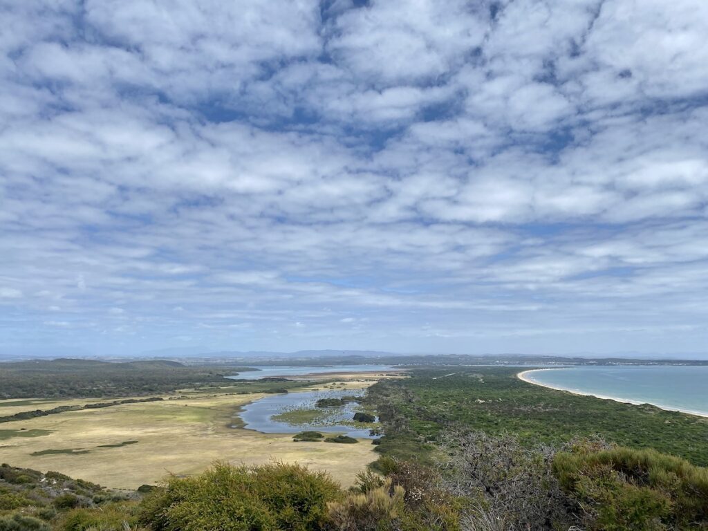
When you’ve had enough, make your way back to the bottom. Retrace your steps or walk back to the visitor centre along Bakers Beach instead.
We chose to retrace our steps, then turn off the Archers Knob track onto the green Springlawn Plain. As you walk across the plain, you’ll see lots of Forester kangaroos along the edge of Springlawn lagoon. If you haven’t been up close to a roo before, then this is a good place to do so.
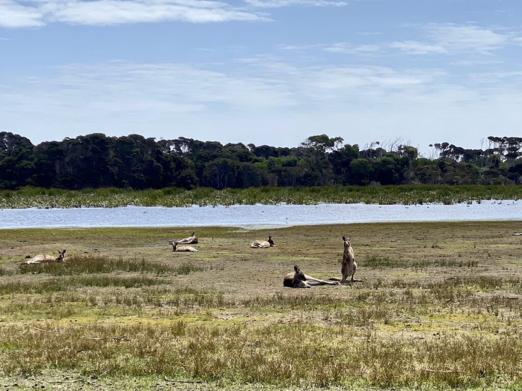
Also notice how the ground’s pockmarked with old holes. These are old wombat burrows. They give you a sense of how many wombats would have lived here before mange decimated them.
The plain’s cut through with man-made channels in places. White settlers dug these to drain the swamplands for cropping and grazing. You can’t help but wonder how different this plain would have been pre-white man.
Once across the plain, you’ll be back at the start of the walk at the visitor centre.
Archers Knob Walk is only one of many walks. We didn’t do any of the others, but we’ve listed them below.
2. Springlawn Circuit Walk
We covered this off above in the Archers Knob Walk. Springlawn Circuit Walk starts at the visitor centre, goes across Springlawn Plain, then back around the northern side of Springlawn Lagoon.
It’s an easy walk with access to the bird hide.
3. Coastal Traverse
The Coastal Traverse is a 21km, all-day walk one way, from Bakers Beach to Green Head.
The walk combines sections of the Archers Knob and Badger Head Walks. If you’re keen to see the park from end to end, then this is for you!
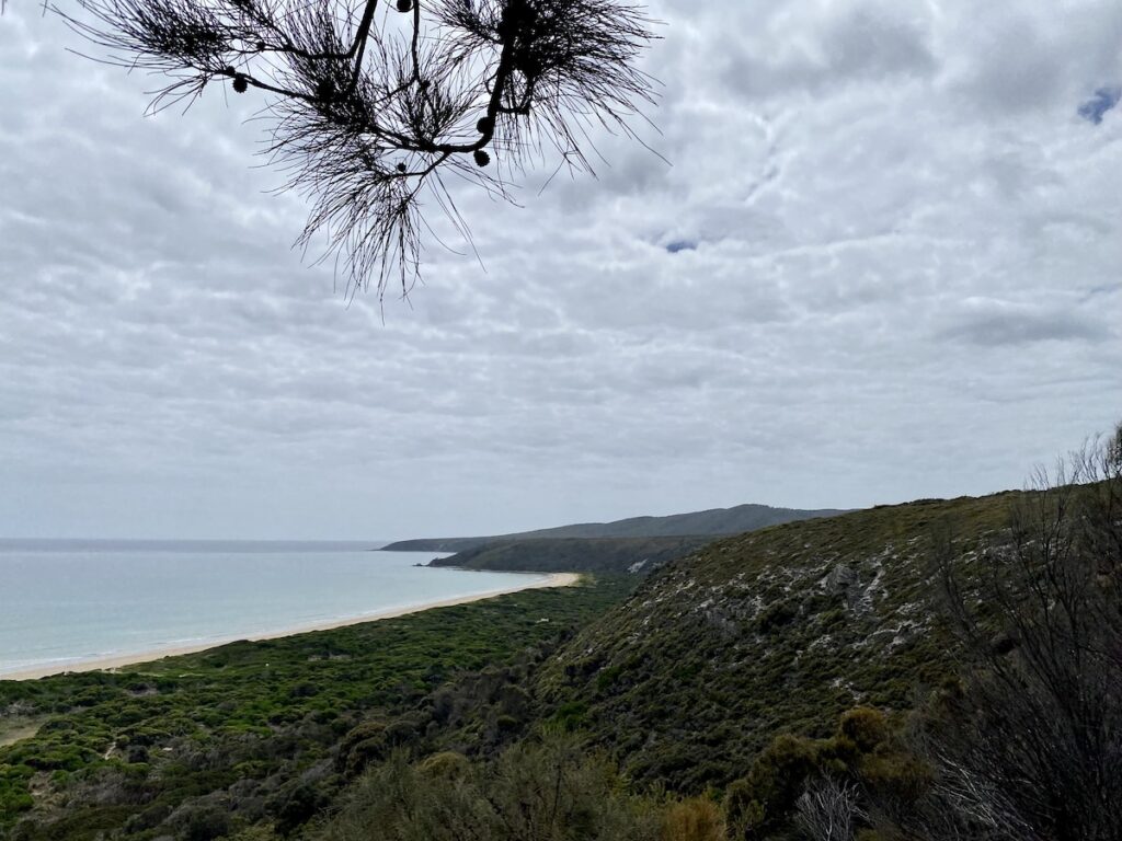
Some sections are steep, mostly around the headlands. And there’ll be plenty of soft sand. So it can be a difficult walk.
4. Badger Head Walk
This is another full day walk, a return walk from the visitor centre to Badger Head and back. You’ll cover around 23km. Like the Coastal Traverse, there are steep sections at headlands plus soft sand in places
5. Point Vision Track
This is one we’d love to do. The Point Vision Track takes you up to the highest accessible point on the Asbestos Range.
It’s a difficult walk… around 15 km return and some very steep sections. The tracks starts and ends at the visitor centre, crossing the Springlawn Plain to the base of the Asbestos Range. From here you follow a fire trail up.
By all accounts, the views and scenery are worth the effort. At 370 meters, the highest point is over three times higher than Archers Knob. And you get among the giant Eucalyptus obliqua, those magnificent wet sclerophyll gums you see in the cool temperate rainforests of Tasmania.
Not a walk for the faint-hearted. But the views are pretty special, according to those who’ve taken the track on.
If you’re searching for camping gear and accessories, Outback Equipment has a wide range available. Go here to find out more.
A Great Intro To Tassie
Narawntapu National Park’s an excellent introduction to Tasmania. Spend a few days there, unwind, enjoy the walks and the wildlife.
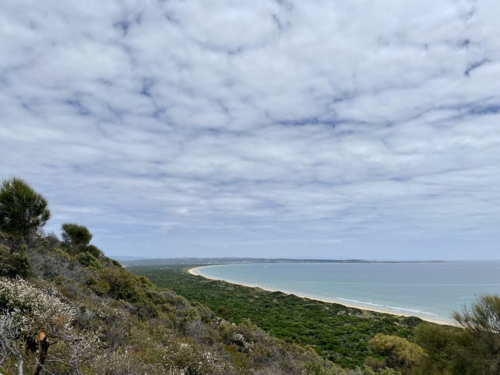
Unlike coastal heathlands on the mainland, the heathlands here have an over-storey of sorts. Even if coastal camping’s not normally your scene, you’ll be pleasantly surprised.
Note: In 2004, ABC Radio National visited Narawntapu. While it’s quite old, the transcript does give a really good summary of the region. Go here to read the transcript.
Narawntapu National Park is on Tommeginne Country.
Looking for more great articles on Tasmanian National Parks? Then go here.

Get your Traveller’s Guides
… and a whole lot more at our FREE RESOURCES Page!
Any questions or comments? Go to the Comments below or join us on Pinterest, Facebook or YouTube.
Any errors or omissions are mine alone.

